MyTopo
Union Maine US Topo Map
Couldn't load pickup availability
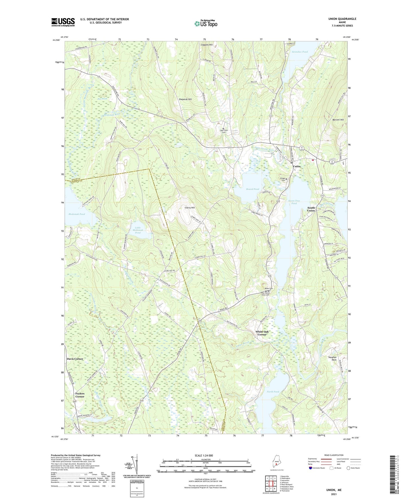
2024 topographic map quadrangle Union in the state of Maine. Scale: 1:24000. Based on the newly updated USGS 7.5' US Topo map series, this map is in the following counties: Knox, Lincoln. The map contains contour data, water features, and other items you are used to seeing on USGS maps, but also has updated roads and other features. This is the next generation of topographic maps. Printed on high-quality waterproof paper with UV fade-resistant inks.
Quads adjacent to this one:
West: Jefferson
Northwest: Razorville
North: Washington
Northeast: Searsmont
East: West Rockport
Southeast: Thomaston
South: Waldoboro East
Southwest: Waldoboro West
This map covers the same area as the classic USGS quad with code o44069b3.
Contains the following named places: Alford Brook, Back River, Barrett Hill, Benner Corner, Camp Adahi, Clark Field Airport, Clarry Hill, Coggans Hill, Davis Corner, Feylers Corner, Fuller Brook, Hodge One Room School, Hope Brook, Lake View Cemetery, Levensaler Brook, Little Medomak Brook, Little Medomak Pond, Manks Corner, Matthews Museum of Maine Heritage, Medomak Pond, Mill Stream, Mill Stream Dam, North Pond, Post Sunny View Cemetery, Rice Heath, Round Pond, Sennebec Pond Dam, Seven Tree Pond, Shepards Hill, South Union, Thompson Memorial School, Town of Union, Union, Union Ambulance Service, Union Elementary School, Union Fairgrounds, Union Fire Department, Union Post Office, Vaughan Neck, Village Cemetery, Vose Library, White Oak Corner, White Oak Pond, Whitney Corner