MyTopo
Stetson Maine US Topo Map
Couldn't load pickup availability
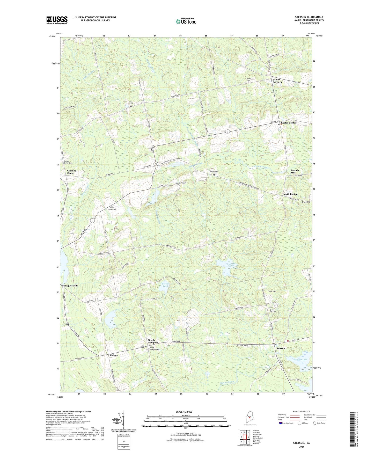
2021 topographic map quadrangle Stetson in the state of Maine. Scale: 1:24000. Based on the newly updated USGS 7.5' US Topo map series, this map is in the following counties: Penobscot. The map contains contour data, water features, and other items you are used to seeing on USGS maps, but also has updated roads and other features. This is the next generation of topographic maps. Printed on high-quality waterproof paper with UV fade-resistant inks.
Quads adjacent to this one:
West: Corinna
Northwest: Dexter
North: Garland
Northeast: Charleston
East: West Corinth
Southeast: Carmel
South: Plymouth
Southwest: Newport
Contains the following named places: Alder Stream, Archers Dam, Bonds Corners, Bragg Hill, Brooks Pond, Chamberlain Cemetery, Cider Hill, Clark Hill, Clark Hill Cemetery, Coburn, Corinna Center, Corinna Center Cemetery, Crossroads Church, Crowell Cemetery, Exeter Center, Exeter Church, Exeter Consolidated School, Exeter Corners, Exeter Post Office, First Baptist Church, Footman Brook, French Mill, French Stream, French Stream Dam, Greenbush Swamp, Morse Corners, Morses Corner Cemetery, Nason Dam, North Newport, North Newport Cemetery, Pleasant Lake, South Exeter, Spragues Mill, Stetson, Stetson Post Office, Stetson Public Library, Stetson Volunteer Fire Department, Stubbs Corner, Town of Exeter, Union Church, White Cemetery, ZIP Code: 04435