MyTopo
Sugarloaf Mountain Maine US Topo Map
Couldn't load pickup availability
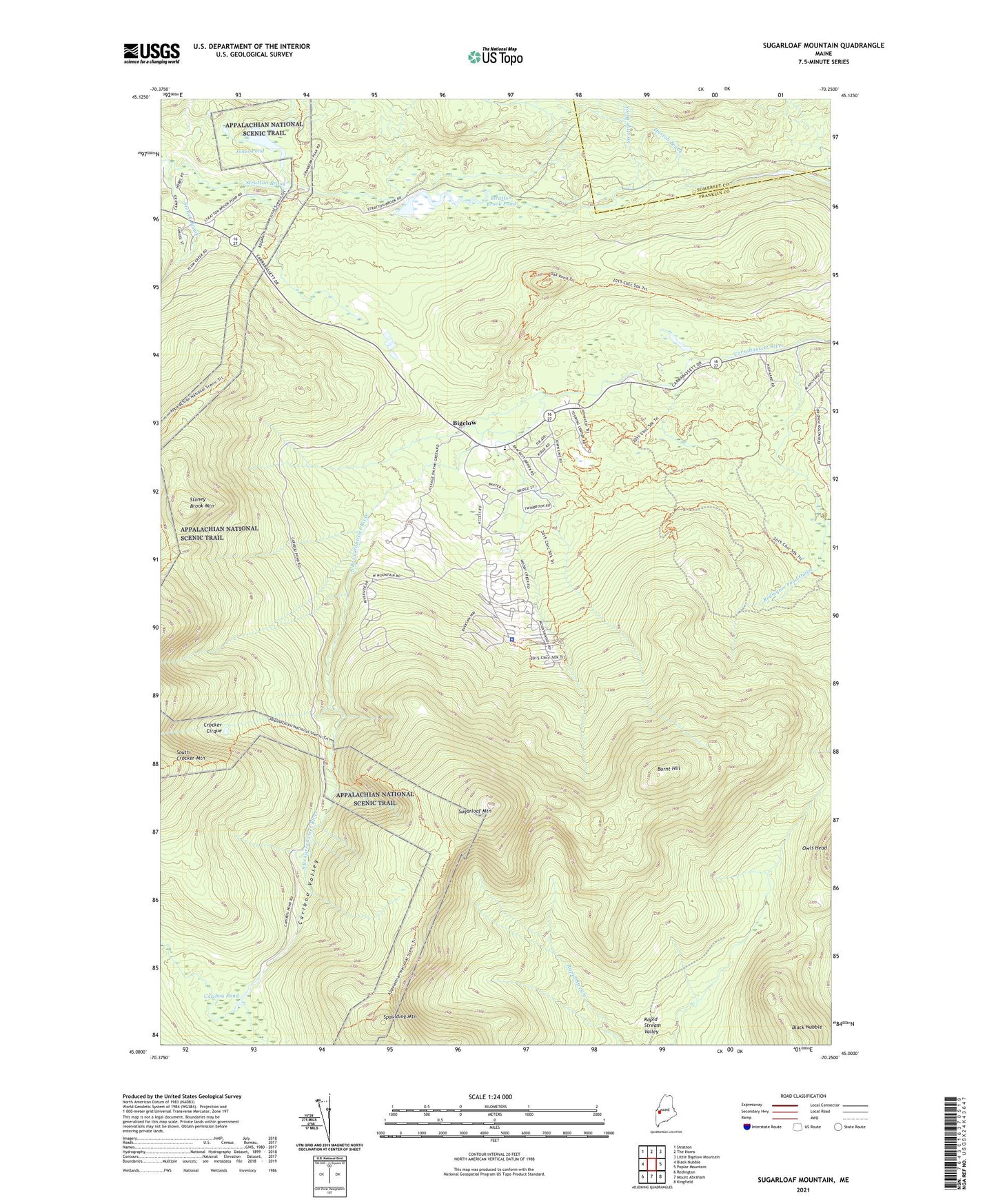
2021 topographic map quadrangle Sugarloaf Mountain in the state of Maine. Scale: 1:24000. Based on the newly updated USGS 7.5' US Topo map series, this map is in the following counties: Franklin, Somerset. The map contains contour data, water features, and other items you are used to seeing on USGS maps, but also has updated roads and other features. This is the next generation of topographic maps. Printed on high-quality waterproof paper with UV fade-resistant inks.
Quads adjacent to this one:
West: Black Nubble
Northwest: Stratton
North: The Horns
Northeast: Little Bigelow Mountain
East: Poplar Mountain
Southeast: Kingfield
South: Mount Abraham
Southwest: Redington
Contains the following named places: Bigelow, Burnt Hill, Caribou Pond, Caribou Valley, Carrabassett Valley Academy, Carrabassett Valley Police Department, Carrabassett Valley Public Library, Carrabassett Valley Volunteer Fire Department Mountain Station, Crocker Cirque, Crocker Mountain Cirque Campground, Jones Pond, Rapid Stream Valley, Redington Pond Outlet, South Branch Carrabasset River, Spaulding Mountain, Stoney Brook, Stoney Brook Mountain, Stratton Brook Pond, Sugarloaf Golf Club, Sugarloaf Mountain, Sugarloaf Outdoor Center, Town of Carrabassett Valley, WTOS-FM (Skowhegan), ZIP Code: 04947