MyTopo
The Horns Maine US Topo Map
Couldn't load pickup availability
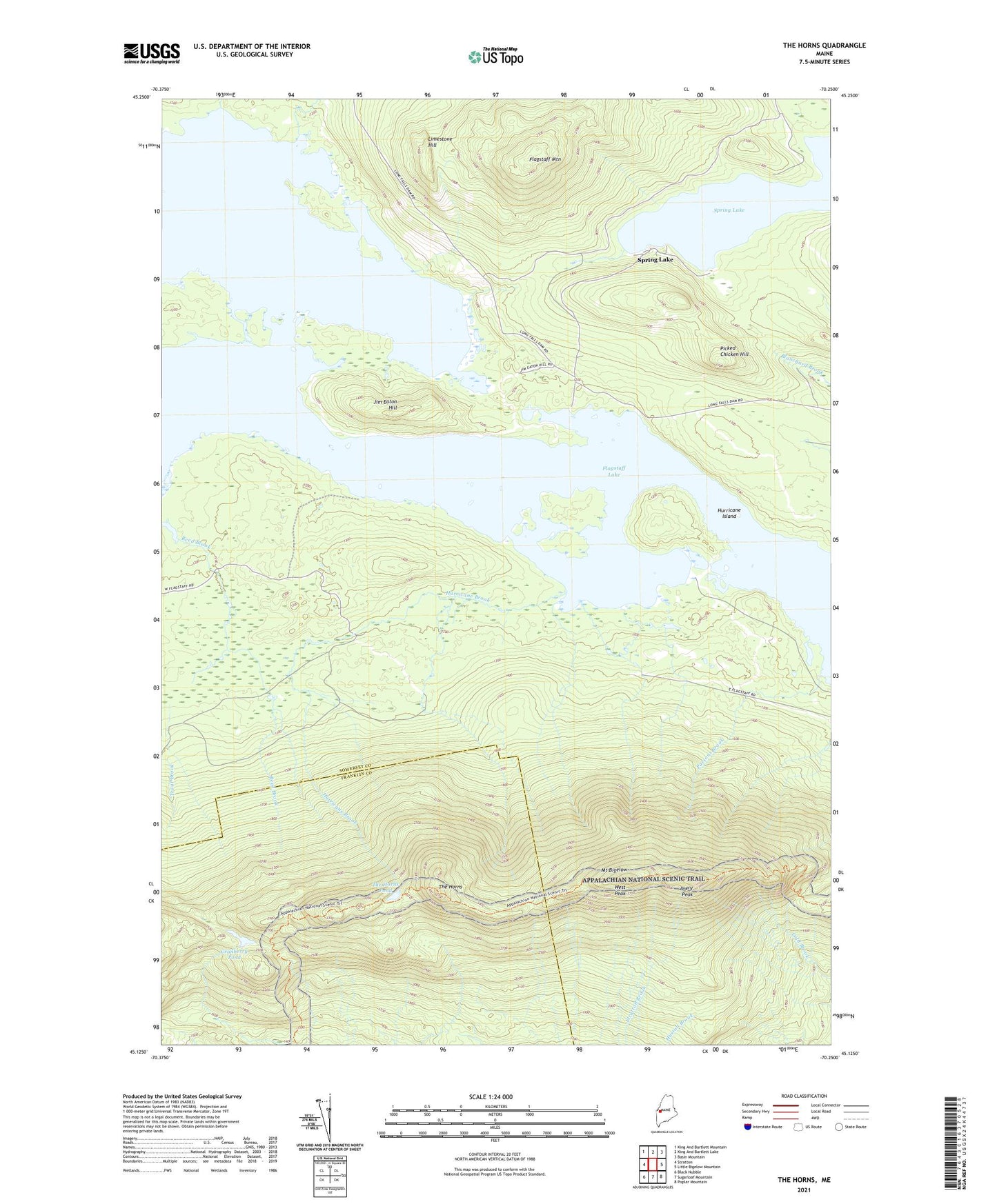
2024 topographic map quadrangle The Horns in the state of Maine. Scale: 1:24000. Based on the newly updated USGS 7.5' US Topo map series, this map is in the following counties: Somerset, Franklin. The map contains contour data, water features, and other items you are used to seeing on USGS maps, but also has updated roads and other features. This is the next generation of topographic maps. Printed on high-quality waterproof paper with UV fade-resistant inks.
Quads adjacent to this one:
West: Stratton
Northwest: King And Bartlett Mountain
North: King And Bartlett Lake
Northeast: Basin Mountain
East: Little Bigelow Mountain
Southeast: Poplar Mountain
South: Sugarloaf Mountain
Southwest: Black Nubble
This map covers the same area as the classic USGS quad with code o45070b3.
Contains the following named places: Avery Peak, Becky Inlet, Bigelow Lookout Tower, Bigelow Township, Cranberry Pond, Fire Warden Trail, Flagstaff Lake, Flagstaff Mountain, Hurricane Brook, Hurricane Island, Jim Eaton Hill, Limestone Hill, Mount Bigelow, Parsons Brook, Picked Chicken Hill, Spring Lake, The Horns, The Horns Pond, Unorganized Territory of Wyman, Usher Inlet, West Peak