MyTopo
West Rockport Maine US Topo Map
Couldn't load pickup availability
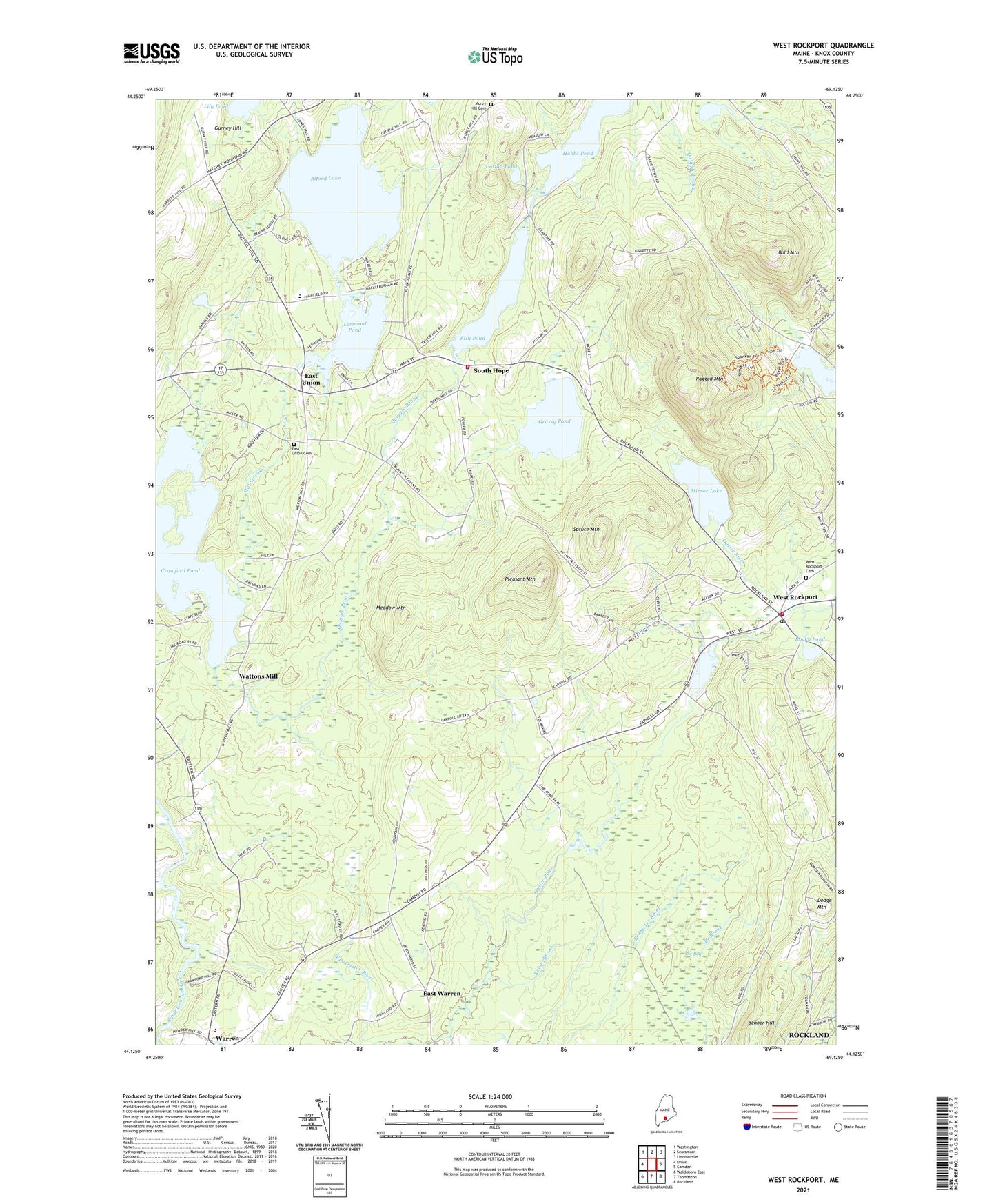
2021 topographic map quadrangle West Rockport in the state of Maine. Scale: 1:24000. Based on the newly updated USGS 7.5' US Topo map series, this map is in the following counties: Knox. The map contains contour data, water features, and other items you are used to seeing on USGS maps, but also has updated roads and other features. This is the next generation of topographic maps. Printed on high-quality waterproof paper with UV fade-resistant inks.
Quads adjacent to this one:
West: Union
Northwest: Washington
North: Searsmont
Northeast: Lincolnville
East: Camden
Southeast: Rockland
South: Thomaston
Southwest: Waldoboro East
Contains the following named places: Alford Lake, Alford Lake Dam, Bald Mountain, Benner Hill, City of Rockland, Cotton Pond, Crawford Pond, Dodge Mountain, East Union, East Union Cemetery, East Union Dam, East Warren, Fish Pond, Fish Pond Dam, Goulds Hospital, Grassy Pond, Gurney Hill, Hobbs Pond, Hope Elementary School, Hope Volunteer Fire Department South Hope Station, Hosmer Pond, Keene Brook, Lermond Pond, Lily Pond, Meadow Mountain, Meadow Mountain Preserve, Mill Stream, Mirror Lake, Mirror Lake Dam, Morey Hill Cemetery, Pleasant Mountain, Quiggle Brook, Ragged Mountain, Ragged Mountain Trail, Rockport Fire Department West Rockport Station, Rocky Pond, South Hope, South Hope Christian School, South Hope Community Church, Spruce Mountain, Sterling Ambulance, The Bog, Tolman Dam, Tolman Pond, Town of Warren, Warren Community School, Wattons Mill, West Branch Oyster River, West Rockport, West Rockport Baptist Church, West Rockport Cemetery, West Rockport Post Office, WMCM-FM (Rockland), WMEP-FM (Camden), WRKD-AM (Rockland), ZIP Codes: 04841, 04847, 04864