MyTopo
Bittinger Maryland US Topo Map
Couldn't load pickup availability
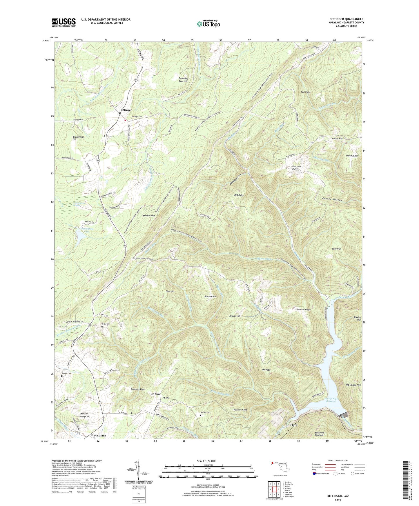
2023 topographic map quadrangle Bittinger in the state of Maryland. Scale: 1:24000. Based on the newly updated USGS 7.5' US Topo map series, this map is in the following counties: Garrett. The map contains contour data, water features, and other items you are used to seeing on USGS maps, but also has updated roads and other features. This is the next generation of topographic maps. Printed on high-quality waterproof paper with UV fade-resistant inks.
Quads adjacent to this one:
West: McHenry
Northwest: Accident
North: Grantsville
Northeast: Avilton
East: Barton
South: Kitzmiller
Southwest: Deer Park
This map covers the same area as the classic USGS quad with code o39079e2.
Contains the following named places: Bear Hill School, Beaver Hill, Big Run, Big Run State Park, Bittinger, Bittinger Cemetery, Bittinger Fire Tower, Bittinger Post Office, Bittinger Volunteer Fire Department Station 90, Blackhawk Run, Blackhawk School, Blossom Hill, Brenneman Hill, Browning Bear Hill, Buck Hill, Chestnut Knob, Contrary Knob, Crabtree Creek, Cunningham Lake, Cunningham Swamp, District 12 Bittinger, Double Lick Run, Dry Run, Dry Run School, Fairview, Floyd, Fort Hill, Jenkins Hill, Maynardier Ridge Church, Meadow Mountain, Meadow Mountain Church, Meadow Mountain Mission, Middle Fork Crabtree Creek, Middle Ridge, Miller Run, Monkey Lodge Hill, Monroe Run, Mount Nebo, Murphy Cemetery, North Glade, North Glade School, North Glade United Methodist Church, Peapatch Ridge, Pine Hill, Pine Swamp Run, Pleasant Valley Recreation Center, Pleasant Valley Run Dam, Pritts Cemetery, Rhodes Cemetery, Savage River Dam, Savage River Reservoir, Solomon Ridge, Tom Ridge, Toms Spring Run, Waters Run, Whiskey Hollow, ZIP Code: 21522