MyTopo
Broomes Island Maryland US Topo Map
Couldn't load pickup availability
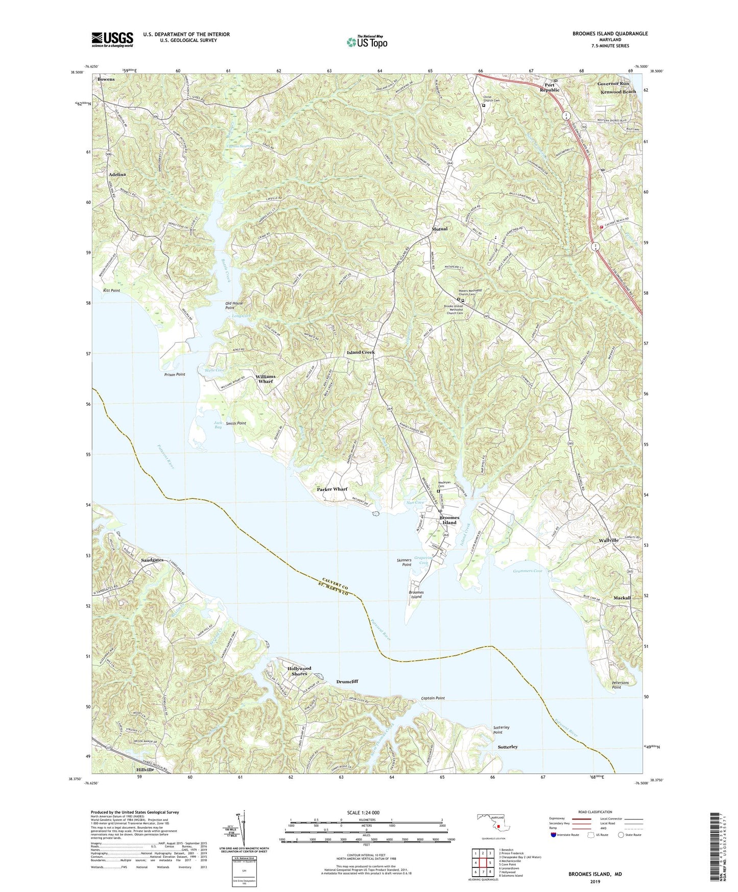
2023 topographic map quadrangle Broomes Island in the state of Maryland. Scale: 1:24000. Based on the newly updated USGS 7.5' US Topo map series, this map is in the following counties: Calvert, St. Mary's. The map contains contour data, water features, and other items you are used to seeing on USGS maps, but also has updated roads and other features. This is the next generation of topographic maps. Printed on high-quality waterproof paper with UV fade-resistant inks.
Quads adjacent to this one:
West: Mechanicsville
Northwest: Benedict
North: Prince Frederick
East: Cove Point
Southeast: Solomons Island
South: Hollywood
Southwest: Leonardtown
This map covers the same area as the classic USGS quad with code o38076d5.
Contains the following named places: Adelina, Another Place, Battle, Battle Creek, Battle Creek Cypress Swamp Nature Center, Battle Creek Cypress Swamp Nature Sanctuary, Ben Creek, Bible Way Church, Blue Dolphin Estates, Bobcat Brook, Botelars Landing, Bowens, Boyds Farm, Briscoe, Briscoe Wharf, Brooks Church, Brooks United Methodist Church Cemetery, Broomes Island, Broomes Island Census Designated Place, Broomes Island Post Office, Cape Saint Marys Marina, Captain Point, Cashners Wharf, Cat Creek, Chippingwood, Christ Church, Christ Church Cemetery, Cole Creek, Community College at Calvert County, Crossroad Christian Church, Cypress Knolls, Cypress Swamp, District 6 Patuxent, Drumcliff, Emerald Cove, Fenwick Manor House, Forest Glade, Forest Wharf, Fox Hill, Goodwins, Governor Run, Grammers Cove, Grapevine Cove, Halls Hacienda, Harbor Hills, Hellen, Hillside Manor, Hog Neck Creek, Hollywood Shores, Home Place, Honey Cove Estates, Horsmon Farm, Island Creek, Island Creek School, Jack Bay, Jefferson Patterson Historical Park, Jefferson Patterson Museum, Kenwood Beach, Kitt Point, Lancaster Hill, Long Cove, Long Cove Estates, Mackall, Mackall Estates, Maryland Gardens, Matapeake, Mutual, Mutual Consent, Mutual Elementary School, Mutual Estates, Nan Cove, Nostalgia, Old House Point, Olde Mill, Parker Wharf, Patterson Park, Perigeaux Vineyards and Winery, Petersons Point, Port Republic Post Office, Prince Frederick Seventh Day Adventist Church, Prison Point, Queen Tree Landing, Rattlesnake Gutt, Riverwood Farms, Rock Creek, Roslin Creek, Ross Woods, Saint Leonard, Saint Leonard Post Office, Saint Leonard Volunteer Fire Department and Rescue Squad Company 7, Saint Lukes Church, Saint Marys Beach, Saint Thomas Creek, Sandgates, Scotterley Wharf, Second Creek, Skinners Point, Smith Point, Sotterley, Sotterley Mansion, Sotterley Point, Sotterley Wharf, Wallville, Wallville Acres, Waters Church, Waters Methodist Church Cemetery, Wells Cove, Wesleyan Cemetery, Wesleyan Methodist Church, Western Church, Western Shores, Wildwood, Williams Wharf, ZIP Codes: 20615, 20676, 20685