MyTopo
Crisfield Maryland US Topo Map
Couldn't load pickup availability
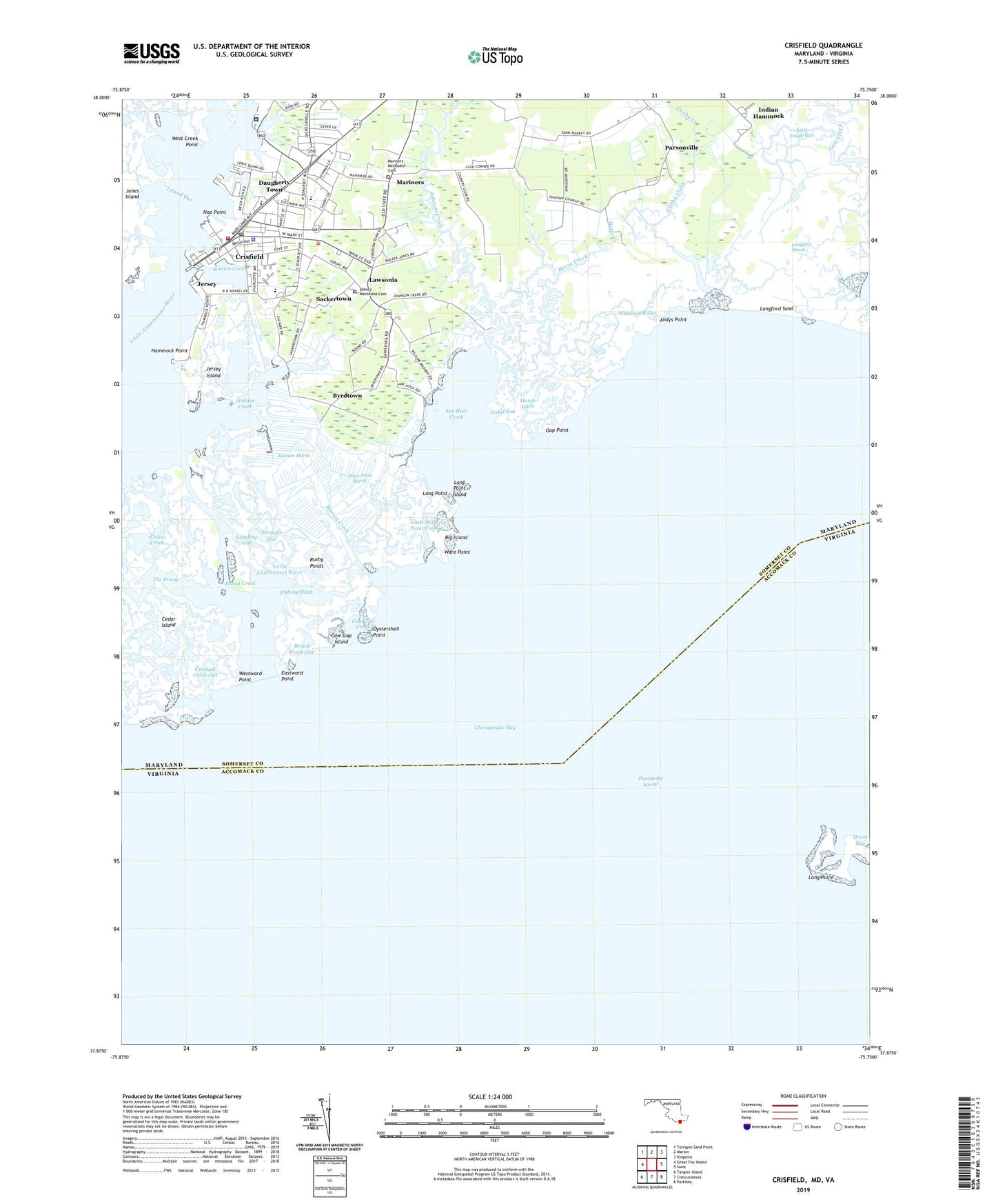
2019 topographic map quadrangle Crisfield in the state of Maryland. Scale: 1:24000. Based on the newly updated USGS 7.5' US Topo map series, this map is in the following counties: Somerset, Accomack. The map contains contour data, water features, and other items you are used to seeing on USGS maps, but also has updated roads and other features. This is the next generation of topographic maps. Printed on high-quality waterproof paper with UV fade-resistant inks.
Quads adjacent to this one:
West: Great Fox Island
Northwest: Terrapin Sand Point
North: Marion
Northeast: Kingston
East: Saxis
Southeast: Parksley
South: Chesconessex
Southwest: Tangier Island
Contains the following named places: Alice Byrd Tawes Nursing Home, Andys Point, Ape Hole Creek, Asbury Methodist Cemetery, Asbury United Methodist Church, Back Creek, Big Island, Brick Kiln Channel, Broad Creek, Broad Creek Gut, Byrdtown, Carter G Woodson Elementary School, Cash Corner, Cedar Creek, Cedar Gut, Church of God, City of Crisfield, Coast Guard Station Crisfield, Cow Gap Creek, Cow Gap Island, Crisfield, Crisfield Christian Academy, Crisfield Country Club, Crisfield Fire Department Station 2, Crisfield High School, Crisfield Historic District, Crisfield Police Department, Crisfield Post Office, Crooked Creek, Crooked Creek Gut, Daugherty Town, District 12 Asbury, East Creek Gut, Eastward Point, Edward McCready Memorial Hospital, Enon Baptist Church of Deliverance, First Baptist Church, Fishing Ditch, Gap Point, Gunby Creek, Hammock Point, Holiness Christian Church, Hop Point, Horse Creek, Horse Ditch, Howard, Immanuel United Methodist Church, Indian Hammock, Island Gut, Jenkins Creek, Jersey, Jersey Island, Johnson Creek, Landing Gut, Langford Marsh, Langford Sand, Lawson, Lawson Marsh, Lawsonia, Lilyan Stratton Corbin Public Library, Little Ware Point Creek, Long Point, Long Point Island, Lower Somerset Ambulance and Rescue Squad Station 8, Mariners, Mariners Methodist Cemetery, Mariners United Methodist Church, Massey Creek, Mount Pleasant United Methodist Church, Nelson, New Union Asbury Methodist Episcopal Church, Oystershell Point, Parsonville, Peyton School, Phoenix Church, Pocomoke Sound Wildlife Management Area, Public School Number Three, Rushy Ponds, Sackertown, Saint Paul African Methodist Episcopal Church, Shiloh Memorial Methodist Episcopal Church, Somers Cove, Straight Gut, The Prong, Tyler, Ward, Ware Point, Ware Point Marsh, West Creek, West Creek Point, Westward Point, Whitewood Gut, WLSL-FM (Crisfield), Woodson High School, Woodson Middle School, ZIP Code: 21817