MyTopo
Parksley Virginia US Topo Map
Couldn't load pickup availability
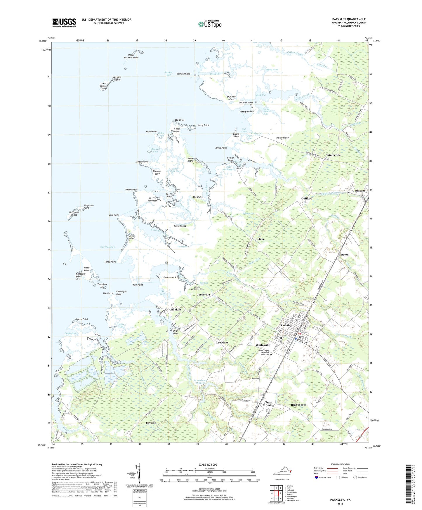
2022 topographic map quadrangle Parksley in the state of Virginia. Scale: 1:24000. Based on the newly updated USGS 7.5' US Topo map series, this map is in the following counties: Accomack. The map contains contour data, water features, and other items you are used to seeing on USGS maps, but also has updated roads and other features. This is the next generation of topographic maps. Printed on high-quality waterproof paper with UV fade-resistant inks.
Quads adjacent to this one:
West: Chesconessex
Northwest: Crisfield
North: Saxis
Northeast: Hallwood
East: Bloxom
Southeast: Metompkin Inlet
South: Accomac
Southwest: Pungoteague
This map covers the same area as the classic USGS quad with code o37075g6.
Contains the following named places: Abrams Family Cemetery, Adams Church, Adams United Methodist Church Cemetery, Annis Point, Bagwell Cove, Bagwell Creek, Bailey Ridge, Bayside Census Designated Place, Beasley Bay, Bernard Flats, Bernard Islands, Bethel Branch, Brewer Gut, Bridge Gut, Byrds Marsh, Cals Hammock, Calvary Church, Canoedas Point, Cedar Cove, Cedar Cove Gut, Cedar Island, Chase Crossing, Chase Crossing Census Designated Place, Clam, Coards Branch, Custis Cove, Custis Point, District 4, Dix Cove, Dix Hammock, Doe Creek, Drummonds Millpond, Drummonds Millpond Dam, Ebb Point, Flannegan Point, Flood Point, France Creek, Graven Point, Great Gut, Grey Ditch, Guard Shore, Guilford, Guilford Church, Guilford Church Branch, Guilford Creek, Halfmoon Island, Halfmoon Point, High Woods, Hopeton, Hopkins, Hunting Creek, Island Field Cove, Jacks Island, Jimmys Gut, Jobes Island, Justis Gut, Justisville, Katy Young Branch, Lee Mont, Lee Mont Branch, Lee Mont Census Designated Place, Lee Mont Post Office, Liberty Cemetery, Little Back Creek, Lower Bernard Island, Marks Island, Metompkin Elementary School, Mill Branch, Muddy Creek, Old Cove, Old Tree Island, Parker Landing, Parksley, Parksley Middle School, Parksley Police Department, Parksley Post Office, Parksley Volunteer Fire Company, Peters Hammock, Peters Point, Peters Tump, Pettigrew Bend, Poulson Point, Real Point, Rock Gut, Rue Gut, Saint Thomas Church, Sandy Point, Simpson Bend, Simpson Point, The Ditches, The Notch, The Oaks, The Ridge, The Thorofare, Thorofare Hill, Town of Parksley, Upper Bernard Island, Webb Island, Weir Point, Whitesville, Whitesville Census Designated Place, Wills Gut, Winterville, Wise Chapel, Zare Point, ZIP Codes: 23308, 23357