MyTopo
Ewell Maryland US Topo Map
Couldn't load pickup availability
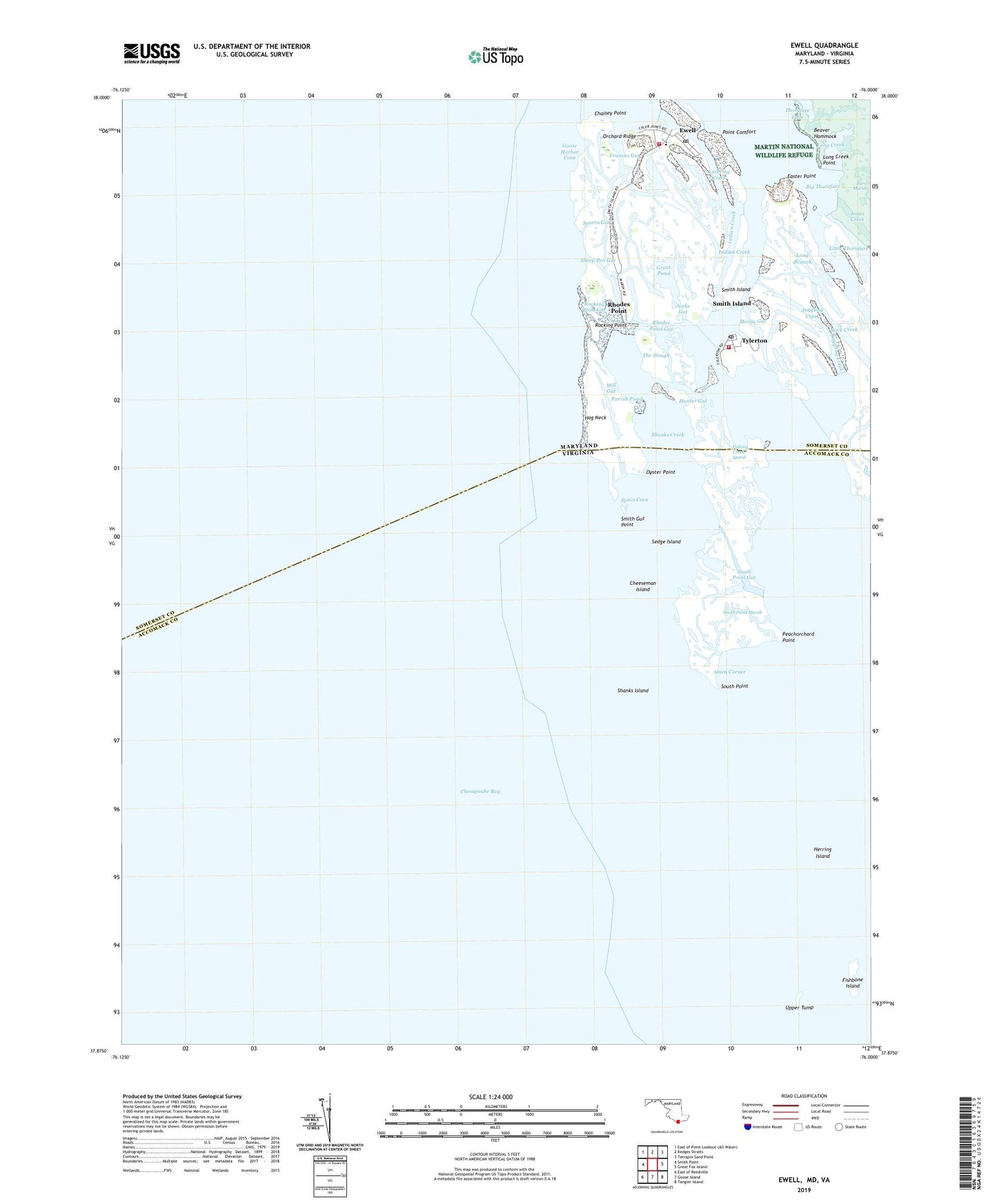
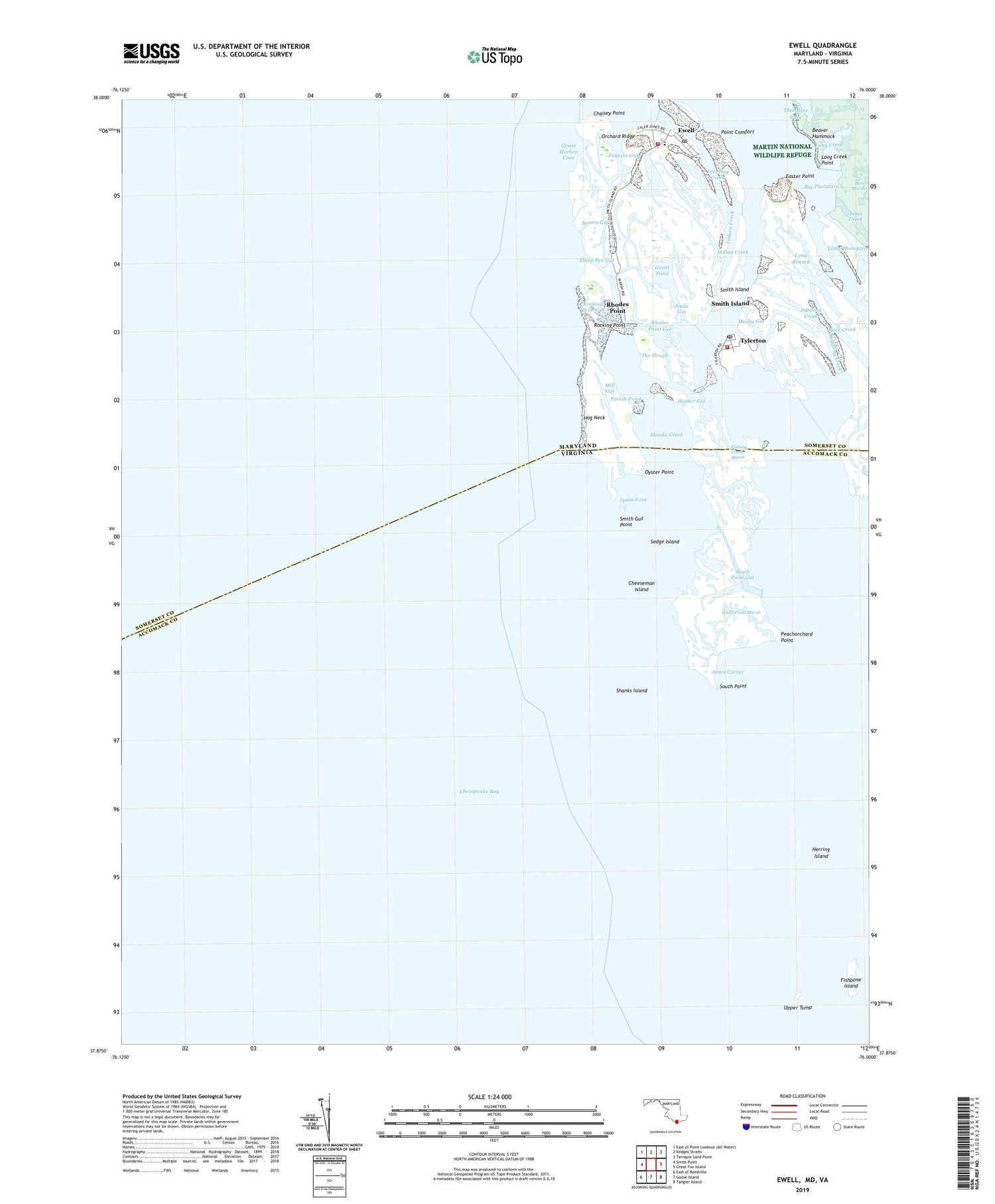
2019 topographic map quadrangle Ewell in the states of Maryland, Virginia. Scale: 1:24000. Based on the newly updated USGS 7.5' US Topo map series, this map is in the following counties: Somerset, Accomack. The map contains contour data, water features, and other items you are used to seeing on USGS maps, but also has updated roads and other features. This is the next generation of topographic maps. Printed on high-quality waterproof paper with UV fade-resistant inks.
Quads adjacent to this one:
West: Smith Point
North: Kedges Straits
Northeast: Terrapin Sand Point
East: Great Fox Island
Southeast: Tangier Island
South: Goose Island
Southwest: East of Reedville
Contains the following named places: Amen Corner, Bare Marsh, Beaver Hammock, Big Thorofare, Calvary Church, Chaisey Point, Cheeseman Island, Easter Point, Ewell, Ewell Elementary School, Ewell Post Office, Ewell United Methodist Church, Ewell Volunteer Fire Department Station 1, Fishbone Island, Fishing Creek, Fishing Creek Marsh, Frances Gut, Goose Harbor Cove, Great Pond, Herring Island, Hog Neck, Hunter Gut, Indian Creek, Jeans Gut, Jones Creek, Juggling Creek, Levering Creek, Long Branch, Long Creek, Long Creek Point, Merlin Gut, Mill Gut, Orchard Ridge, Oyster Point, Parks Ditch, Peachorchard Point, Point Comfort, Rhodes Point, Rhodes Point Gut, Rock Creek, Rocking Point, Rocking Point Gut, Sedge Island, Severn Gut, Shanks Creek, Shanks Island, Sheep Pen Gut, Smith Gut Point, Smith Island, Smith Island Census Designated Place, South Point, South Point Gut, South Point Marsh, Spain Cove, The Canal, The Slough, Thorofare Cove, Tyler Creek, Tyler Ditch, Tylerton, Tylerton Elementary School, Tylerton Fire Department Station 7, Tylerton Post Office, Union United Methodist Church, Upper Tump, Wading Place, ZIP Codes: 21824, 21866