MyTopo
Gaithersburg Maryland US Topo Map
Couldn't load pickup availability
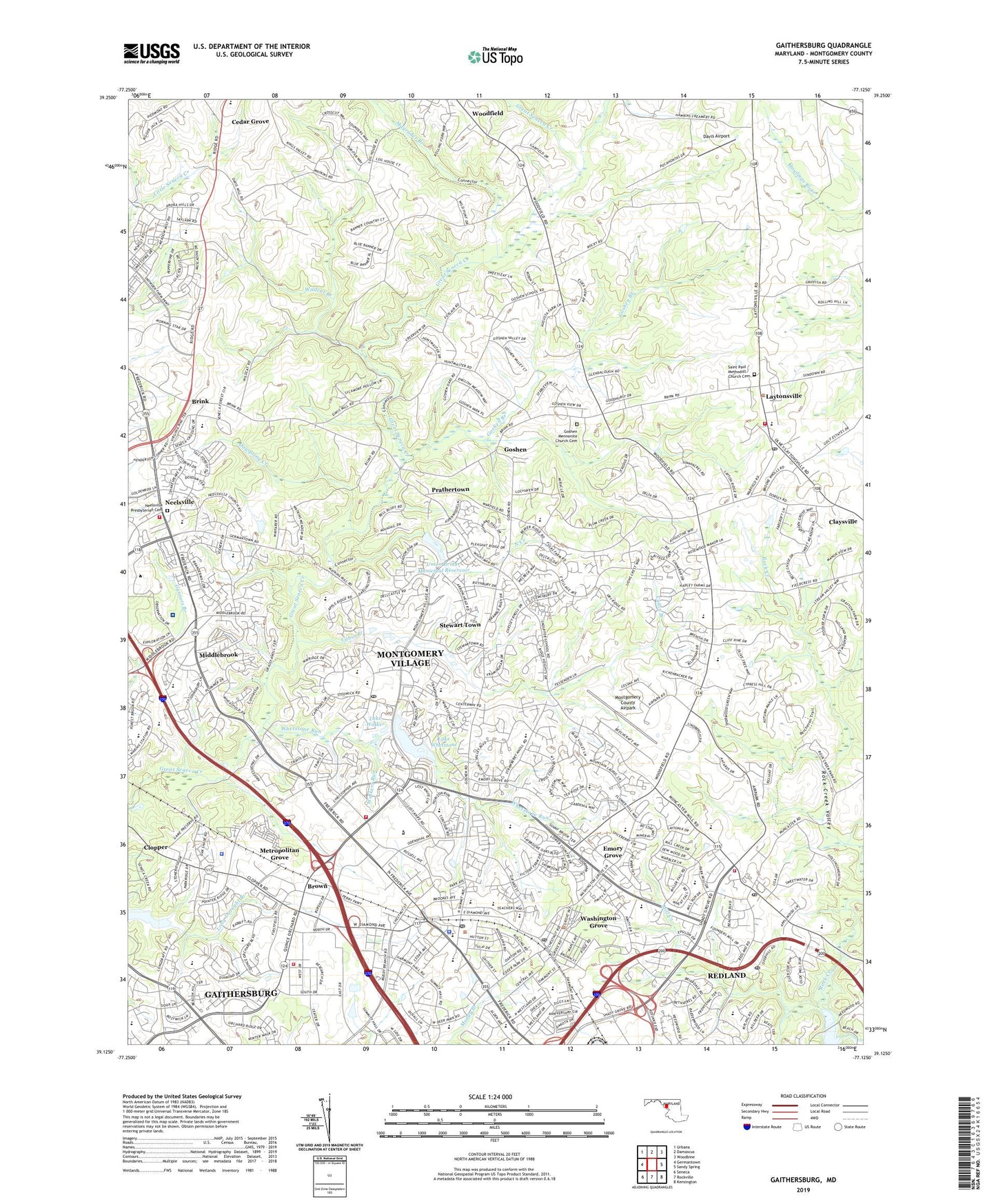
2023 topographic map quadrangle Gaithersburg in the state of Maryland. Scale: 1:24000. Based on the newly updated USGS 7.5' US Topo map series, this map is in the following counties: Montgomery. The map contains contour data, water features, and other items you are used to seeing on USGS maps, but also has updated roads and other features. This is the next generation of topographic maps. Printed on high-quality waterproof paper with UV fade-resistant inks.
Quads adjacent to this one:
West: Germantown
Northwest: Urbana
North: Damascus
Northeast: Woodbine
East: Sandy Spring
Southeast: Kensington
South: Rockville
Southwest: Seneca
This map covers the same area as the classic USGS quad with code o39077b2.
Contains the following named places: Airport Business Center, Avenel Business Industrial Park, Banner Country, Barton Woods, Beaverbrook, Bennington, Bennington Corporate Center, Blount Commons, Bohrer Park, Brandermill, Bridlewood, Brink, Brink Meadow, Brinkwood Estates, Brook Hollow, Brooke Grove, Brookgrove Schools, Brown, Brown Station Elementary School, Browns Station Park, Burnham Hills, Burnham Woods, Butlers Orchard, Cabin Branch, Cabin Branch Park, Candlewood Elementary School, Candlewood Park, Captain James E Daly Elementary School, Cashell Estates, Cedar Grove, Cedar Grove Elementary School, Centerway Park, Central Maintenance Depot, Chadswood, Charlene, Christman Park, Cider Barrel Motor Home Court, City of Gaithersburg, Clear Spring Park, Clopper, Clopper Siding, County Service Park, Coventry, Crown Pointe Corporate Center, Davis Airport, Dayspring Creek, Diamond Elementary School, Diamond Farm Park, Diamond Farms, Diamond Square Shopping Center, District 1, District 9, Dorsey Estates, East Park, Edinburgh, Emory Grove, Fawnwalk Run, Fernshire Farms, Fernshire Woods, Festival at Muddy Branch Shopping Center, Fetrows, Flower Hill, Flower Hill Census Designated Place, Flower Hill Elementary School, Flower Hill Park, Flower Hill Shopping Center, Fox Chapel, Fox Chapel Elementary School, Fox Chapel Park, Fox Chapel Shopping Center, Foxkit Creek, Foxlair Acres, Freedom Forest, Frenchton Place, Gaithersburg, Gaithersburg High School, Gaithersburg Middle School, Gaithersburg Public Works, Gaithersburg Square Shopping Center, Garfield Manor, Germantown Park, Golf Estates, Goshen, Goshen Branch, Goshen Branch Park, Goshen Crossing Shopping Center, Goshen Elementary School, Goshen Hunt Estates, Goshen Hunt Hills, Goshen Mennonite Church Cemetery, Goshen Recreational Park, Great Blue Heron Rill, Green Valley Conservation Park, Hadley Farms, Hamlet North, Henderson Corner, Hickory Grove, Honkers Rush, Ibm Heliport, Judith A Resnik Elementary School, King Farm, Kings Square, Lake Walker, Lake Walker Dam, Lake Walker Pond Number Two, Lake Walker-Pond Number Two Dam, Lake Whetstone, Lake Whetstone Dam, Lakeforest Mall Shopping Center, Layton Ridge, Laytonsville, Laytonsville Elementary School, Laytonsville Knolls, Laytonsville Park, Laytonville Golf Course, Lindbergh Center Business Park, Log Town, Londonderry, Longdraft, Longview School, Longview South, Lower Magruder Branch Park, Magruder Branch, Martin Luther King Middle School, Metropolitan Grove, Metropolitan Grove Industrial Park, Middlebrook, Middlebrook Hills, Middlebrook Mobile Home Park, Middlebrook Village Shopping Center, Milestone, Milestone Center Shopping Center, Mill Creek, Mill Creek Towne Elementary School, Montgomery College Germantown Campus, Montgomery Country Club, Montgomery County, Montgomery County Airpark, Montgomery County Airpark Industrial Park, Montgomery County Golf Course, Montgomery Meadows, Montgomery Village, Montgomery Village Census Designated Place, Montgomery Village Golf Course, Montgomery Village Middle School, Montgomery Village Off-Price Shopping Center, Muncaster Junior High School, Nathans Hill, Neelsville, Neelsville Presbyterian Cemetery, Neelsville Village Shopping Center, North Creek, North Creek Dam, North Germantown Special Park, Oakmont Manor, Observatory Heights, Orchard Place, Orchard Pond, Ovid Hazen Wells Recreational Park, Parkridge, Parkridge Estates, Pleasant Run, Plumgar, Plumgar Park, Prathertown, Quail Ridge, Quail Valley, Quince Orchard Corporate Park, Quince Orchard Plaza Shopping Center, Quince Tree Executive Center, Red Mill Shopping Center, Redland, Redland Census Designated Place, Redland Middle School, Redland Park, Relda Square, Ridgecrest, Ridges of Stedwick, Ridgeview Middle School, Rocky Road Park, Rosemont, Rosemont Elementary School, Rosewood Estates, Route 124 Plaza Shopping Center, Saint Paul Methodist Church Cemetery, Schneiders Trailer Haven, Seneca Park, Seneca Upland, Shady Grove Industrial Park, South Lake Elementary School, Stedwick Elementary School, Stewart Town, Strawberry Knoll Elementary School, Strawberry Knoll Park, Summit Hall Elementary School, Technical Park 270, The Elms at Germantown, The Grove Shopping Center, The Plantations, The Village Mall Shopping Center, Town of Laytonsville, Town of Washington Grove, Union Bridge Municipal Reservoir, Walkers Choice, Walkers Run, Walnut Hill, Walnut Hills Shopping Center, Ward Farm Estates, Washington Grove, Washington Grove Elementary School, Washington Square Park, Watkins Mill, Watkins Mill Elementary School, Watkins Overlook, West Riding, Wexford, Whetstone, Whetstone Run, Wildcat Branch, Wildcat Forest, Wilderness Walk, Windbrook, Winters Run, Winters Run Park, WMET-AM (Gaithersburg), Woodfield, Woodward Park, ZIP Codes: 20855, 20876, 20877, 20879, 20880, 20882, 20886, 20899


