MyTopo
Golden Hill Maryland US Topo Map
Couldn't load pickup availability
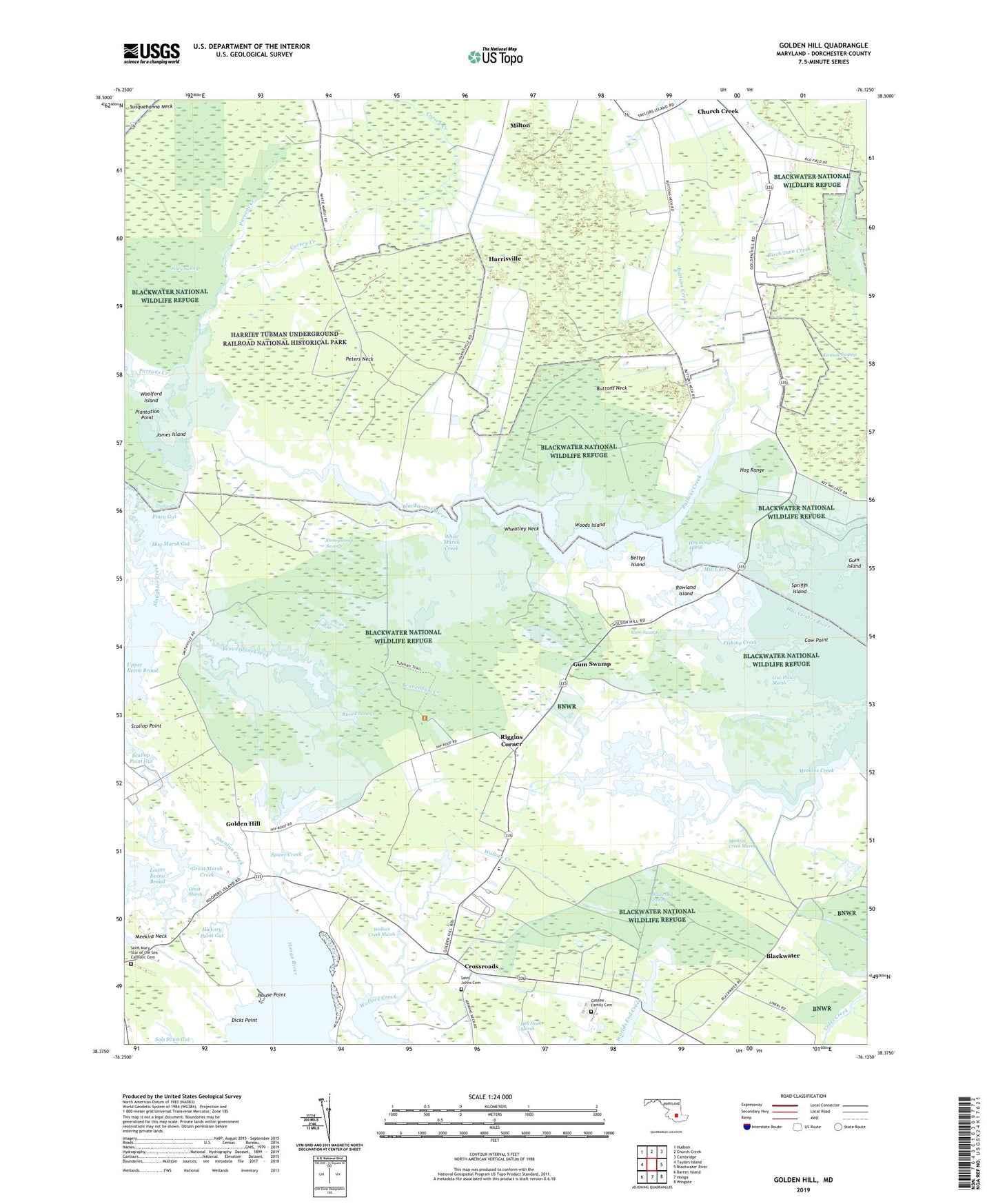
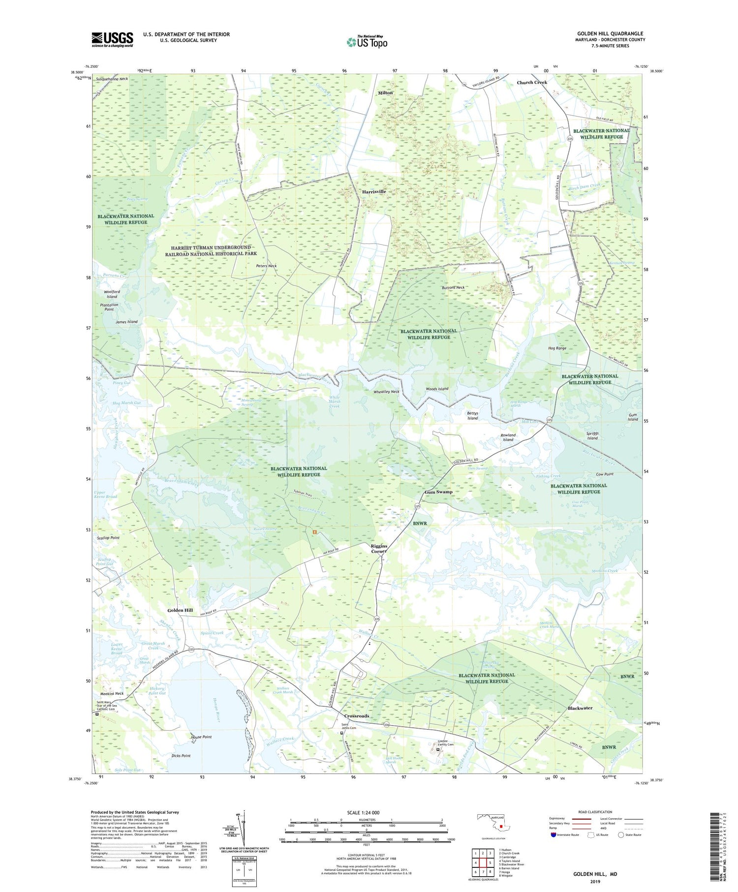
2019 topographic map quadrangle Golden Hill in the state of Maryland. Scale: 1:24000. Based on the newly updated USGS 7.5' US Topo map series, this map is in the following counties: Dorchester. The map contains contour data, water features, and other items you are used to seeing on USGS maps, but also has updated roads and other features. This is the next generation of topographic maps. Printed on high-quality waterproof paper with UV fade-resistant inks.
Quads adjacent to this one:
West: Taylors Island
Northwest: Hudson
North: Church Creek
Northeast: Cambridge
East: Blackwater River
Southeast: Wingate
South: Honga
Southwest: Barren Island
Contains the following named places: Beaverdam Creek, Bettys Island, Birch Dam Creek, Blackwater, Buttons Creek, Buttons Neck, Church Creek Fire Tower, Corsey Creek, Cow Point, Cow Point Marsh, Crossroads, Dicks Point, District 16 Madison, District 9 Church Creek, Fishing Creek, Golden Hill, Gootee Family Cemetery, Great Marsh, Great Marsh Creek, Gum Island, Gum Swamp, Harriet Tubman Underground Railroad National Historical Park, Harrisville, Hickory Point Gut, Hog Marsh Gut, Hog Range, Hog Range Marsh, House Point, Hudson Creek, James Island, John Wesley United Methodist Church, Malone Methodist Episcopal Church, Meekins Creek, Meekins Creek Marsh, Mill Cove, Milton, Milton United Methodist Church, Moneystump Swamp, Oak Grove Church, Old Field, Old Field Church, Out Back, Peters Neck, Piney Gut, Piney Swamp, Plantation Point, Riggins Corner, Rowland Island, Russell Swamp, Saint Johns Cemetery, Saint Johns Church, Saint Mary Star of the Sea Catholic Cemetery, Saint Marys Star of the Sea Church, Scallop Point, Scallop Point Gut, Shenton Creek, South Dorchester School, Spicer Creek, Spriggs Island, Tubman Church, Uncle Robert Creek, Upper Keene Broad, Wallace Creek Marsh, Walnut Landing, Wheatley Neck, White Marsh Creek, White Oak Swamp, Woods Island, Woolford Island, ZIP Codes: 21622, 21648, 21677