MyTopo
Wingate Maryland US Topo Map
Couldn't load pickup availability
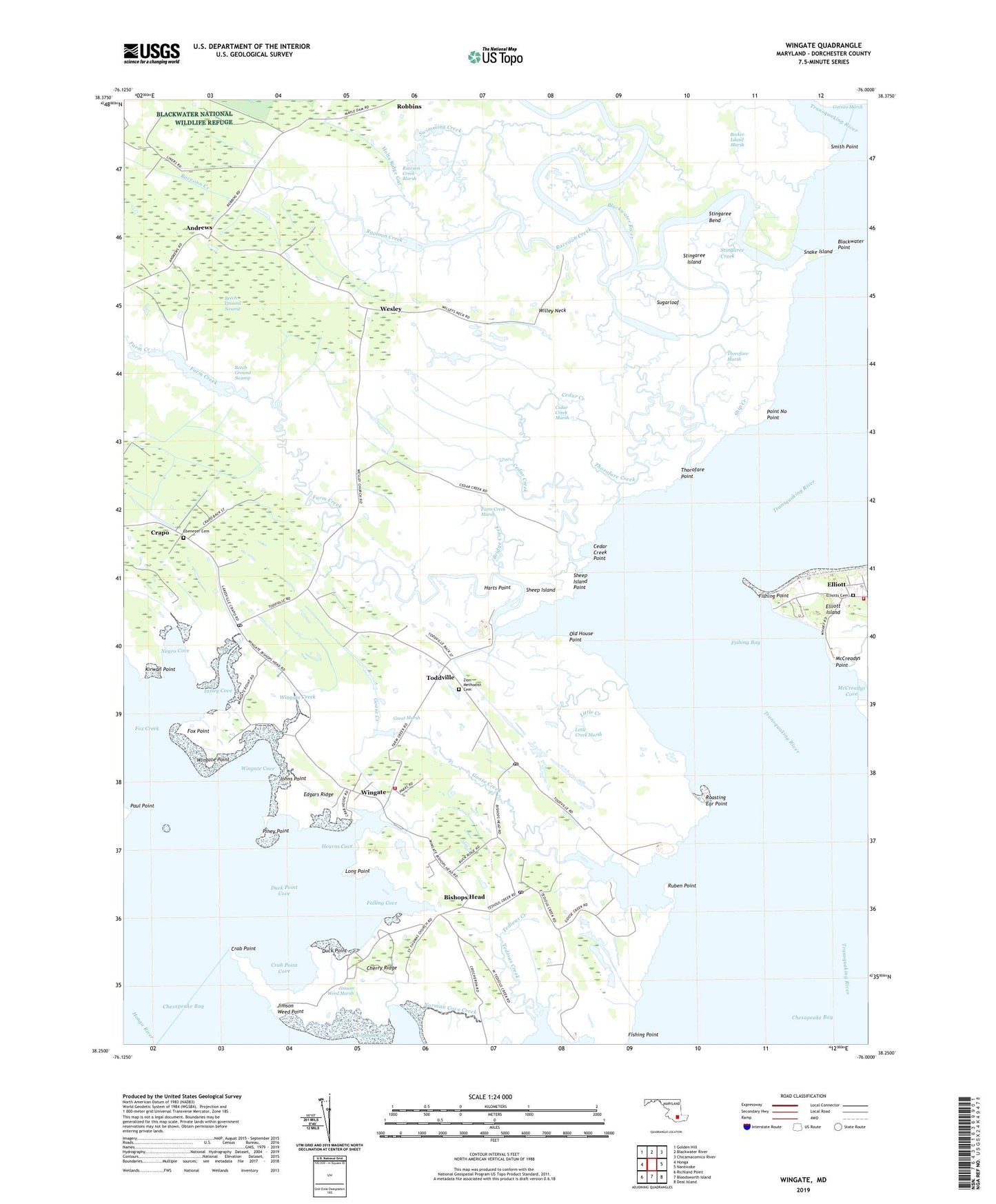
2023 topographic map quadrangle Wingate in the state of Maryland. Scale: 1:24000. Based on the newly updated USGS 7.5' US Topo map series, this map is in the following counties: Dorchester. The map contains contour data, water features, and other items you are used to seeing on USGS maps, but also has updated roads and other features. This is the next generation of topographic maps. Printed on high-quality waterproof paper with UV fade-resistant inks.
Quads adjacent to this one:
West: Honga
Northwest: Golden Hill
North: Blackwater River
Northeast: Chicamacomico River
East: Nanticoke
Southeast: Deal Island
South: Bloodsworth Island
Southwest: Richland Point
This map covers the same area as the classic USGS quad with code o38076c1.
Contains the following named places: Andrews, Beech Ground Swamp, Bishops Head, Bishops Head Post Office, Blackwater Point, Blackwater River, Bridge Creek, Cedar Creek, Cedar Creek Marsh, Cedar Creek Point, Cherry Ridge, Crab Point, Crab Point Cove, Duck Point, Duck Point Cove, Ebenezer Cemetery, Ebenezer Church, Edgars Ridge, Elliott Census Designated Place, Elliott Island, Elliott Post Office, Elliotts Cemetery, Elliotts Island Volunteer Fire Company Station 71, Elliotts United Methodist Church, Falling Cove, Farm Creek, Farm Creek Marsh, Fishing Bay, Fishing Point, Fox Creek, Fox Point, Goose Creek, Great Marsh, Harts Point, Hearns Cove, Hearns Creek, Holts Ridge Gut, Insley Cove, Jimson Weed Marsh, Jimson Weed Point, Jobs Ditch, Johns Point, Kirwan Point, Lakes and Straits Volunteer Fire Department Station 41, Little Creek, Little Creek Marsh, Long Point, McCreadys Cove, McCreadys Creek, McCreadys Point, Negro Cove, Norman Cove, Norman Cove Creek, Old House Landing, Old House Point, Paul Point, Piney Point, Point No Point, Raccoon Creek, Raccoon Creek Marsh, Roasting Ear Point, Ruben Point, Saint Thomas Church, Sheep Island, Sheep Island Point, Ship Creek, Smith Point, Snake Island, Stingaree Bend, Stingaree Creek, Stingaree Island, Sugarloaf, Swimming Creek, Thorofare Creek, Thorofare Marsh, Thorofare Point, Toddville, Toddville Post Office, Transquaking River, Wesley, Willey Neck, Wingate, Wingate Cove, Wingate Creek, Wingate Point, Wingate Post Office, Wingate United Methodist Church, Wrights Landing, Zion Methodist Cemetery, Zion United Methodist Church, ZIP Codes: 21626, 21672, 21675