MyTopo
Hughesville Maryland US Topo Map
Couldn't load pickup availability
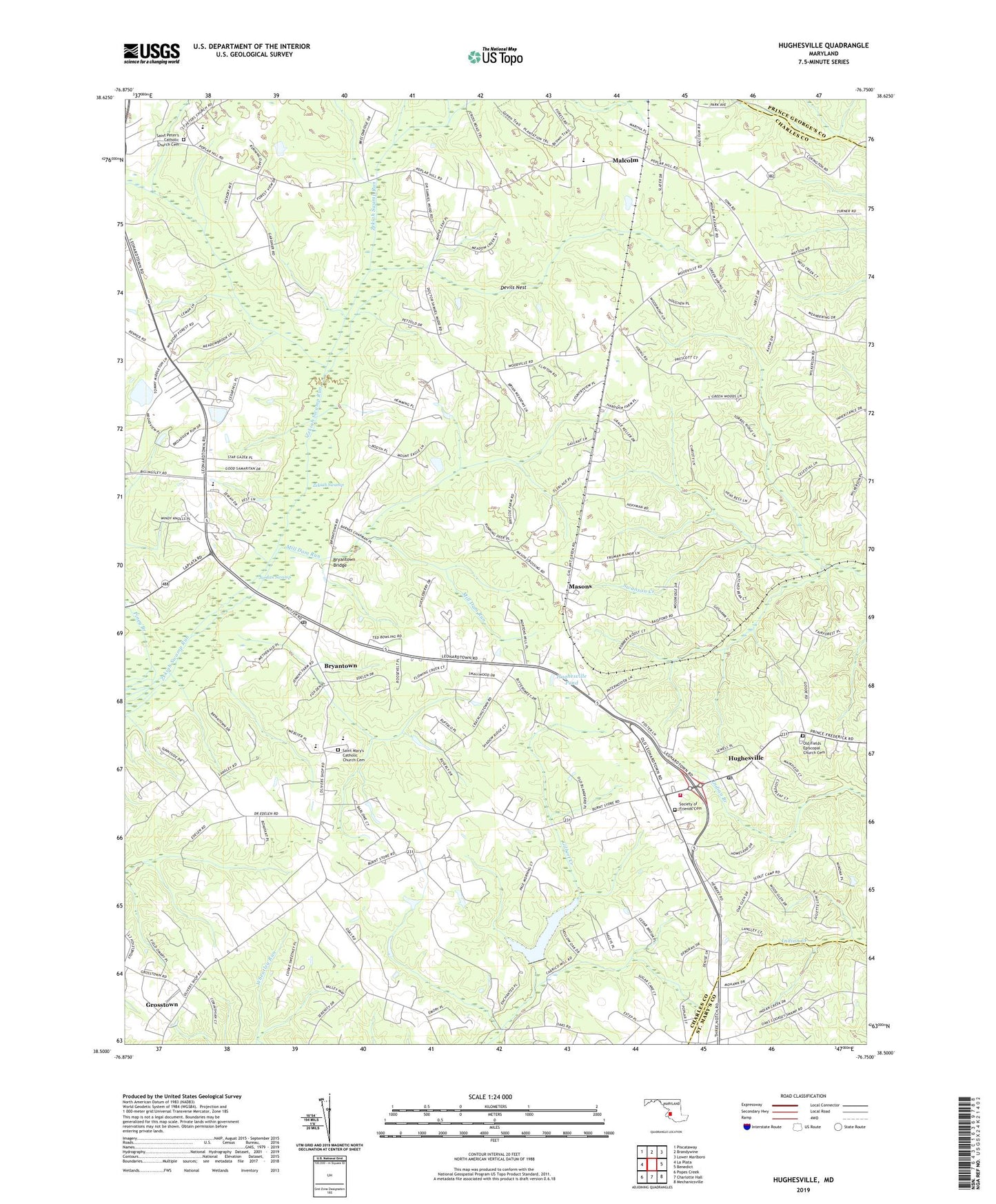
2023 topographic map quadrangle Hughesville in the state of Maryland. Scale: 1:24000. Based on the newly updated USGS 7.5' US Topo map series, this map is in the following counties: Charles, St. Mary's, Prince George's. The map contains contour data, water features, and other items you are used to seeing on USGS maps, but also has updated roads and other features. This is the next generation of topographic maps. Printed on high-quality waterproof paper with UV fade-resistant inks.
Quads adjacent to this one:
West: La Plata
Northwest: Piscataway
North: Brandywine
Northeast: Lower Marlboro
East: Benedict
Southeast: Mechanicsville
South: Charlotte Hall
Southwest: Popes Creek
This map covers the same area as the classic USGS quad with code o38076e7.
Contains the following named places: AAA Transport, Belle Ridge Farms, Bellewood, Bowen Estates, Breezy Knolls, Briar Ridge, Bryantown, Bryantown Bridge, Bryantown Census Designated Place, Bryantown Estates, Bryantown Hills, Bryantown Historic District, Bryantown Post Office, Burnt Store, Cameron Ridge, Carrico Mill Estates, Charles County Gardens, Clayton Run Estates, Devils Nest, District 8 Bryantown, Edelen Estates, Forest Estates, Forest Glen Estates, Forest Park, Forest Park Baptist Church, Gallant Acres, Gallant Green, Gallant Green Woods, Gilbert Pond, Grace Brethren Church, Grace Christian Academy of Maryland, Green Spring, Grosstown, Hickory Thicket, Hidden Valley, Hughesville, Hughesville Census Designated Place, Hughesville Company 2 Fire Station, Hughesville High School, Hughesville Industrial Park, Hughesville Manor, Hughesville Pond, Hughesville Pond Recreation Area, Hughesville Post Office, Hughesville Volunteer Fire Department and Emergency Medical Services, Hunters Farms, Independence Village, Jameson Dam, Karen Knolls, Kindy Hook, Knolland, Malcolm, Malcolm Elementary School, Mandleys, Masons, McKays Plaza Shopping Center, Meadow Creek Manor, Meadowbrook, Metro Gun Club, Middleton's Cedar Hill Farm, Mill Dam Run, New Covenant Church, North Indian Creek Estates, Notre Dame High School, Oak Estates, Oakland Acres, Old Field Church, Old Fields Episcopal Church Cemetery, Park Estates, Pine Grove Estates, Piney Branch, Plainview Gardens, Ridgeview, Saint Charles Church of the Nazarene, Saint Mary Catholic Church, Saint Mary's Catholic Church Cemetery, Saint Mary's School, Saint Peters Catholic Church, Saint Peter's Catholic Church Cemetery, Saint Peters School, Sandy Level Estates, Serenity Woods, Smoots Pond Run, Society of Friends Cemetery, Sothorons Desire, Southern Maryland Public Works Camp, Sunnyside, Sylvanhurst, T C Martin Elementary School, Three Brothers, Timbuktu Arabian Horse Farm, Underwood, Walnut Hills, WNTL-AM (Indian Head), Wolf Den Branch, Woodridge Acres, WXTR-FM (Waldorf), Zekiah Valley, ZIP Codes: 20601, 20617, 20637