MyTopo
Point No Point Maryland US Topo Map
Couldn't load pickup availability
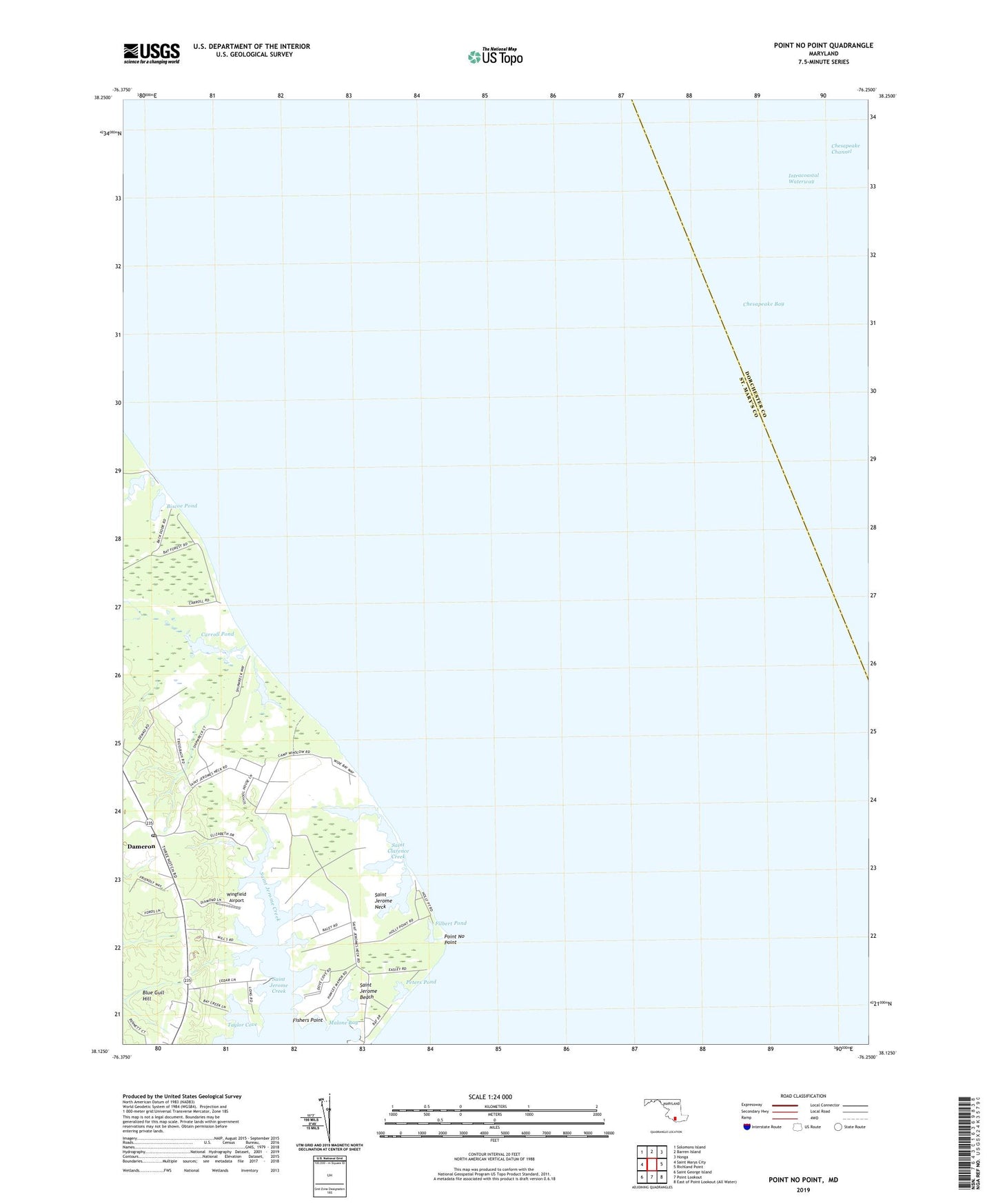
2019 topographic map quadrangle Point No Point in the state of Maryland. Scale: 1:24000. Based on the newly updated USGS 7.5' US Topo map series, this map is in the following counties: St. Mary's, Dorchester. The map contains contour data, water features, and other items you are used to seeing on USGS maps, but also has updated roads and other features. This is the next generation of topographic maps. Printed on high-quality waterproof paper with UV fade-resistant inks.
Quads adjacent to this one:
West: Saint Marys City
Northwest: Solomons Island
North: Barren Island
Northeast: Honga
East: Richland Point
South: Point Lookout
Southwest: Saint George Island
Contains the following named places: Bay Forest, Biscoe Pond, Blue Gull Hill, Carroll Pond, Dameron, Dameron House, Dameron Post Office, Elms Beach, Filbert Pond, Fishers Point, Howleys Manor, Malone Bay, Peters Pond, Point No Point, Saint Clarence Creek, Saint Jerome Beach, Saint Jerome Creek, Saint Jerome Neck, Saint Jerome Shores, Saint Jeromes Landing, Saint Jeromes Manor, Taylor Cove, Wingfield Airport, ZIP Code: 20628