MyTopo
Barre Massachusetts US Topo Map
Couldn't load pickup availability
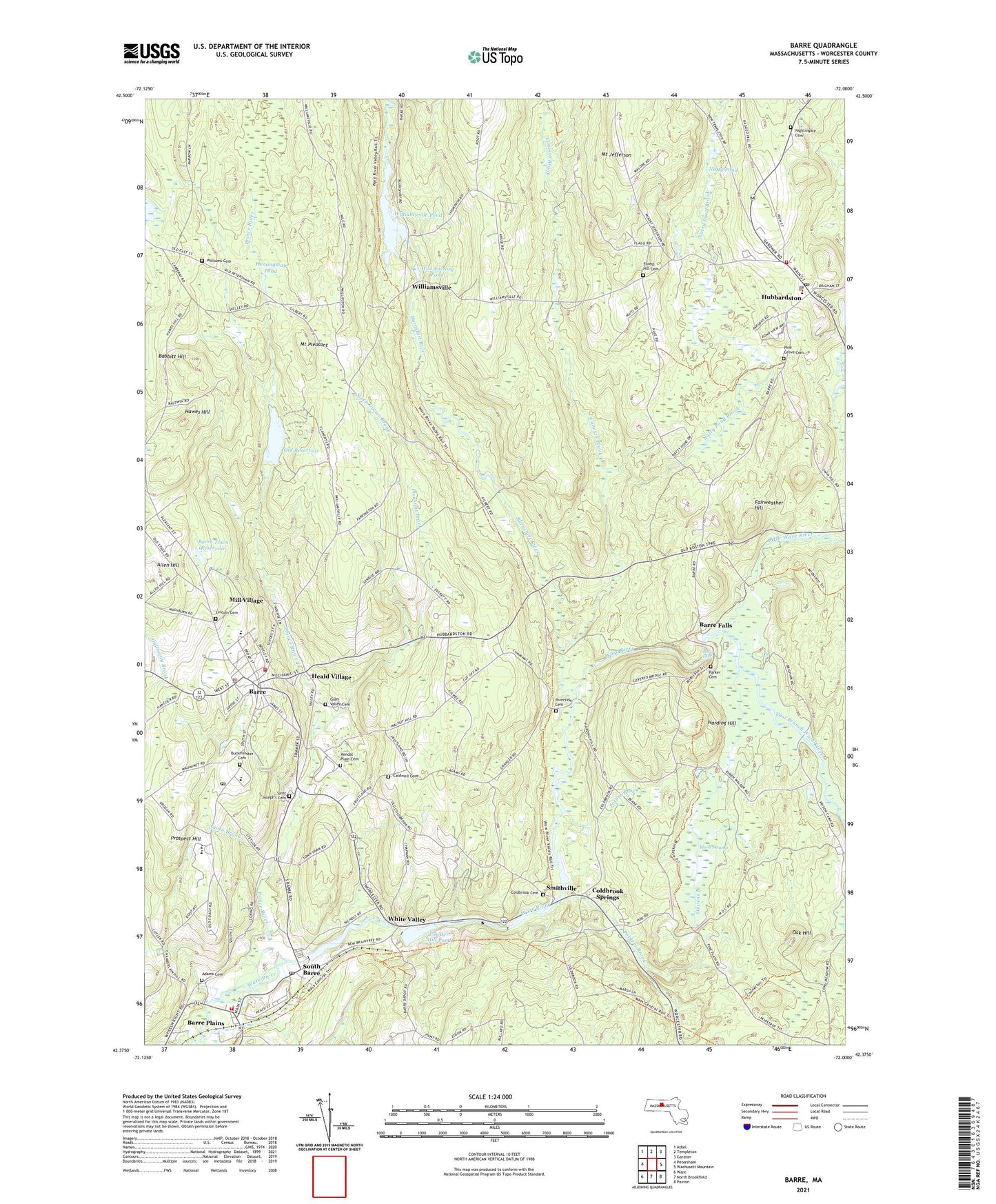
2024 topographic map quadrangle Barre in the state of Massachusetts. Scale: 1:24000. Based on the newly updated USGS 7.5' US Topo map series, this map is in the following counties: Worcester. The map contains contour data, water features, and other items you are used to seeing on USGS maps, but also has updated roads and other features. This is the next generation of topographic maps. Printed on high-quality waterproof paper with UV fade-resistant inks.
Quads adjacent to this one:
West: Petersham
Northwest: Athol
North: Templeton
Northeast: Gardner
East: Wachusett Mountain
Southeast: Paxton
South: North Brookfield
Southwest: Ware
This map covers the same area as the classic USGS quad with code k42072d1.
Contains the following named places: Adams Cemetery, Allen Hill, Babbitt Hill, Barre, Barre Ambulance Service, Barre Census Designated Place, Barre Common District, Barre Congregational Church, Barre Falls, Barre Falls Dam, Barre Fire Department Station 1 Headquarters, Barre Fire Department Station 2, Barre Plains, Barre Police Department, Barre Post Office, Barre Reservoir Dam, Barre State Forest, Barre Town Reservoir, Barre-Bassett Heliport, Blessed Sacrament Novitiate, Blood Swamp, Buckminster Cemetery, Burnshirt River, Caldwell Cemetery, Canesto Brook, Coldbrook Cemetery, Coldbrook Springs, Dicks Brook, East Branch Ware River, Evangelical Congregational Church, Fairweather Hill, Felton Field, Forest Hill Cemetery, Galloway Brook, Glen Valley Cemetery, Goldsmith's Greenhouse, Harding Hill, Hawes Hill, Heald Village, Hemingway Pond, High Plains School, Holden Dam, Hubbardston, Hubbardston Center Elementary School, Hubbardston Federated Church, Hubbardston Fire Department Station 1, Hubbardston Fire Department Station 2 Headquarters, Hubbardston Police Department, Hubbardston Post Office, Hubbardston Town Hall, Kendal Plain Cemetery, Langley School, Lincoln Cemetery, Mill Village, Mount Jefferson, Mount Pleasant, Natty Pond, Natty Pond Brook, Nightingale Cemetery, Oak Hill, Old Reservoir, Parker Cemetery, Parkers Brook, Parkers Mills, Pine Grove Cemetery, Pine Ridge Ski Area, Pleasant Brook, Potash Brook, Powder Mill Pond, Prince River, Prospect Hill, Quabbin Aqueduct, Quabbin Regional Junior-Senior High School, Riverside Cemetery, Ruggles Lane School, Ruggles Lane School Library, Rural Glen Cemetery, Saint Joseph's Cemetery, Saint Josephs Church, Smith Brook, Smithville, Smithville Post Office, South Barre, South Barre Post Office, Steep Gutter Brook, Stetson School, Stevens Branch, Stoney Hill Farm, Town of Barre, Town of Hubbardston, Wax Factory Pond, Wax Factory Pond Dam, West Branch Ware River, White Valley, Williams Cemetery, Williamsville, Williamsville Pond, Williamsville Pond Dam, ZIP Codes: 01005, 01074, 01452