MyTopo
State Line Massachusetts US Topo Map
Couldn't load pickup availability
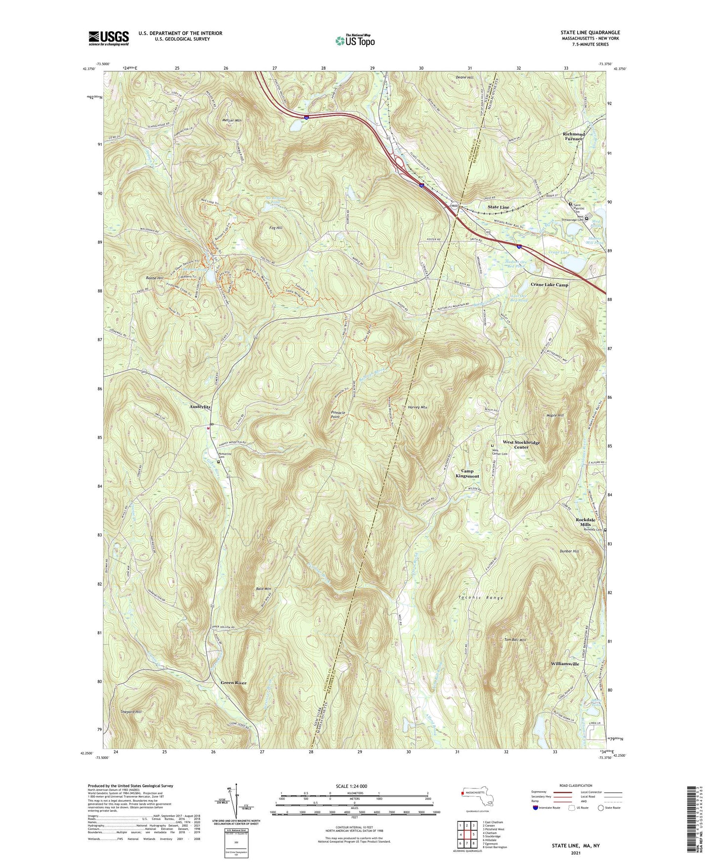
2021 topographic map quadrangle State Line in the states of New York, Massachusetts. Scale: 1:24000. Based on the newly updated USGS 7.5' US Topo map series, this map is in the following counties: Berkshire, Columbia. The map contains contour data, water features, and other items you are used to seeing on USGS maps, but also has updated roads and other features. This is the next generation of topographic maps. Printed on high-quality waterproof paper with UV fade-resistant inks.
Quads adjacent to this one:
West: Chatham
Northwest: East Chatham
North: Canaan
Northeast: Pittsfield West
East: Stockbridge
Southeast: Great Barrington
South: Egremont
Southwest: Hillsdale
Contains the following named places: Austerlitz, Austerlitz Cemetery, Austerlitz Post Office, Austerlitz Volunteer Fire Company, Bald Mountain, Baldwin Brook, Barrett Pond, Beebe Hill, Beebe Hill State Forest, Camp Kingsmont, Cranberry Pond, Crane Lake, Crane Lake Camp, Cranse Creek, Deane Hill, Dunbar Hill, Edwards Park, Flat Brook, Fog Hill, Furnace Brook, Green River, Harts Pond, Harvey Mountain, Hudson Ore Bed Pond, Leet Ore Bed Pond, Maple Hill, Mercer Mountain, Mud Ponds, No Bottom Pond, Pinnacle Point, Richmond Furnace, Rock Dale Mills Post Office, Rockdale Cemetery, Rockdale Mills, Round Pond Dam, Saint Patricks Cemetery, Scribner Brook, Shepard Hill, State Line, Tom Ball Brook, Tom Ball Mountain, Town of West Stockbridge, West Center Cemetery, West Stockbridge Cemetery, West Stockbridge Center, Westover Brook, Williamsville, Woodland Hills Campground, ZIP Codes: 01236, 01266, 12017