MyTopo
Adams Park Michigan US Topo Map
Couldn't load pickup availability
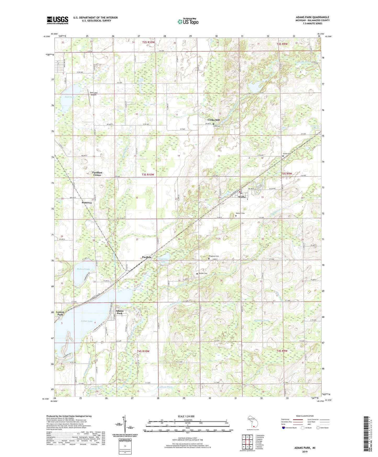
2019 topographic map quadrangle Adams Park in the state of Michigan. Scale: 1:24000. Based on the newly updated USGS 7.5' US Topo map series, this map is in the following counties: Kalamazoo. The map contains contour data, water features, and other items you are used to seeing on USGS maps, but also has updated roads and other features. This is the next generation of topographic maps. Printed on high-quality waterproof paper with UV fade-resistant inks.
Quads adjacent to this one:
West: Portage
Northwest: Kalamazoo
North: Galesburg
Northeast: Augusta
East: Climax
Southeast: Leonidas
South: Mendon
Southwest: Vicksburg
Contains the following named places: Adams Park, Asher Drain, Bond School, Boughton Cemetery, Chapman Memorial Church, Climax-Scotts Elementary School, Collins Corner, Cook Cemetery, Cooks Mill, Cooley School, Country Christian Evangelical Free Church, Dorrance Creek, East Lake, East Lake Airport, Gilson Cemetery, Hull School, Indian Lake, Indian Lake Drain, Indian Lake School, Lemon Park, McKain Cemetery, McKain Corners, Morse School, Pavilion, Pavilion Post Office, Pavilion Station, Pavilion Township Fire Department Station 1, Pavillion Center, Pavillion Estates Mobile Home Park, Pickerel Lake, Pomeroy, Prairie Church, Reinbold Drain, Sagamaw Lake, Scotts, Scotts Census Designated Place, Scotts Mill County Park, Scotts Post Office, Scotts Station, Scotts United Methodist Church, Timberlake Campground, Township of Pavilion, Universal Life Church, Wakeshma Tabernacle, Wolcott Cemetery, ZIP Code: 49088