MyTopo
Climax Michigan US Topo Map
Couldn't load pickup availability
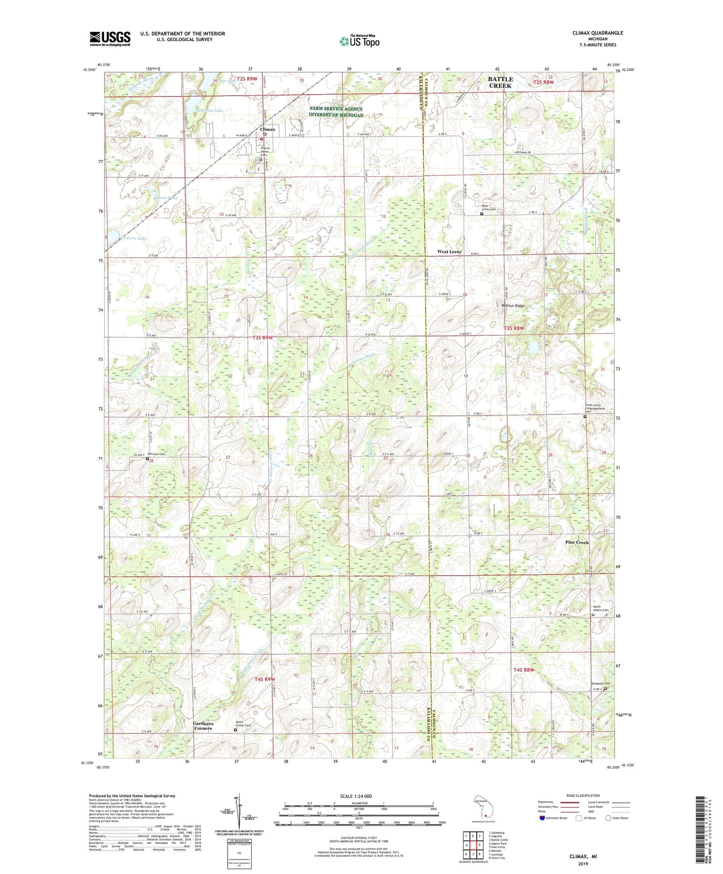
2023 topographic map quadrangle Climax in the state of Michigan. Scale: 1:24000. Based on the newly updated USGS 7.5' US Topo map series, this map is in the following counties: Kalamazoo, Calhoun. The map contains contour data, water features, and other items you are used to seeing on USGS maps, but also has updated roads and other features. This is the next generation of topographic maps. Printed on high-quality waterproof paper with UV fade-resistant inks.
Quads adjacent to this one:
West: Adams Park
Northwest: Galesburg
North: Augusta
Northeast: Battle Creek
East: East Leroy
Southeast: Union City
South: Leonidas
Southwest: Mendon
This map covers the same area as the classic USGS quad with code o42085b3.
Contains the following named places: Athens Church, Berger School, Bigelow School, Climax, Climax Mobile Home Park, Climax Post Office, Climax Station, Climax Township Fire Department, Climax Township Hall, Climax United Methodist Church, Climax-Scotts Junior/Senior High School, Daniel B. Eldred House Historical Marker, Eldred Drain, Gardners Corners, Goose Pond, Harrison Cemetery, Harvey School, Hiscock School, Johnson Drain, Langeland Climax Chapel, Lawrence Memorial Library, Le Ferre Lake, Longman Drain, Lynn School, McGinnis Lake, North Athens Baptist Church, North Athens Cemetery, North Fulton Cemetery, Pine Creek, Pinecreek Post Office, Potter Lake, Prairie Home Cemetery, School Number 4, Seeley School, South Climax Post Office, South Leroy Congregational Cemetery, Stimpson Cemetery, Township of Climax, Village of Climax, Wakeshma Church, Wakeshma Drain, Wakeshma Post Office, Walnut Ridge, West Leroy, West Leroy Bible Church, West Leroy Cemetery, West Leroy Post Office, Willow Swamp Drain, WRKR-FM (Portage), ZIP Code: 49034