MyTopo
Leonidas Michigan US Topo Map
Couldn't load pickup availability
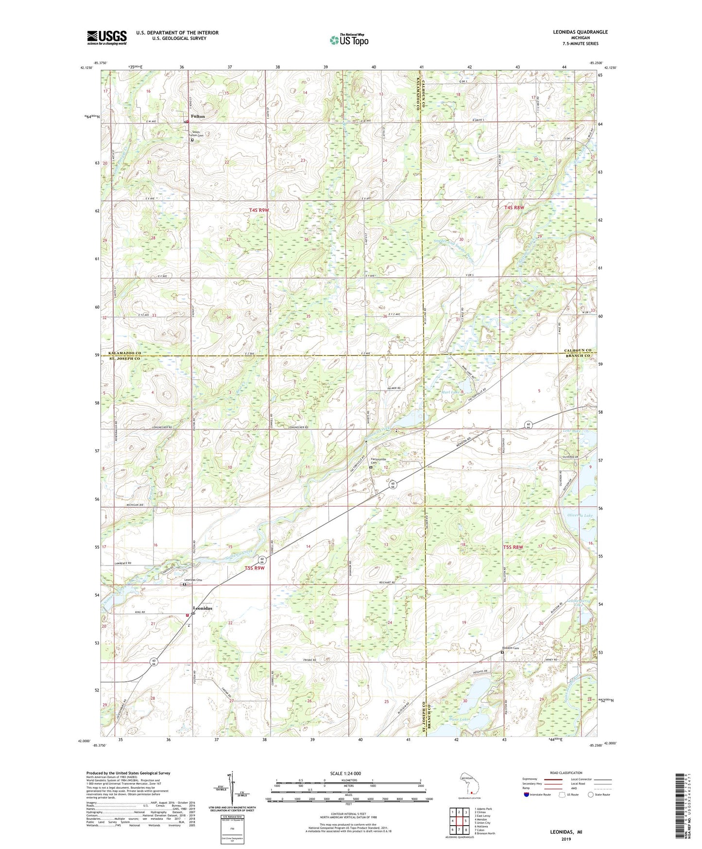
2023 topographic map quadrangle Leonidas in the state of Michigan. Scale: 1:24000. Based on the newly updated USGS 7.5' US Topo map series, this map is in the following counties: St. Joseph, Kalamazoo, Branch, Calhoun. The map contains contour data, water features, and other items you are used to seeing on USGS maps, but also has updated roads and other features. This is the next generation of topographic maps. Printed on high-quality waterproof paper with UV fade-resistant inks.
Quads adjacent to this one:
West: Mendon
Northwest: Adams Park
North: Climax
Northeast: East Leroy
East: Union City
Southeast: Bronson North
South: Colon
Southwest: Nottawa
This map covers the same area as the classic USGS quad with code o42085a3.
Contains the following named places: Ashley Drain, Blossom Cemetery, Blossom Lake, Blossom School, Carpenter School, Culp School, Dane Lake, Factoryville, Factoryville Cemetery, Factoryville School, Factoryville Station, Faith Bible Church, Foote School, Fulton, Fulton Christian Church, Fulton Post Office, Fulton State Game Area, Harvey Lake, Hunt School, Huron Potawatomi Reservation, Indian Cemetery, Kenyon Lake, Kirby School, Leatherberry Lake, Leggett School, Lehr Lake, Leonidas, Leonidas Cemetery, Leonidas Elementary School, Leonidas Post Office, Leonidas School, Leonidas Station, Leonidas Township Hall, Leonidas Volunteer Fire Department, Level Acres Landing Strip, Marl Lake, McCauley Drain, Mission Church, Mud Lake, Oliverda Lake, Pine Creek, Sherwood Post Office, Slayton Post Office, Snyder and Snyder Drain, South Fulton Cemetery, South Kalamazoo County Fire Authority Station 3, Township of Leonidas, Township of Wakeshma, Tutewiter and Town Line Drain, Worden School, ZIP Codes: 49052, 49066