MyTopo
Alden Michigan US Topo Map
Couldn't load pickup availability
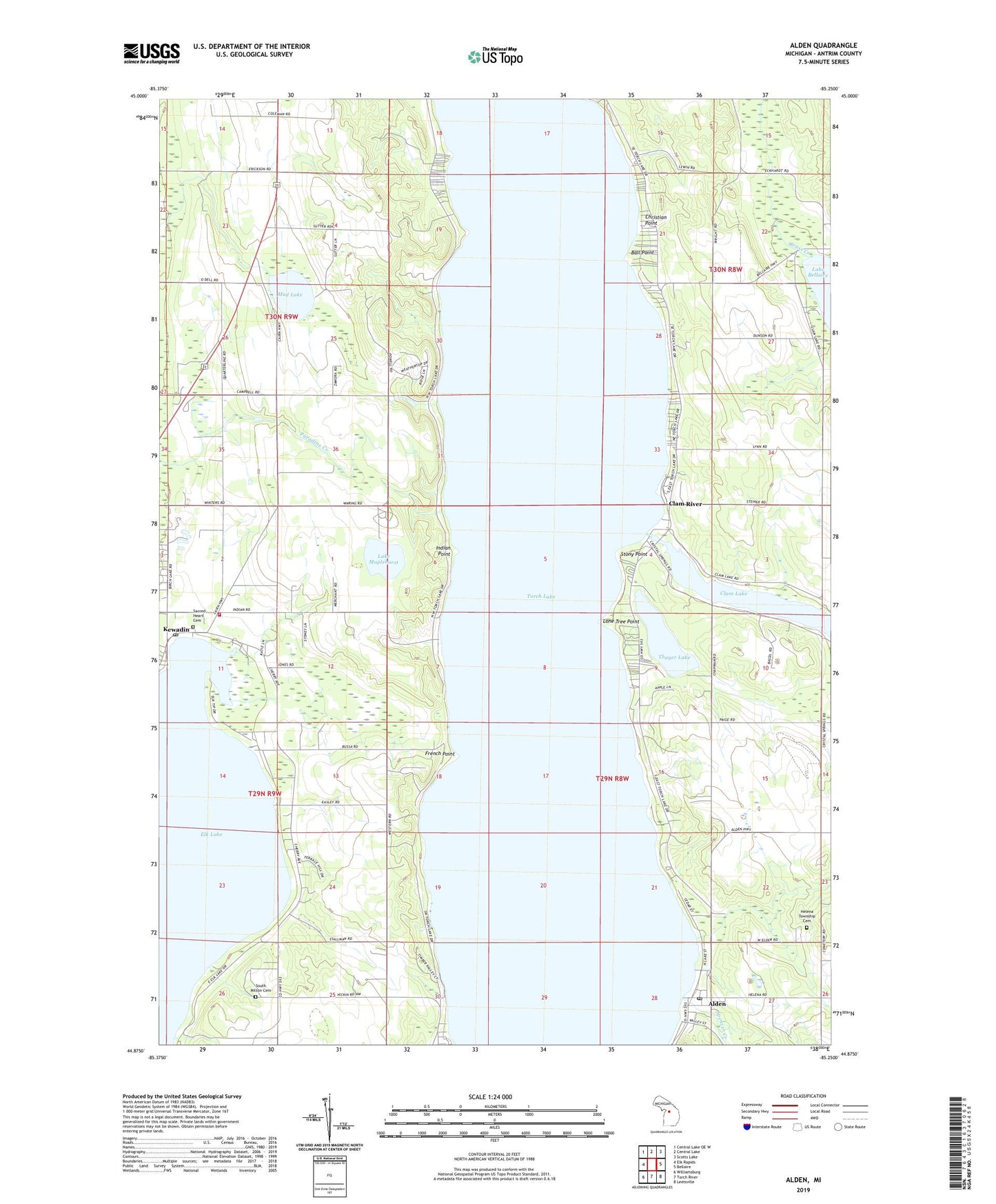
2019 topographic map quadrangle Alden in the state of Michigan. Scale: 1:24000. Based on the newly updated USGS 7.5' US Topo map series, this map is in the following counties: Antrim. The map contains contour data, water features, and other items you are used to seeing on USGS maps, but also has updated roads and other features. This is the next generation of topographic maps. Printed on high-quality waterproof paper with UV fade-resistant inks.
Quads adjacent to this one:
West: Elk Rapids
Northwest: Central Lake OE W
North: Central Lake
Northeast: Scotts Lake
East: Bellaire
Southeast: Leetsville
South: Torch River
Southwest: Williamsburg
Contains the following named places: Alden, Alden Census Designated Place, Alden Depot Museum, Alden Depot Park, Alden Post Office, Alden Station, Alden United Methodist Church, Ball Point, Camp Fairwood, Camp Maplehurst, Christian Point, Clam Lake School, Clam River, Clam River Post Office, Deepwater Point, French Point, Grass Creek, Helena Township Cemetery, Helena Township Library, Helena Township Park, Indian Point, Kewadin, Kewadin Indian Cemetery, Kewadin Indian Mission, Kewadin Post Office, Kewadin United Methodist Church, Lake Maplehurst, Lone Tree Point, Milton Township Fire Department Station 1 Headquarters, Milton Township Park, Mud Lake, Sacred Heart Cemetery, South Milton Cemetery, South Milton Post Office, Spencer Creek, Stony Point, Thayer Lake, Torch Lake, Township of Forest Home, Township of Helena, Township of Milton, Valleau Landing, ZIP Code: 49648