MyTopo
Torch River Michigan US Topo Map
Couldn't load pickup availability
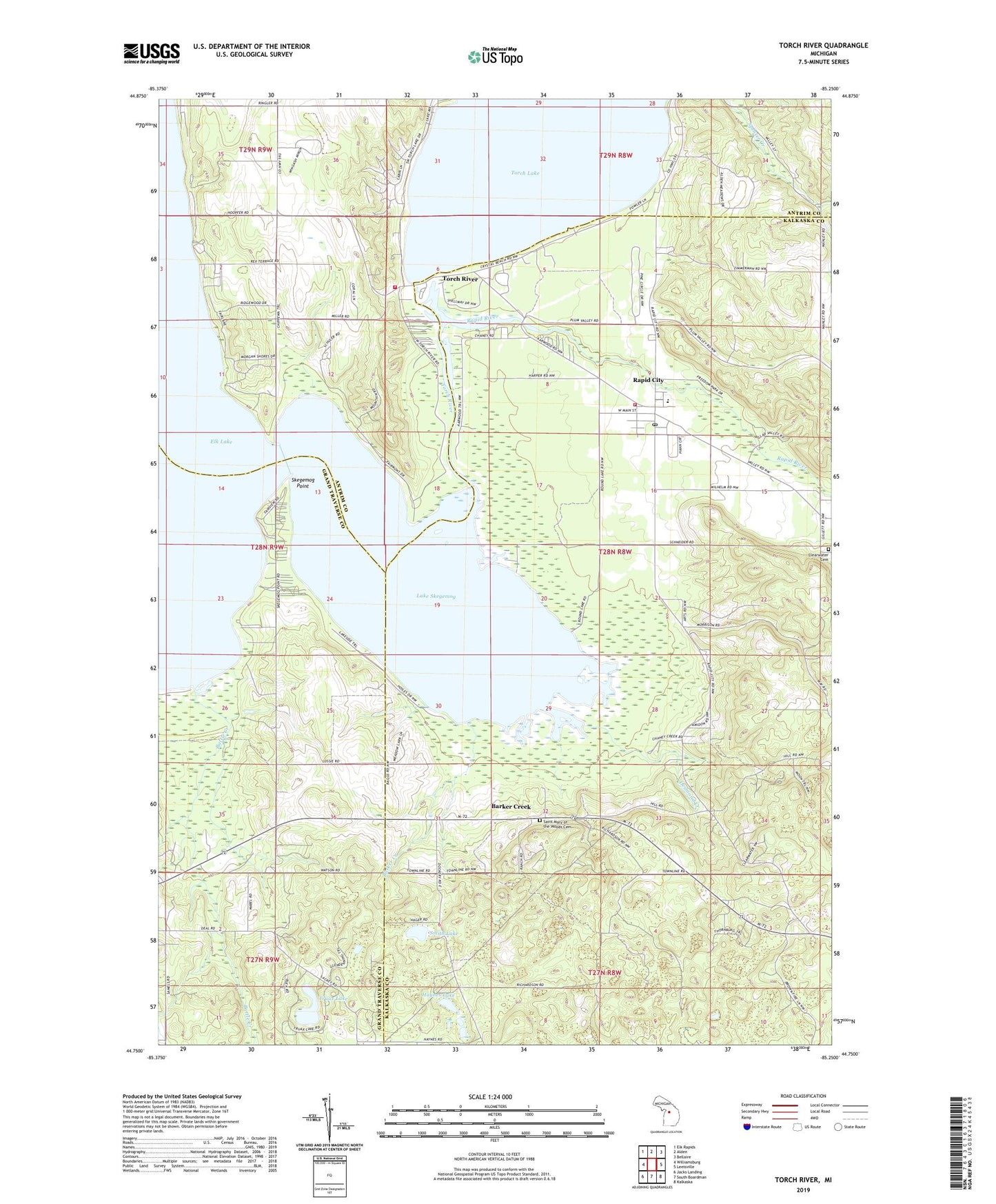
2023 topographic map quadrangle Torch River in the state of Michigan. Scale: 1:24000. Based on the newly updated USGS 7.5' US Topo map series, this map is in the following counties: Kalkaska, Antrim, Grand Traverse. The map contains contour data, water features, and other items you are used to seeing on USGS maps, but also has updated roads and other features. This is the next generation of topographic maps. Printed on high-quality waterproof paper with UV fade-resistant inks.
Quads adjacent to this one:
West: Williamsburg
Northwest: Elk Rapids
North: Alden
Northeast: Bellaire
East: Leetsville
Southeast: Kalkaska
South: South Boardman
Southwest: Jacks Landing
This map covers the same area as the classic USGS quad with code o44085g3.
Contains the following named places: Aarwood Post Office, Assembly of God Church, Barker Creek, Barker Creek Post Office, Barker Creek Station, Battle Creek, Church of Christ, Clearwater Chapel, Clearwater Post Office, Clearwater Township Cemetery, Clearwater Township Fire Department Station 5, Desmond Creek, Freedom Park, Haynes Lake, Lake Skegemog, Mabel, Mabel Post Office, Mabel Station, Milton Township Fire Department Station 2, Rapid City, Rapid City Census Designated Place, Rapid City Post Office, Rapid City School, Rapid City Station, Rapid River, Saint Mary of the Woods Catholic Cemetery, Skegemog Point, Smith Lake, South Milton Community Hall, South Torch Lake Fire Station, Torch Grove Campgrounds, Torch River, Township of Clearwater, Truax Lake, ZIP Code: 49676