MyTopo
Bad Axe SE Michigan US Topo Map
Couldn't load pickup availability
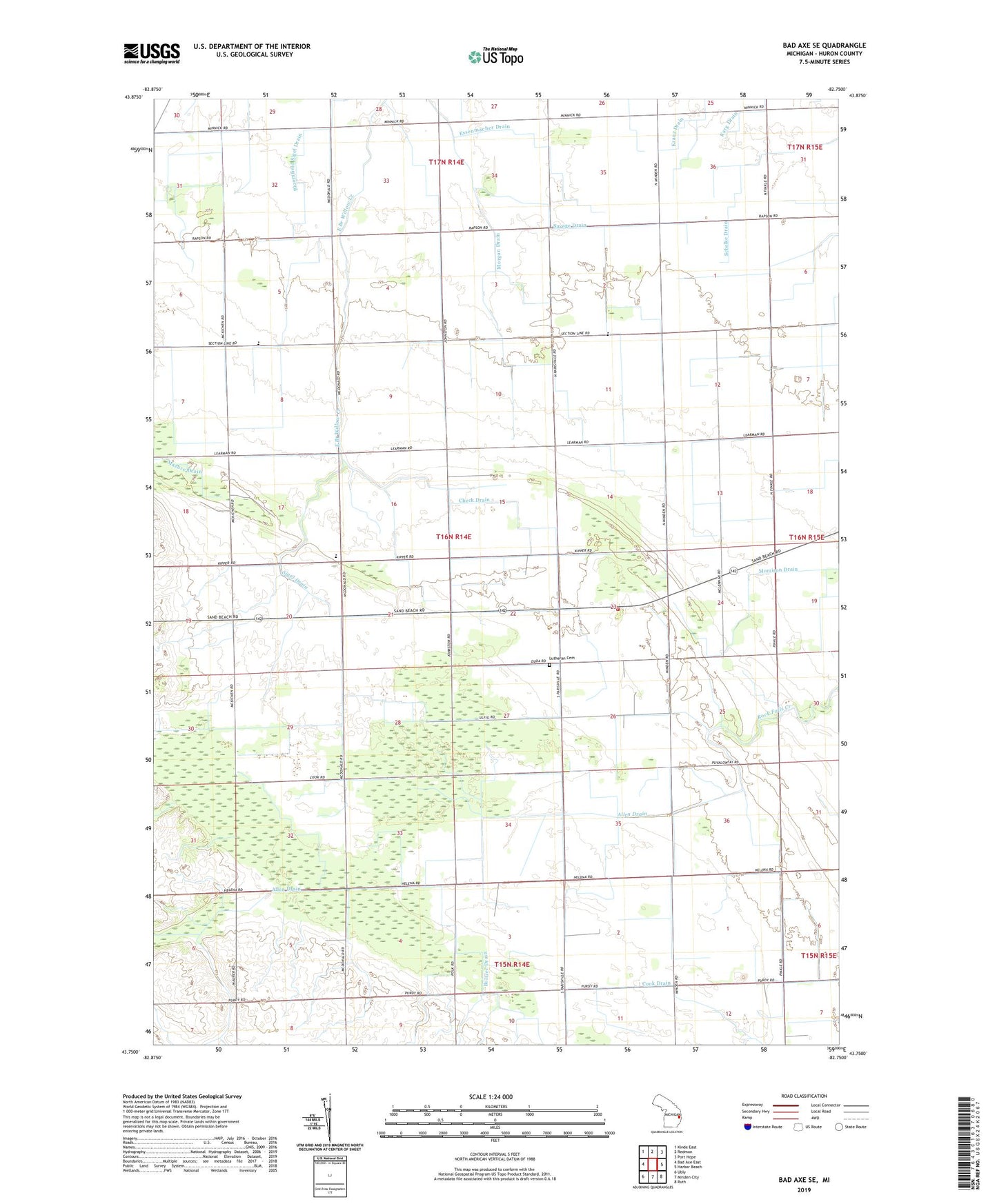
2019 topographic map quadrangle Bad Axe SE in the state of Michigan. Scale: 1:24000. Based on the newly updated USGS 7.5' US Topo map series, this map is in the following counties: Huron. The map contains contour data, water features, and other items you are used to seeing on USGS maps, but also has updated roads and other features. This is the next generation of topographic maps. Printed on high-quality waterproof paper with UV fade-resistant inks.
Quads adjacent to this one:
West: Bad Axe East
Northwest: Kinde East
North: Redman
Northeast: Port Hope
East: Harbor Beach
Southeast: Ruth
South: Minden City
Southwest: Ubly
Contains the following named places: Adams School, Allen Drain, Check Drain, Eccles School, Essenmacher Drain, Halfway Corners, Jericho School, Kipper School, Morgan Drain, Roggenbuck Farms, Savage Drain, Schelke Drain, Sigel Drain, Sigel Township Fire Hall, Sigel Township Lutheran Cemetery, Swayze School, Tenbusch Farm, Township of Sigel