MyTopo
Minden City Michigan US Topo Map
Couldn't load pickup availability
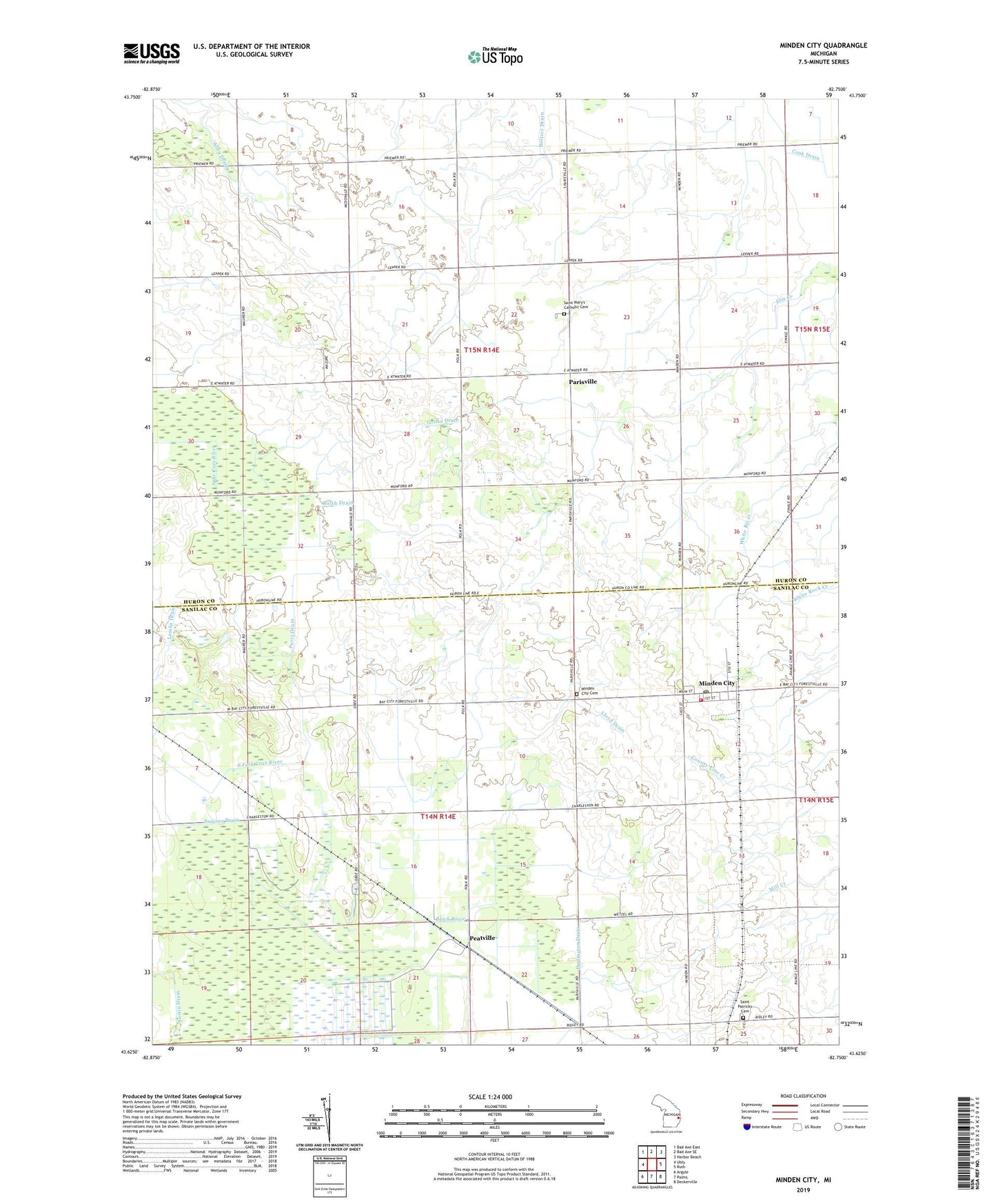
2023 topographic map quadrangle Minden City in the state of Michigan. Scale: 1:24000. Based on the newly updated USGS 7.5' US Topo map series, this map is in the following counties: Huron, Sanilac. The map contains contour data, water features, and other items you are used to seeing on USGS maps, but also has updated roads and other features. This is the next generation of topographic maps. Printed on high-quality waterproof paper with UV fade-resistant inks.
Quads adjacent to this one:
West: Ubly
Northwest: Bad Axe East
North: Bad Axe SE
Northeast: Harbor Beach
East: Ruth
Southeast: Deckerville
South: Palms
Southwest: Argyle
This map covers the same area as the classic USGS quad with code o43082f7.
Contains the following named places: Boltzer Drain, Brackley Cemetery, Butch Drain, Cook Drain, Darlington Drain, Grifka Drain, Kowalski Drain, Lloyd Drain, Minden City, Minden City Cemetery, Minden City Fire Department, Minden City Post Office, Minden City Station, Osintoski Drain, Palms School, Paris Drain, Parisville, Parisville Post Office, Pawlowski Post Office, Peatville, Saint Mary's Catholic Cemetery, Saint Mary's Church, Saint Mary's Historical Museum, Saint Marys School, Saint Patricks Cemetery, Swiercz Drain, Township of Minden, Township of Paris, Village of Minden City, ZIP Codes: 48456, 48470