MyTopo
Bay Shore Michigan US Topo Map
Couldn't load pickup availability
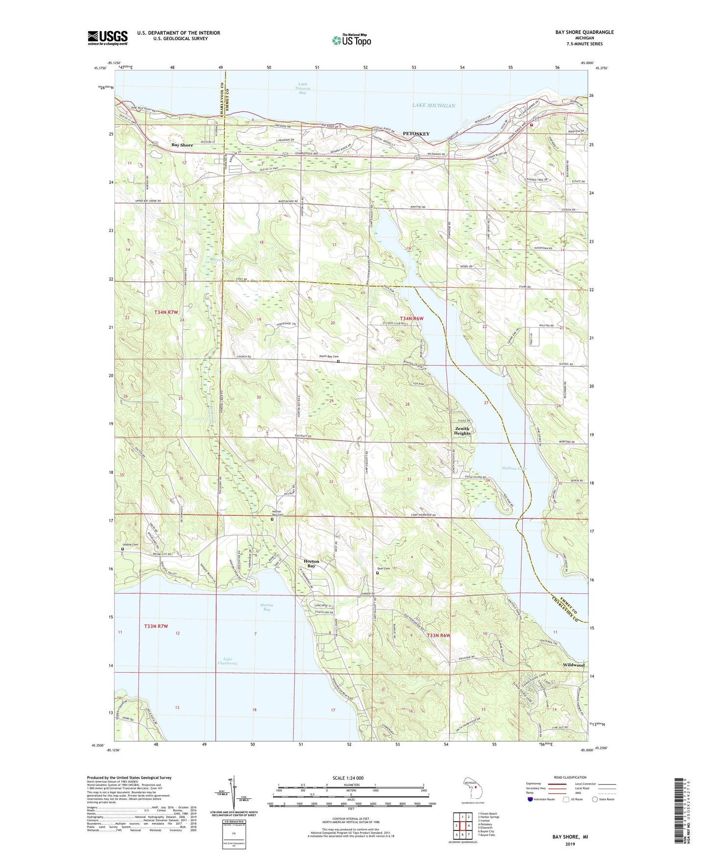
2023 topographic map quadrangle Bay Shore in the state of Michigan. Scale: 1:24000. Based on the newly updated USGS 7.5' US Topo map series, this map is in the following counties: Charlevoix, Emmet. The map contains contour data, water features, and other items you are used to seeing on USGS maps, but also has updated roads and other features. This is the next generation of topographic maps. Printed on high-quality waterproof paper with UV fade-resistant inks.
Quads adjacent to this one:
West: Ironton
North: Forest Beach
Northeast: Harbor Springs
East: Petoskey
Southeast: Boyne Falls
South: Boyne City
Southwest: Ellsworth
This map covers the same area as the classic USGS quad with code o45085c1.
Contains the following named places: Bay Harbor Golf Club, Bay Shore, Bay Shore Census Designated Place, Bay Shore Estates, Bay Shore Post Office, Bay Shore Presbyterian Church, Bay Shore Station, Bay View Family Medicine, Carpenter Post Office, Crooked Tree Golf Club, Dyer Cemetery, Horton Bay, Horton Bay Cemetery, Horton Bay Census Designated Place, Horton Bay Historical Marker, Horton Bay Post Office, Horton Bay United Methodist Church, Horton Creek, Indian Cemetery, Lakegrove Post Office, Maplewood School, Murray School, North Bay Cemetery, North Bay School, Northern Michigan Sports Medicine, Penn-Dixie Cement Corporation, Saint Solanus Church, Township of Bay, Township of Resort, Undine Cemetery, Wildwood, Zenith Heights