MyTopo
Betsy Lake North Michigan US Topo Map
Couldn't load pickup availability
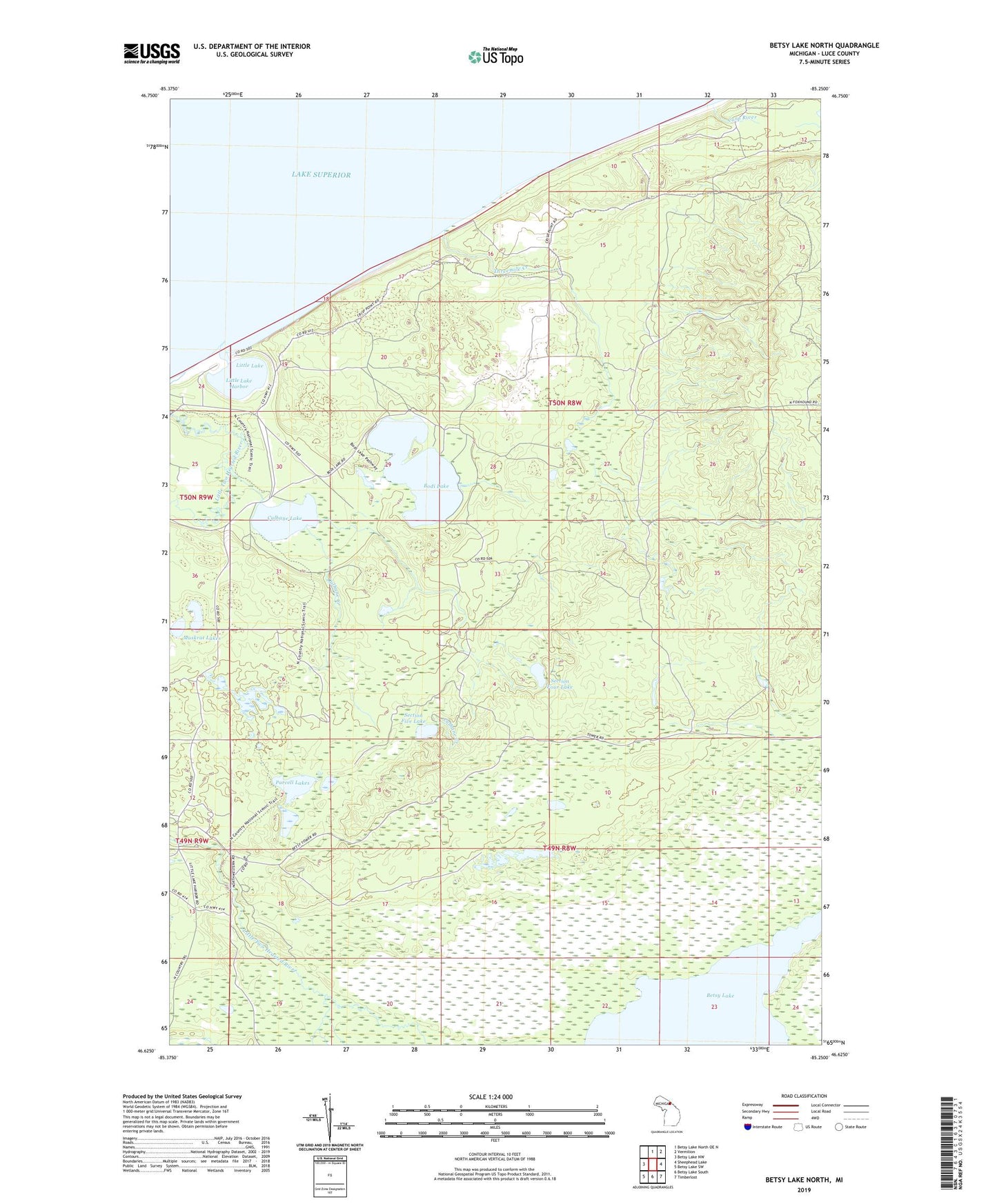
2019 topographic map quadrangle Betsy Lake North in the state of Michigan. Scale: 1:24000. Based on the newly updated USGS 7.5' US Topo map series, this map is in the following counties: Luce. The map contains contour data, water features, and other items you are used to seeing on USGS maps, but also has updated roads and other features. This is the next generation of topographic maps. Printed on high-quality waterproof paper with UV fade-resistant inks.
Quads adjacent to this one:
West: Betsy Lake NW
North: Betsy Lake North OE N
Northeast: Vermilion
East: Sheephead Lake
Southeast: Timberlost
South: Betsy Lake South
Southwest: Betsy Lake SW
Contains the following named places: Betsy Lake, Bodi Lake, Bodi Lake State Forest Campground, Carp River, Chippewa Lodge, Culhane Creek, Culhane Lake, Culhane Lake State Forest Campground, Dry Lakes, Little Lake, Little Lake Harbor, Muskrat Lakes, Parcell Lakes, Section Five Lake, Section Four Lake, Seminole Lodge, State Waterways Commission Dock, Threemile Creek