MyTopo
Betsy Lake South Michigan US Topo Map
Couldn't load pickup availability
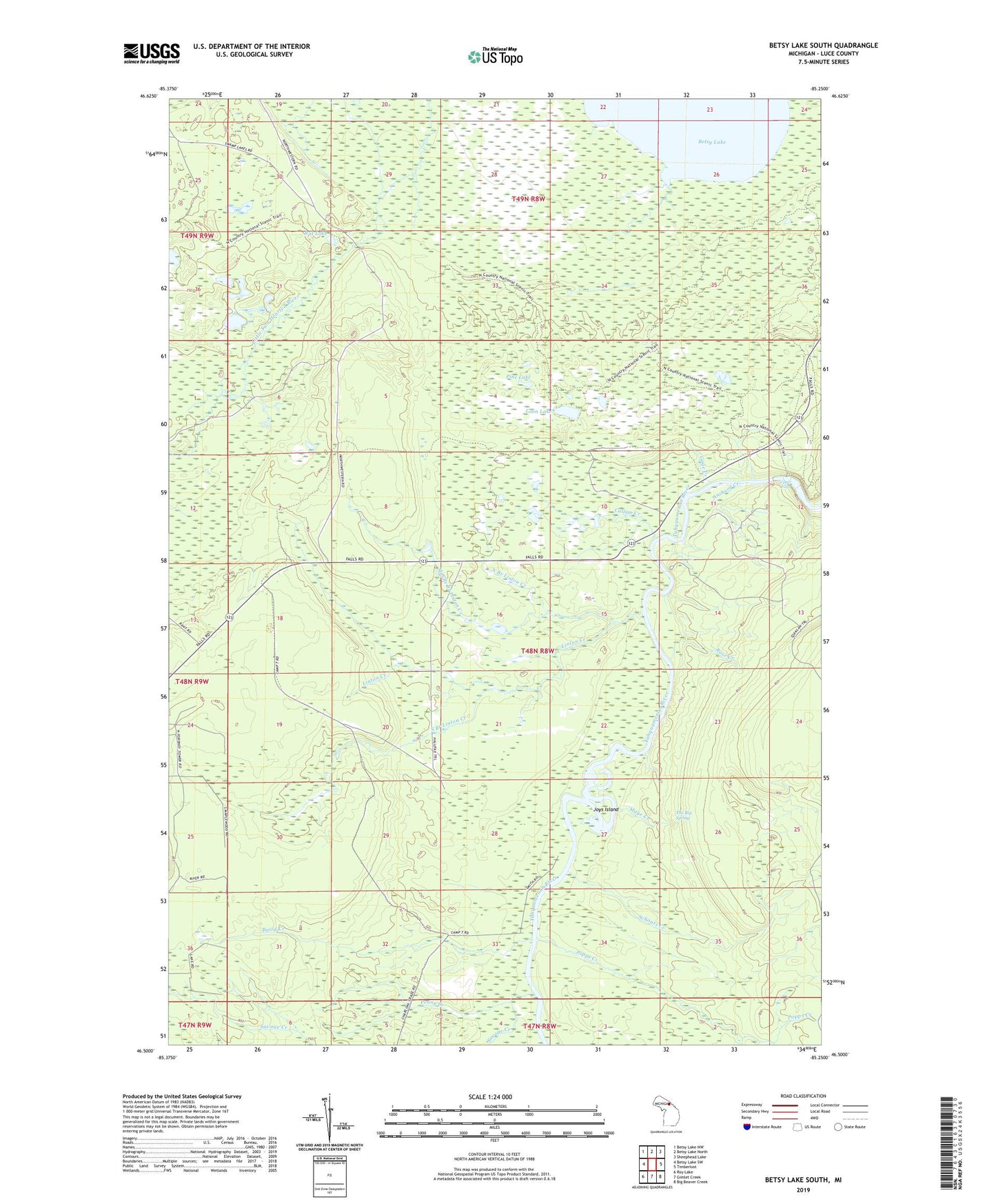
2023 topographic map quadrangle Betsy Lake South in the state of Michigan. Scale: 1:24000. Based on the newly updated USGS 7.5' US Topo map series, this map is in the following counties: Luce. The map contains contour data, water features, and other items you are used to seeing on USGS maps, but also has updated roads and other features. This is the next generation of topographic maps. Printed on high-quality waterproof paper with UV fade-resistant inks.
Quads adjacent to this one:
West: Betsy Lake SW
Northwest: Betsy Lake NW
North: Betsy Lake North
Northeast: Sheephead Lake
East: Timberlost
Southeast: Big Beaver Creek
South: Gimlet Creek
Southwest: Roy Lake
This map covers the same area as the classic USGS quad with code o46085e3.
Contains the following named places: Anchard Creek, Baird Creek, Callam Creek, Gage Creek, Joys Island, Linton Creek, Loon Lake, Maye Creek, Middle Branch Linton Creek, North Branch Linton Creek, Penny Creek, Pine Lake, Popps Creek, Rat Lake, Rose Creek, Savage Creek, Schouts Creek, South Branch Linton Creek, The Big Spring, Upper Falls, Wolf Creek