MyTopo
Betsy Lake NW Michigan US Topo Map
Couldn't load pickup availability
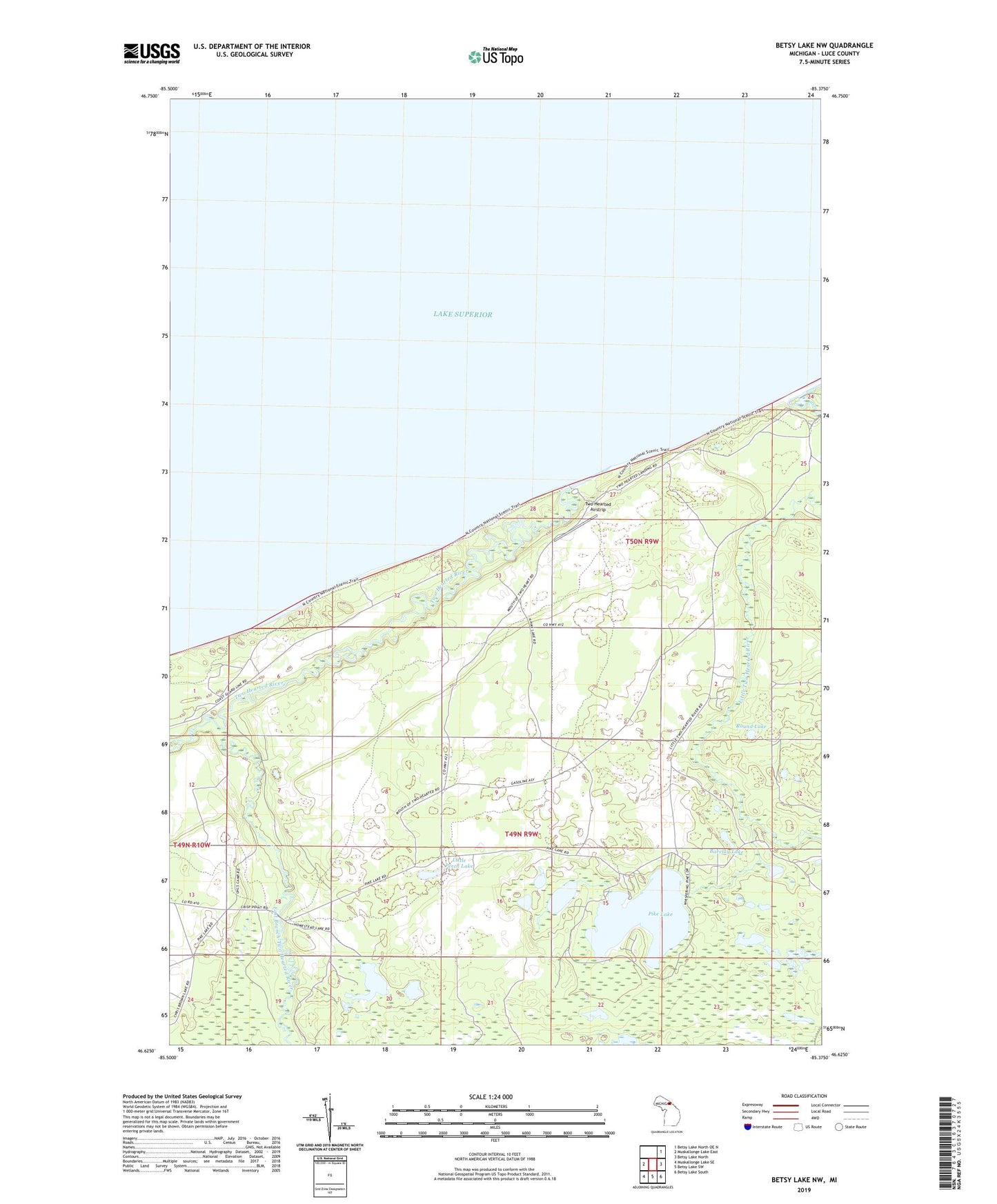
2023 topographic map quadrangle Betsy Lake NW in the state of Michigan. Scale: 1:24000. Based on the newly updated USGS 7.5' US Topo map series, this map is in the following counties: Luce. The map contains contour data, water features, and other items you are used to seeing on USGS maps, but also has updated roads and other features. This is the next generation of topographic maps. Printed on high-quality waterproof paper with UV fade-resistant inks.
Quads adjacent to this one:
West: Muskallonge Lake East
Northeast: Betsy Lake North OE N
East: Betsy Lake North
Southeast: Betsy Lake South
South: Betsy Lake SW
Southwest: Muskallonge Lake SE
This map covers the same area as the classic USGS quad with code o46085f4.
Contains the following named places: Barclay Lake, East Branch Two Hearted River, Homestead Lake, Life Saving Station Historical Marker, Little Perch Lake, Little Pike Lake, Little Two Hearted River, Mouth of Two Hearted River State Forest Campground, Pike Lake, Pike Lake State Forest Campground, Round Lake, Two Hearted Airstrip, Two Hearted River