MyTopo
Big Star Lake Michigan US Topo Map
Couldn't load pickup availability
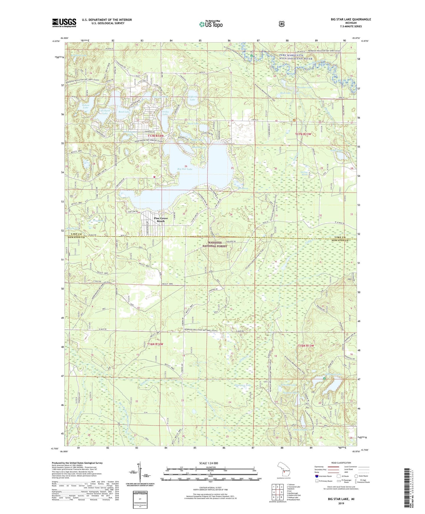
2019 topographic map quadrangle Big Star Lake in the state of Michigan. Scale: 1:24000. Based on the newly updated USGS 7.5' US Topo map series, this map is in the following counties: Newaygo, Lake. The map contains contour data, water features, and other items you are used to seeing on USGS maps, but also has updated roads and other features. This is the next generation of topographic maps. Printed on high-quality waterproof paper with UV fade-resistant inks.
Quads adjacent to this one:
West: Carr
Northwest: Tallman
North: Townsend Lake
Northeast: Baldwin
East: Marlborough
Southeast: Woodland Park
South: Walkup Lake
Southwest: Walkerville East
Contains the following named places: Amaung Lake, Basford Lake, Big Star Lake, Big Star Lake Church, Bradford Lake, Cecilia Lake, Cedar Creek, Condon Lake, Danaher Creek, Danaher Lake, Duck Lake, Freeman Creek, Frog Marsh, Gifford Lake, Gleasons Landing Recreation Area, Highbank Lake, Highbank Lake Recreation Area, Honeymoon Lake, Honeymoon Lake Snowmobile Trail, Jenks Creek, Jenks Lake, Kenosha Lake, Lake Community Bible Church, Lake Township Fire Department, Lamoreaux Lake, Marquette Trails Country Club, Miller Lake, Mud Lake, Orchard Lake, Otterman Lake, Oxbow Lake, Pine Grove Beach, Rainbow Lake, Reed Lake, Sawkaw Lake, Shonenya Lake, Star Lake Lookout Tower, Star Marsh, Sterling Marsh, Township of Lake, Township of Troy, Triple Lakes Creek, Walkers Corners, ZIP Code: 49309