MyTopo
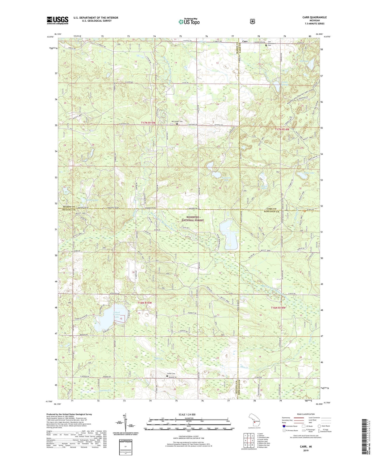
Carr Michigan US Topo Map
Couldn't load pickup availability
Also explore the Carr Forest Service Topo of this same quad for updated USFS data
2023 topographic map quadrangle Carr in the state of Michigan. Scale: 1:24000. Based on the newly updated USGS 7.5' US Topo map series, this map is in the following counties: Oceana, Mason, Newaygo, Lake. The map contains contour data, water features, and other items you are used to seeing on USGS maps, but also has updated roads and other features. This is the next generation of topographic maps. Printed on high-quality waterproof paper with UV fade-resistant inks.
Quads adjacent to this one:
West: Crystal Valley
Northwest: Custer
North: Tallman
Northeast: Townsend Lake
East: Big Star Lake
Southeast: Walkup Lake
South: Walkerville East
Southwest: Walkerville West
This map covers the same area as the classic USGS quad with code o43086g1.
Contains the following named places: Allen Creek, Allencreek Post Office, Augustine Lake, Carr, Carr Settlement Cemetery, Carrs Post Office, Colfax Cemetery, Darkeys Marsh, Gillen Springs, Hill Lake, McCumber Cemetery, Misti Pines Campground, Pine Haven Camp Ground, Roby Lake, Ruby Creek, School Section Lake, Township of Colfax, Township of Logan, Tuckett Lake, Woody Creek