MyTopo
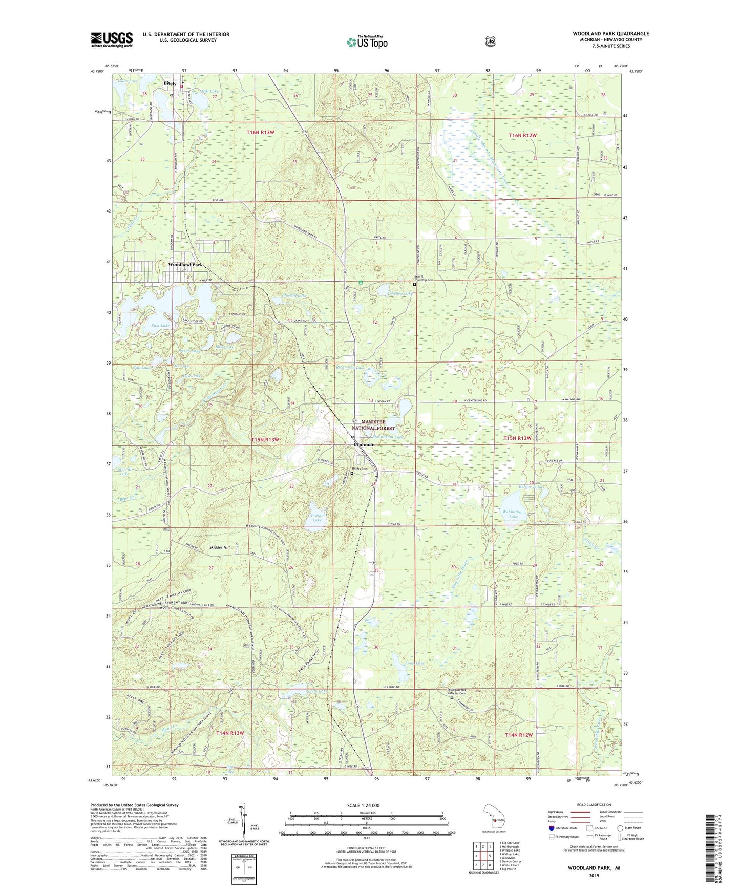
Woodland Park Michigan US Topo Map
Couldn't load pickup availability
Also explore the Woodland Park Forest Service Topo of this same quad for updated USFS data
2023 topographic map quadrangle Woodland Park in the state of Michigan. Scale: 1:24000. Based on the newly updated USGS 7.5' US Topo map series, this map is in the following counties: Newaygo. The map contains contour data, water features, and other items you are used to seeing on USGS maps, but also has updated roads and other features. This is the next generation of topographic maps. Printed on high-quality waterproof paper with UV fade-resistant inks.
Quads adjacent to this one:
West: Walkup Lake
Northwest: Big Star Lake
North: Marlborough
Northeast: Whipple Lake
East: Woodville
Southeast: Big Prairie
South: White Cloud
Southwest: Dayton Center
This map covers the same area as the classic USGS quad with code o43085f7.
Contains the following named places: Bass Lake, Berger Pond, Biteley Station, Bitely, Bitely Community Church, Bitely Lake, Bitely Post Office, Blue Lake Drain, Bluegill Lake, Broham Station, Brohman, Brohman Post Office, Bub Lake, East Lake, Egg Lake, First Baptist Church of Woodland, Hillers Cemetery, Indian Lake, Isaac Lake, James Creek, Lilley Township Fire Department, Loda Lake, Loda Lake Recreation Site, Loda Lake Wildflower Sanctuary, Loon Lake, Lost Lake, Mena Creek Waterfowl Area, Merrill Lake, Merrill Township Cemetery, Middle Lake, Mill Lake, Moonbeam Lake, Perch Lake, Richmond Lake, Saint Joseph's Catholic Cemetery, Shelley Lake, Sis Lake, Skidder Hill, Township of Merrill, Webinguaw Lake, Woodland Lake, Woodland Park, ZIP Code: 49312