MyTopo
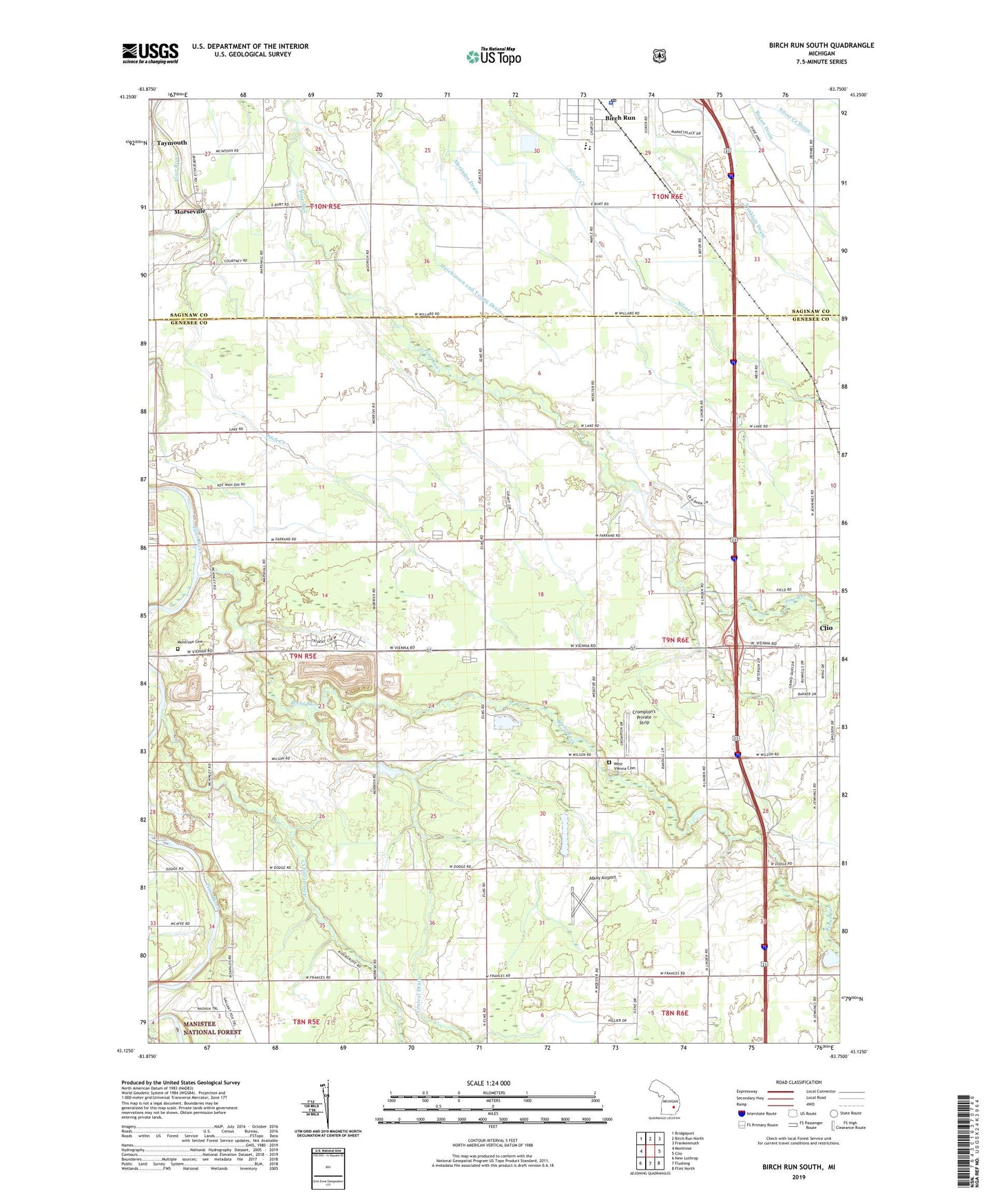
Birch Run South Michigan US Topo Map
Couldn't load pickup availability
2019 topographic map quadrangle Birch Run South in the state of Michigan. Scale: 1:24000. Based on the newly updated USGS 7.5' US Topo map series, this map is in the following counties: Genesee, Saginaw. The map contains contour data, water features, and other items you are used to seeing on USGS maps, but also has updated roads and other features. This is the next generation of topographic maps. Printed on high-quality waterproof paper with UV fade-resistant inks.
Quads adjacent to this one:
West: Montrose
Northwest: Bridgeport
North: Birch Run North
Northeast: Frankenmuth
East: Clio
Southeast: Flint North
South: Flushing
Southwest: New Lothrop
Contains the following named places: Alexander Drain, Alkay Airport, Armstrong Creek, Birch Run High School, Birch Run Police Department, Birch Run Post Office, Birch Run Township Park, Birch Run United Methodist Church, Birchwood Farms Mobile Home Park, Brent Creek, Brent Run, Central Drain, Charter Township of Montrose, Charter Township of Vienna, Christ Lutheran Church, Christian Faith Church, Clio Golf Course, Clio Rest Area, Community of Christ Clio Church, County Line Station, Countyline Post Office, Crompton's Private Strip, Dodge Road Rest Area, Edgerton School, Gibson Drain, Montrose Cemetery, Montrose Church, Montrose Mobile Home Park, Morseville, Morseville Bridge Historical Marker, New Covenant Free Methodist Church, North Elementary School, Parker Creek, Pine Forest Mobile Home Park, Pitch Creek, Prime Outlets at Birch Run Shopping Center, Riverside Mobile Home Park, Sacred Heart Church, Saint Mary's Medical Center, Taymouth, Taymouth Church, Taymouth Post Office, Trinklein Drain, Vienna Road Medical Center, West Vienna Cemetery, West Vienna Church