MyTopo
Frankenmuth Michigan US Topo Map
Couldn't load pickup availability
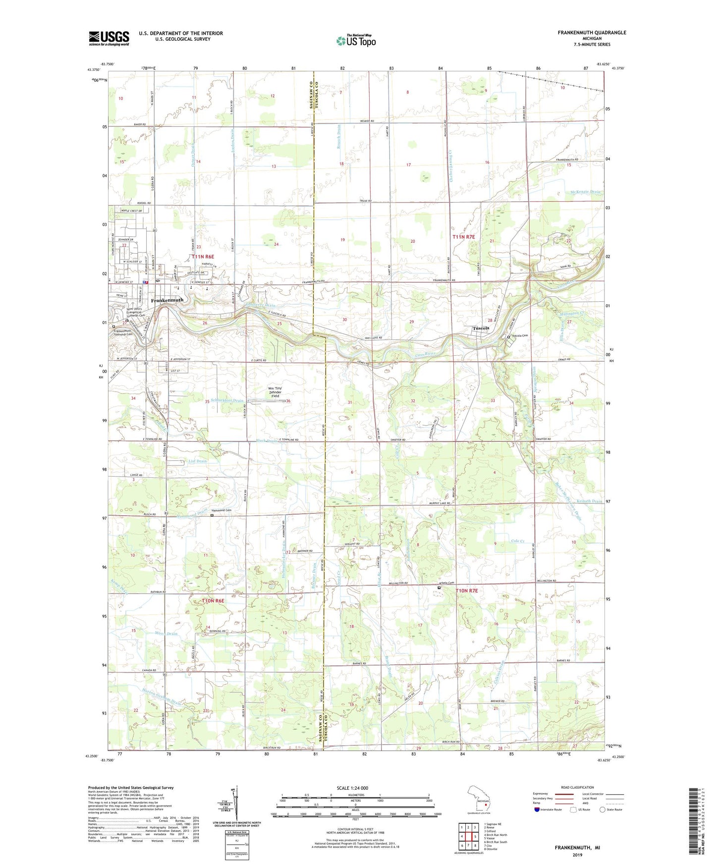
2023 topographic map quadrangle Frankenmuth in the state of Michigan. Scale: 1:24000. Based on the newly updated USGS 7.5' US Topo map series, this map is in the following counties: Tuscola, Saginaw. The map contains contour data, water features, and other items you are used to seeing on USGS maps, but also has updated roads and other features. This is the next generation of topographic maps. Printed on high-quality waterproof paper with UV fade-resistant inks.
Quads adjacent to this one:
West: Birch Run North
Northwest: Saginaw NE
North: Reese
Northeast: Gilford
East: Vassar
Southeast: Otisville
South: Clio
Southwest: Birch Run South
This map covers the same area as the classic USGS quad with code o43083c6.
Contains the following named places: Arabela United Methodist Church, Arbela Cemetery, Baker McPherson Drain, Barrett Drain, Blessed Trinity Catholic Church, Block Drain, Boots Drain, Brand Drain, Brenner Drain, Calkins Drain, City of Frankenmuth, Cole Creek, Covenant Health Care, Cross Park, EF Rittmueller Middle School, Elliot Branch, Ellis Drain, Elva Post Office, Fortress Golf Course, Frankenmuth, Frankenmuth Bavarian Inn Historical Marker, Frankenmuth Bible Church, Frankenmuth City Hall, Frankenmuth Fire Department, Frankenmuth High School, Frankenmuth Historical Museum, Frankenmuth Jellystone Park, Frankenmuth Police Department, Frankenmuth Post Office, Frankenmuth River Place, Frankenmuth Township Cemetery, Frankenmuth United Methodist Church, Galsterer Drain, Hadstadt Drain, Hammond Cemetery, Hammond Drain, Heritage Park, Hubenstricker Drain, James E Wickson Memorial Library, Kemp Drain, List Drain, List Elementary School, McKenzie Drain, Memorial Park, Michigan Military and Space Musuem, Michigan's German Settlers Historical Marker, Millington Creek, Ortner Drain, Perry Creek, Pickett Drain, Pine Ridge RV Campground, Pleasant Ridge Church, Saint John's Evangelical Lutheran Cemetery, Saint John's Lutheran Church, Saint Lorenz School, Saint Martin Lutheran Church, Schluckbier Drain, Smith Drain, Sprague Drain, Timbers Golf Course, Township of Arbela, Township of Tuscola, Tuscola, Tuscola Assembly of God Church, Tuscola Cemetery, Tuscola Community Church, Tuscola Post Office, Tuscola Township Hall, Whitney School, Wilderness Trails Animal Park, Wm 'Tiny' Zehnder Field, Zehnders Restaurant Historical Marker, ZIP Code: 48734