MyTopo
Bridgeport Michigan US Topo Map
Couldn't load pickup availability
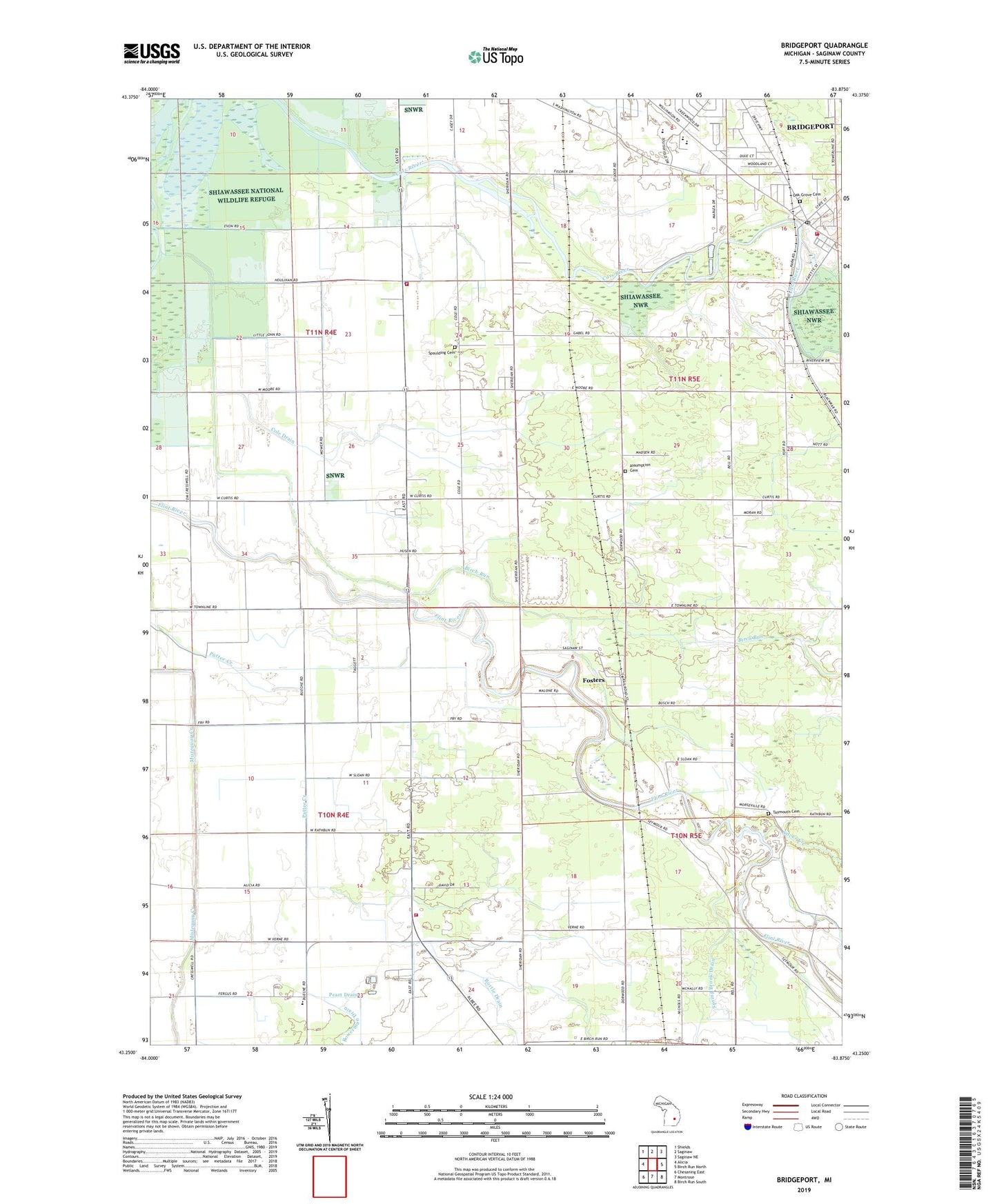
2023 topographic map quadrangle Bridgeport in the state of Michigan. Scale: 1:24000. Based on the newly updated USGS 7.5' US Topo map series, this map is in the following counties: Saginaw. The map contains contour data, water features, and other items you are used to seeing on USGS maps, but also has updated roads and other features. This is the next generation of topographic maps. Printed on high-quality waterproof paper with UV fade-resistant inks.
Quads adjacent to this one:
West: Alicia
Northwest: Shields
North: Saginaw
Northeast: Saginaw NE
East: Birch Run North
Southeast: Birch Run South
South: Montrose
Southwest: Chesaning East
This map covers the same area as the classic USGS quad with code o43083c8.
Contains the following named places: Albee School, Albee Township Fire Department, Assumption Cemetery, Assumption Church, Birch Run, Bortle Drain, Bridgeport, Bridgeport Census Designated Place, Bridgeport Community Church, Bridgeport Fire Department, Bridgeport Mobile Home Park, Bridgeport Post Office, Bridgeport Public Library, Bridgeport Station, Brucker School, Calvary Community Church, Charter Township of Bridgeport, Cole Drain, Davis Park, Faith Lutheran Church, Ferguson Bayou, Fosters, Fosters Post Office, Hess School, Hess School Historical Marker, Lyle Park, Mahar School, Martin G. Atkins Elementary School, Oak Grove Cemetery, Orville School, Parkwood Village Mobile Home Park, Price Nature Center, Saint Christopher's Church, Saint Mark's Episcopal Church, Sheridan Road Baptist Church, Silver Creek, Spaulding Cemetery, Spaulding Township Fire Department, Spaulding Township Police Department, Spring Brook Drain, Taymouth Cemetery, Township of Albee, Township of Spaulding, Verne Post Office, Village Park, White School, WKNX-AM (Frankenmuth), WTLZ-FM (Saginaw), ZIP Code: 48417