MyTopo
Borculo Michigan US Topo Map
Couldn't load pickup availability
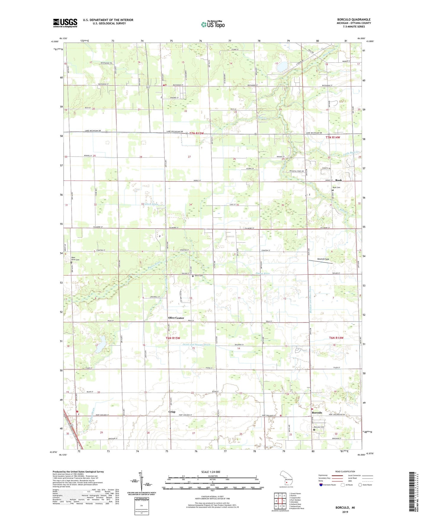
2019 topographic map quadrangle Borculo in the state of Michigan. Scale: 1:24000. Based on the newly updated USGS 7.5' US Topo map series, this map is in the following counties: Ottawa. The map contains contour data, water features, and other items you are used to seeing on USGS maps, but also has updated roads and other features. This is the next generation of topographic maps. Printed on high-quality waterproof paper with UV fade-resistant inks.
Quads adjacent to this one:
West: Port Sheldon
Northwest: Grand Haven
North: Nunica
Northeast: Coopersville
East: Allendale
Southeast: Hudsonville West
South: Holland East
Southwest: Holland West
Contains the following named places: Bass Creek, Bear Creek, Blendon and Olive Drain, Blendon Township Fire Department, Borculo, Borculo Cemetery, Borculo Christian Church, Borculo Christian School, Borculo Post Office, Christian Reformed Church of Rusk, Crestview Golf Course, Crisp, Crisp Post Office, Dewind Field, Faith United Reformed Church, Generations Baptist Church, Little Bass Creek, Olive Center, Olive Center Post Office, Olive Township Cemetery, Olive Township Fire and Rescue, Olive Township Fire Department, Ottawa Church, Ottawa County Sheriff's Office, Ottawa Station Post Office, Ovens and Sawyer Drain, Pheasant Golf Course, Pigeon Creek Golf Course, Pigeon Creek Park, River Pines RV Park and Campground, Robinson, Robinson Baptist Church, Robinson Elementary School, Robinson Post Office, Robinson Township Fire Department, Rusk, Rusk Cemetery, Rusk Post Office, Sawyer Creek, South Olive Christian Church, South Olive Christian Reformed Church Historical Marker, Township of Olive, Township of Robinson, Walters Drain, West Olive Cemetery, Worley Drain