MyTopo
Bridgewater Michigan US Topo Map
Couldn't load pickup availability
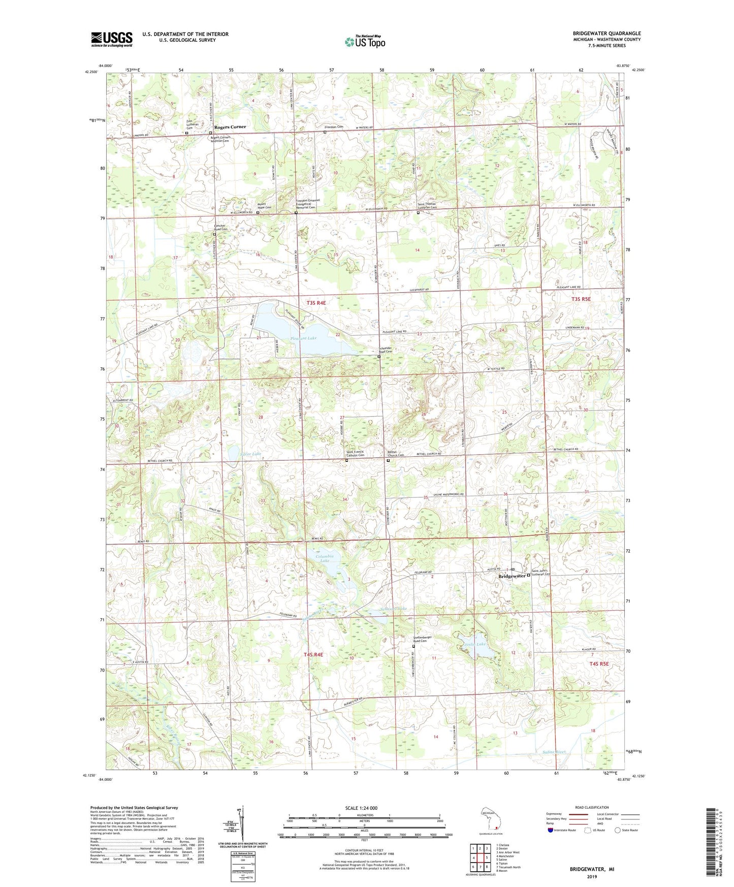
2019 topographic map quadrangle Bridgewater in the state of Michigan. Scale: 1:24000. Based on the newly updated USGS 7.5' US Topo map series, this map is in the following counties: Washtenaw. The map contains contour data, water features, and other items you are used to seeing on USGS maps, but also has updated roads and other features. This is the next generation of topographic maps. Printed on high-quality waterproof paper with UV fade-resistant inks.
Quads adjacent to this one:
West: Manchester
Northwest: Chelsea
North: Dexter
Northeast: Ann Arbor West
East: Saline
Southeast: Macon
South: Tecumseh North
Southwest: Tipton
Contains the following named places: Bethel Church, Bethel Church Cemetery, Bethel Church Historical Marker, Bridgewater, Bridgewater Post Office, Bridgewater Station, Columbia Lake, Fletcher Road Cemetery, Fredonia Post Office, Freedom Emanuel Evangelical Memorial Cemetery, Freedom Township Cemetery, Hickory Sticks Golf Course, Joslin Lake, Mount Hope Cemetery, Pleasant Lake, Pleasant Lake School, Rogers Corner, Rogers Corners Addition Cemetery, Saint Francis' Catholic Cemetery, Saint John United Church, Saint John's Lutheran Cemetery, Saint Thomas Church, Saint Thomas' Lutheran Cemetery, Schasser Lake, Schneider Road Cemetery, Shellenberger Road Cemetery, Silver Lake, Thomas Church Historical Marker, Township of Freedom, Weinsburg Post Office, Zion Lutheran Cemetery, Zion Lutheran Church, Zion Lutheran Church Historical Marker