MyTopo
Tipton Michigan US Topo Map
Couldn't load pickup availability
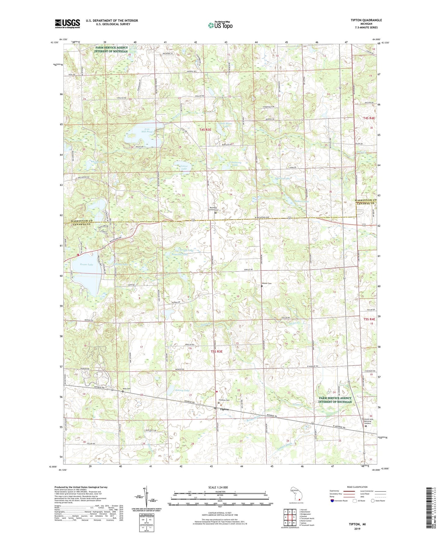
2023 topographic map quadrangle Tipton in the state of Michigan. Scale: 1:24000. Based on the newly updated USGS 7.5' US Topo map series, this map is in the following counties: Lenawee, Washtenaw. The map contains contour data, water features, and other items you are used to seeing on USGS maps, but also has updated roads and other features. This is the next generation of topographic maps. Printed on high-quality waterproof paper with UV fade-resistant inks.
Quads adjacent to this one:
West: Onsted
Northwest: Norvell
North: Manchester
Northeast: Bridgewater
East: Tecumseh North
Southeast: Tecumseh South
South: Adrian
Southwest: Rome Center
This map covers the same area as the classic USGS quad with code o42084a1.
Contains the following named places: Bradley School, Bruno Drain, Church of God, Cranberry Lake, Davenport House Historical Marker, English School, Evans Lake, Evans Lake Post Office, Evans School, Excelsior School, Franklin Cemetery, Franklin Center School, Grace Bible Church, Grubb School, Half Moon Lake, Hidden Lake, Hidden Lake Gardens, Hidden Lake Park, Hudson Lake, Iron Creek Church, Iron Mill Pond, Jado Park Campground, Jefferey Lake, Jehovah's Witnesses, Keeney Lake, Lamkin Drain, Lamkin School, Lenawee Hills Memorial Gardens, Lower Lake, Madison School, Manchester Speedway, McMahon School, Mills Cemetery, Pentecost School, Pink School, Reynolds Corners Cemetery, Reynolds Lake, Sand Lake Fire Department Station 2, Sand Lake Volunteer Fire Department Station 1, Smalley Lake, Spring Lake, Stone School, Taylor Creek, Tecumseh Woods Camp, Tipton, Tipton Community Church, Tipton Post Office, Tipton Station, Township of Franklin, Township of Manchester, Twin Lakes, West Clinton School, Whelan Lake, Wisner Cemetery, Zimmerman School, ZIP Code: 49287