MyTopo
Bruneau Creek Michigan US Topo Map
Couldn't load pickup availability
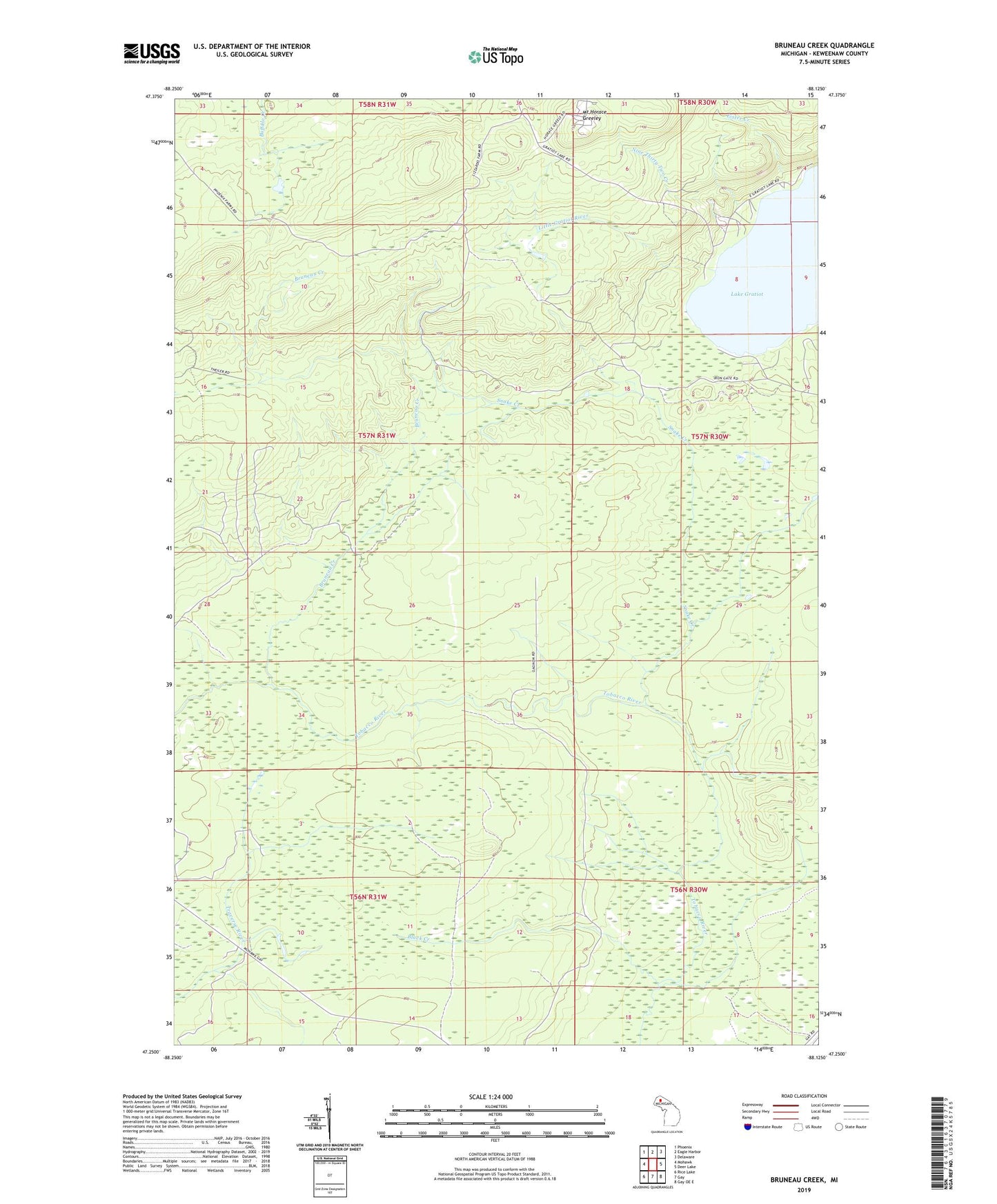
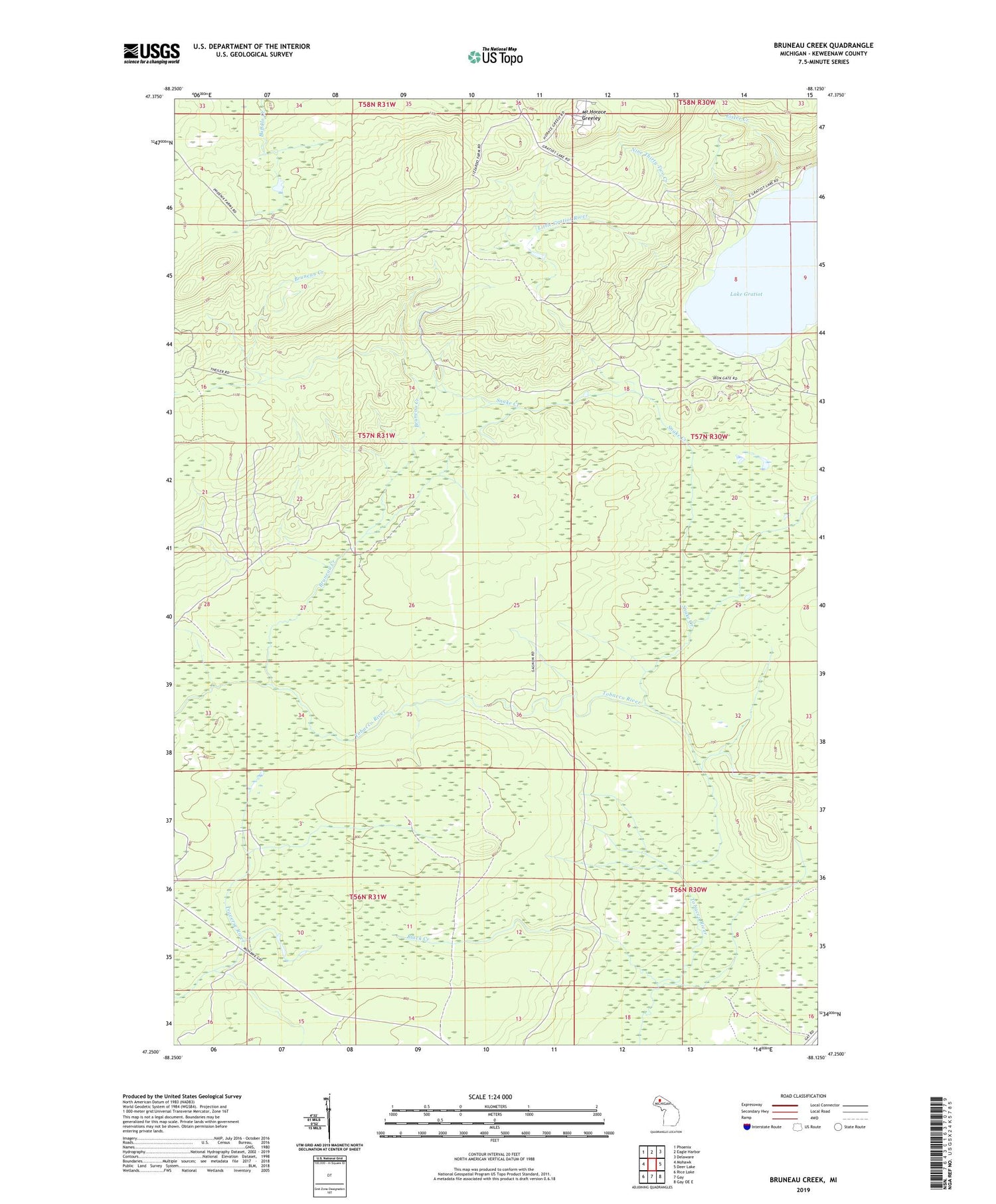
2019 topographic map quadrangle Bruneau Creek in the state of Michigan. Scale: 1:24000. Based on the newly updated USGS 7.5' US Topo map series, this map is in the following counties: Keweenaw. The map contains contour data, water features, and other items you are used to seeing on USGS maps, but also has updated roads and other features. This is the next generation of topographic maps. Printed on high-quality waterproof paper with UV fade-resistant inks.
Quads adjacent to this one:
West: Mohawk
Northwest: Phoenix
North: Eagle Harbor
Northeast: Delaware
East: Deer Lake
Southeast: Gay OE E
South: Gay
Southwest: Rice Lake
Contains the following named places: Black Creek, Bruneau Creek, Calumet Air Force Station, Eagle Harbor Township Volunteer Fire Department Station 2, Eister Creek, Lake Gratiot, Mount Horace Greeley, Nine Thirty Two Creek, Snake Creek, Township of Sherman