MyTopo
Eagle Harbor Michigan US Topo Map
Couldn't load pickup availability
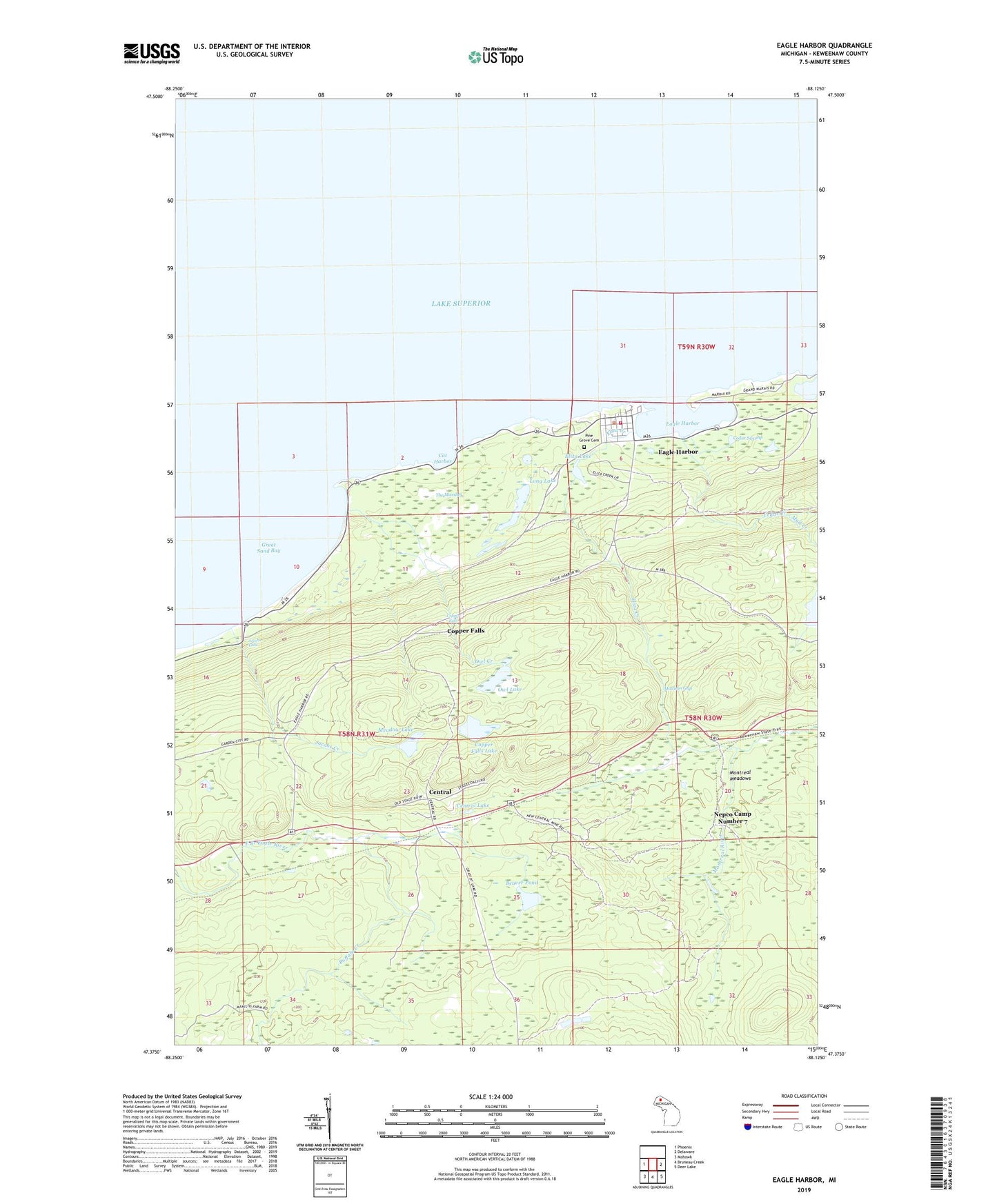
2023 topographic map quadrangle Eagle Harbor in the state of Michigan. Scale: 1:24000. Based on the newly updated USGS 7.5' US Topo map series, this map is in the following counties: Keweenaw. The map contains contour data, water features, and other items you are used to seeing on USGS maps, but also has updated roads and other features. This is the next generation of topographic maps. Printed on high-quality waterproof paper with UV fade-resistant inks.
Quads adjacent to this one:
West: Phoenix
East: Delaware
Southeast: Deer Lake
South: Bruneau Creek
Southwest: Mohawk
This map covers the same area as the classic USGS quad with code o47088d2.
Contains the following named places: Beaver Pond, Buffalo Creek, Cat Harbor, Cedar Creek, Cedar Swamp, Central, Central Lake, Central Mine Post Office, Copper Falls, Copper Falls Lake, Eagle Harbor, Eagle Harbor Census Designated Place, Eagle Harbor House Historical Marker, Eagle Harbor Lighthouse, Eagle Harbor Marina, Eagle Harbor Post Office, Eagle Harbor Township Volunteer Fire Department Station 1 Headquarters, Eliza Creek, Eliza Lake, Great Sand Bay, Jacobs Creek, Jacobs Falls, Long Lake, Madison Gap, Meadow Lake, Montreal Meadows, Mud Creek, Nepco Camp Number 7, Owl Creek, Owl Lake, Pine Grove Cemetery, The Marshes, ZIP Code: 49950