MyTopo
Buckeye Lake Michigan US Topo Map
Couldn't load pickup availability
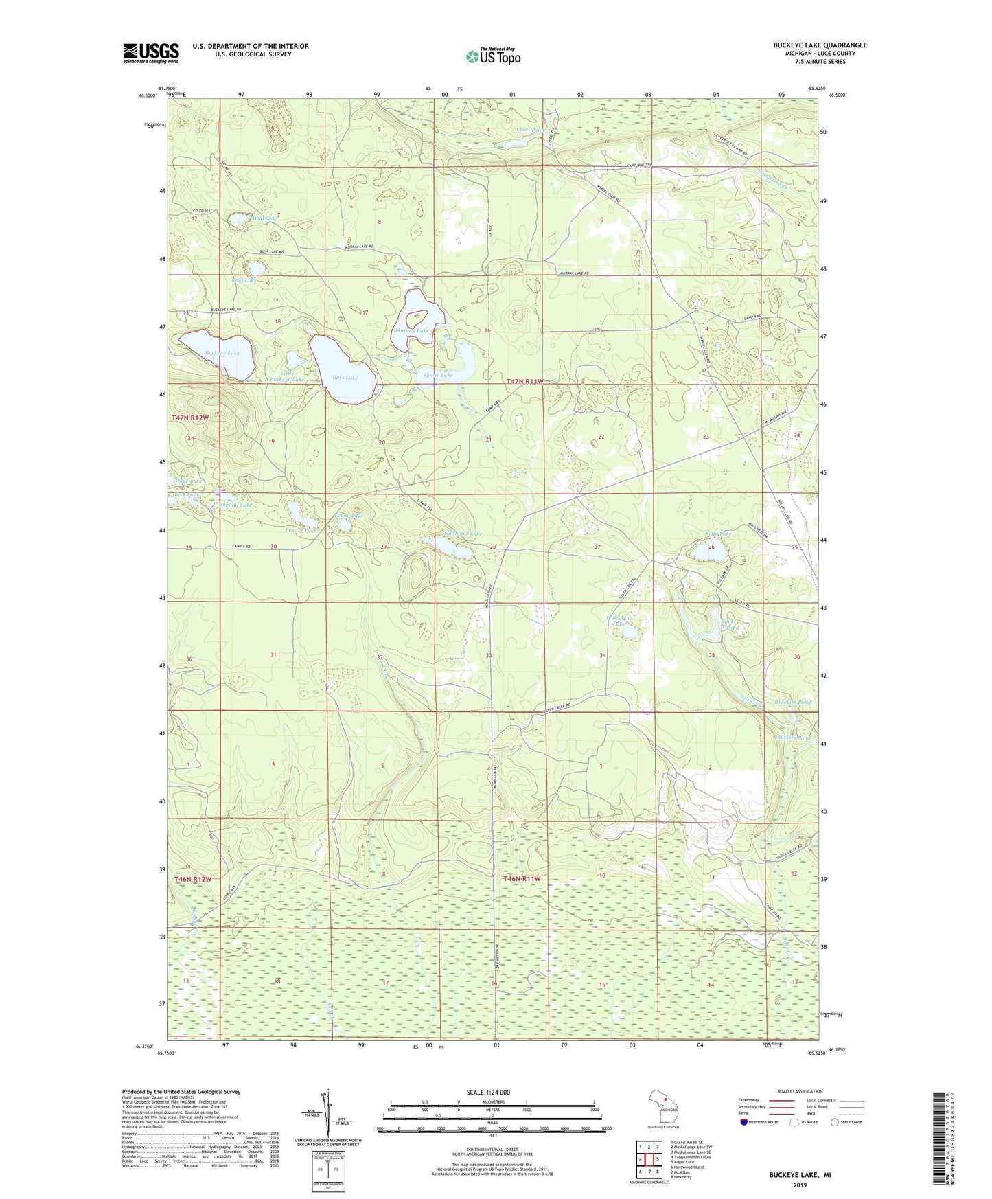
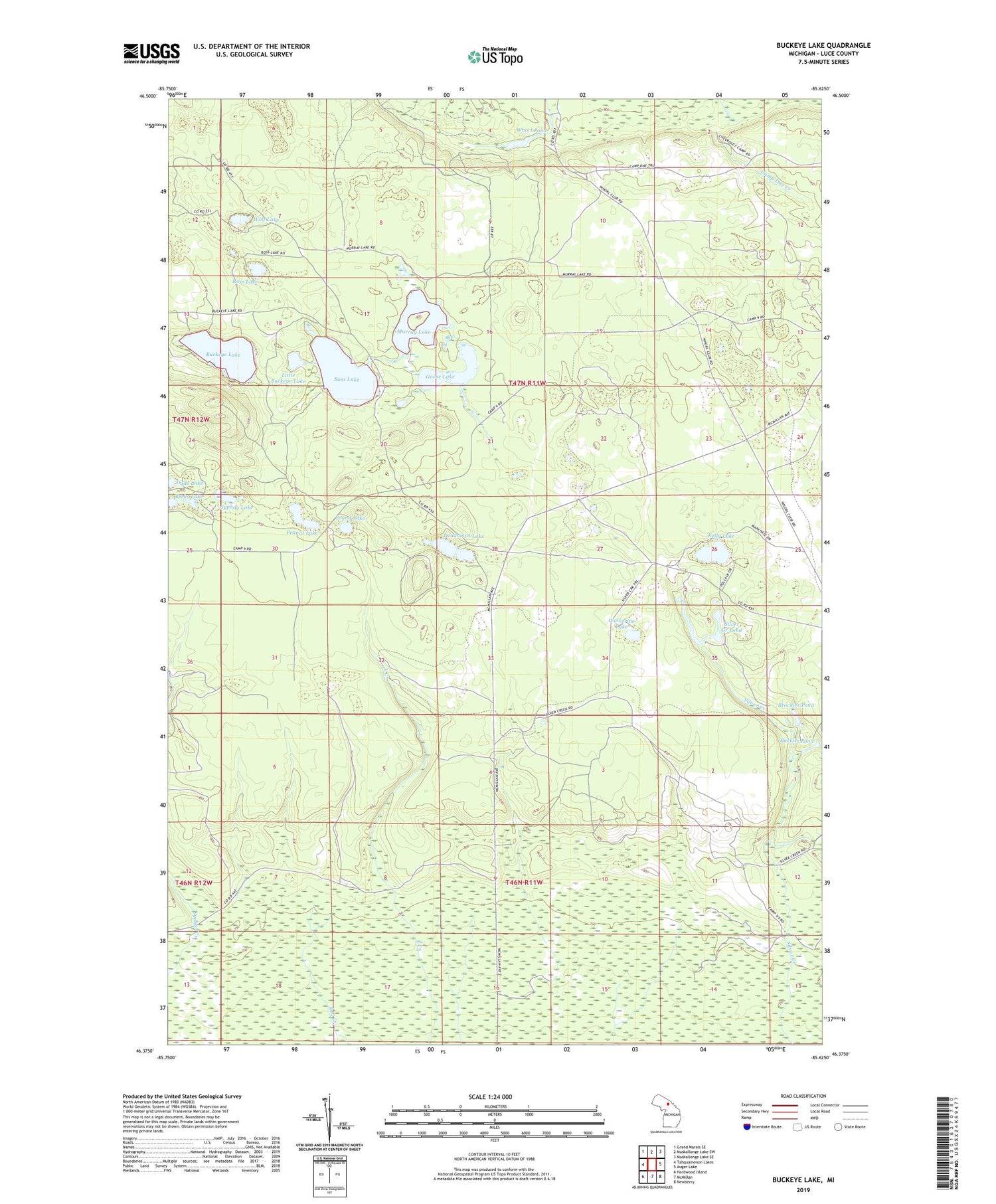
2019 topographic map quadrangle Buckeye Lake in the state of Michigan. Scale: 1:24000. Based on the newly updated USGS 7.5' US Topo map series, this map is in the following counties: Luce. The map contains contour data, water features, and other items you are used to seeing on USGS maps, but also has updated roads and other features. This is the next generation of topographic maps. Printed on high-quality waterproof paper with UV fade-resistant inks.
Quads adjacent to this one:
West: Tahquamenon Lakes
Northwest: Grand Marais SE
North: Muskallonge Lake SW
Northeast: Muskallonge Lake SE
East: Auger Lake
Southeast: Newberry
South: McMillan
Southwest: Hardwood Island
Contains the following named places: Bass Lake, Bass Lake State Forest Campground, Becks Lake, Beech Hill Lookout Tower, Brockies Pond, Buckeye Lake, Buckies Pond, Deadmans Lake, Dude Lake, Goose Lake, Kelly Lake, Little Buckeye Lake, Murray Lake, Peanut Lake, Ross Lake, Silver Creek Pond, Syphon Lake, Township of Columbus, Whorl Pond, Wolf Lake, Wolverine Lake, Young Lake