MyTopo
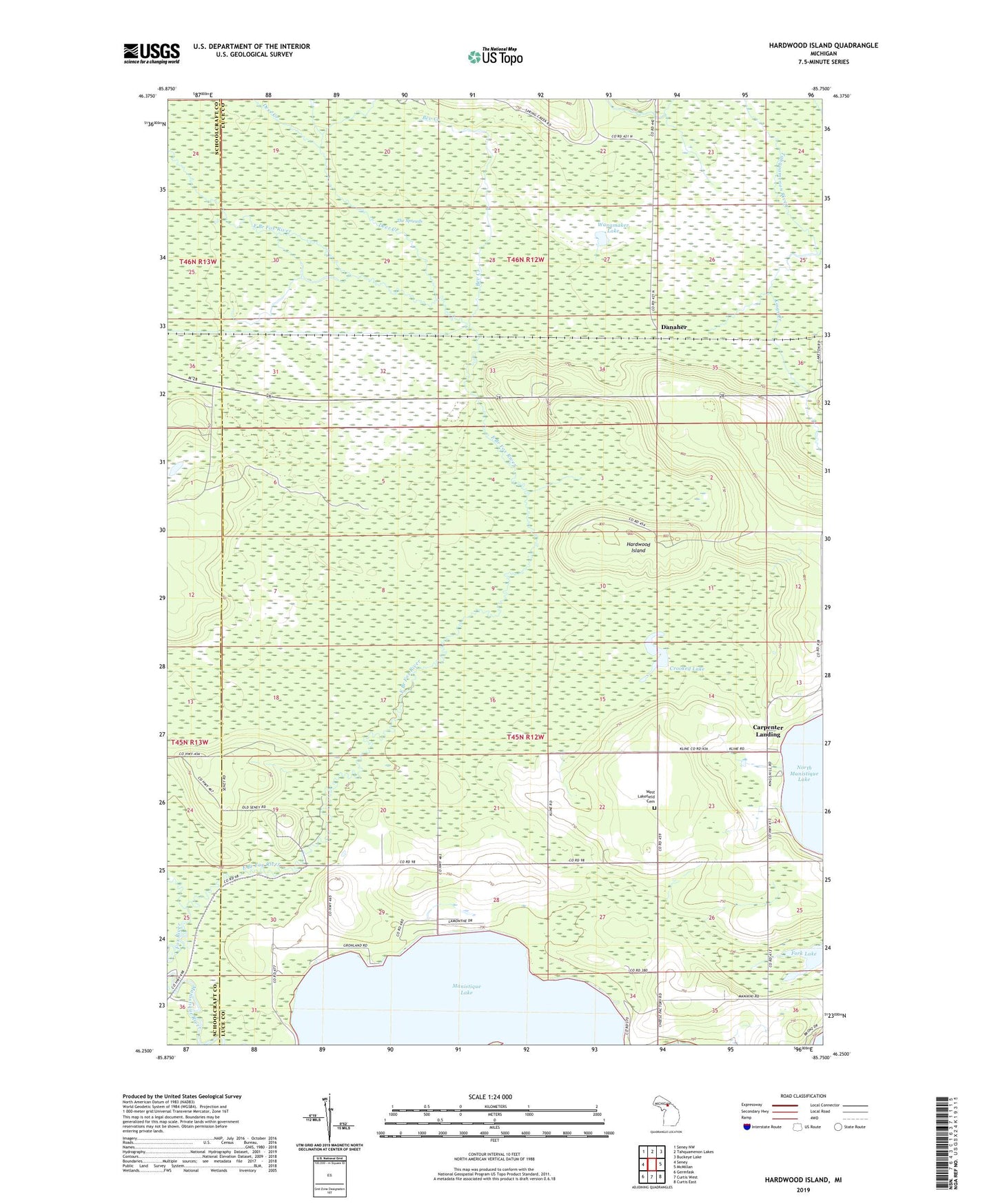
Hardwood Island Michigan US Topo Map
Couldn't load pickup availability
2023 topographic map quadrangle Hardwood Island in the state of Michigan. Scale: 1:24000. Based on the newly updated USGS 7.5' US Topo map series, this map is in the following counties: Luce, Schoolcraft. The map contains contour data, water features, and other items you are used to seeing on USGS maps, but also has updated roads and other features. This is the next generation of topographic maps. Printed on high-quality waterproof paper with UV fade-resistant inks.
Quads adjacent to this one:
West: Seney
Northwest: Seney NW
North: Tahquamenon Lakes
Northeast: Buckeye Lake
East: McMillan
Southeast: Curtis East
South: Curtis West
Southwest: Germfask
This map covers the same area as the classic USGS quad with code o46085c7.
Contains the following named places: Bev Creek, Carpenter Landing, Crooked Lake, Danaher, Danaher Station, Deer Creek, East Branch Fox River, Fork Lake, Hardwood Island, Kings Creek, Lakefield Baptist Church, Seabrook Post Office, Wanamaker Lake, West Lakefield Cemetery, ZIP Code: 49853