MyTopo
Burnips Michigan US Topo Map
Couldn't load pickup availability
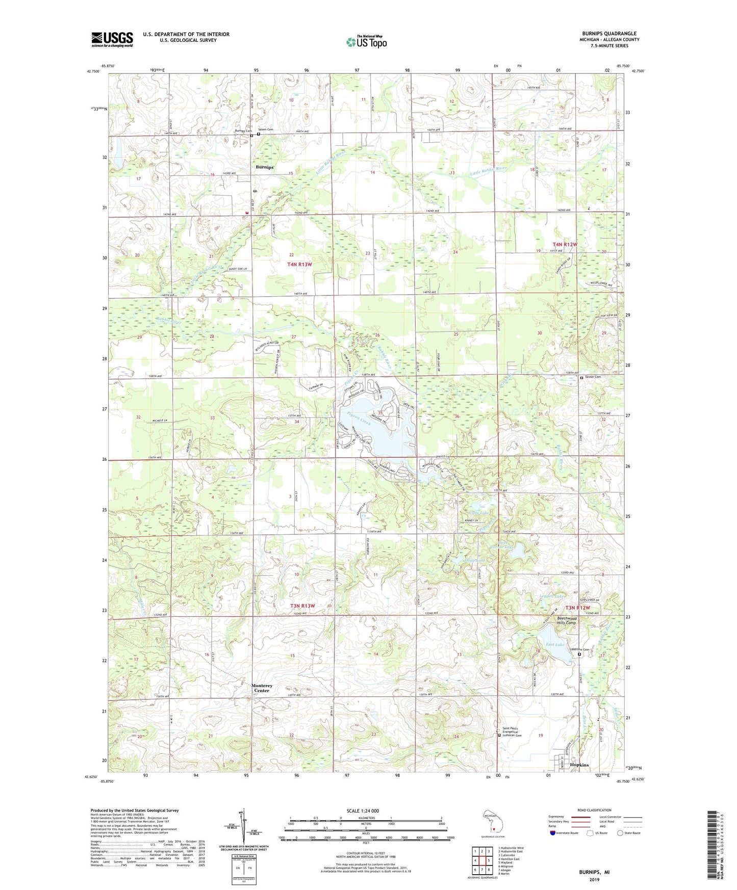
2019 topographic map quadrangle Burnips in the state of Michigan. Scale: 1:24000. Based on the newly updated USGS 7.5' US Topo map series, this map is in the following counties: Allegan. The map contains contour data, water features, and other items you are used to seeing on USGS maps, but also has updated roads and other features. This is the next generation of topographic maps. Printed on high-quality waterproof paper with UV fade-resistant inks.
Quads adjacent to this one:
West: Hamilton East
Northwest: Hudsonville West
North: Hudsonville East
Northeast: Cutlerville
East: Wayland
Southeast: Martin
South: Allegan
Southwest: Millgrove
Contains the following named places: Bear Creek, Beechwood Hills Camp, Burnips, Burnips Cemetery, Burnips Post Office, Burnips United Methodist Church, Burnips Wesleyan Church, Byron Center Christian School, Cady Lake, Dallas Post Office, Dallas School, Dorr and Byron Drain, East Lake, East Lake Camping, Fairview School, Friendship Bible Church, Hartzig School, Holiday Mobile Home Park, Hopkins United Methodist Church, Indian Mission, Lake Monterey Golf Course, Lakeview Cemetery, Leggett Lake, Little Rabbit River, Market Street Church, McDermott Lake, Miller Creek, Monterey Center, Monterey Center United Methodist Church, Monterey Church, Monterey Lake, Monterey Post Office, Pickle Street School, Pigeon Creek, Plainview School, Red Run, Saint Paul Church, Saint Paul's Evangelical Lutheran Cemetery, Saint Paul's Lutheran Church, Saint Peter and Paul Lutheran School, Salem Cemetery, Salem Township Fire Department, Salem Township Library, Sandhill School, Sandy Pines, Sandy Pines RV Resort, Shipp Lake, Tanner Cemetery, Three Corner Lake, Township of Monterey, Township of Salem, Village of Hopkins, Wayland Area Ambulance Service, Winks Branch, ZIP Codes: 49323, 49328