MyTopo
Martin Michigan US Topo Map
Couldn't load pickup availability
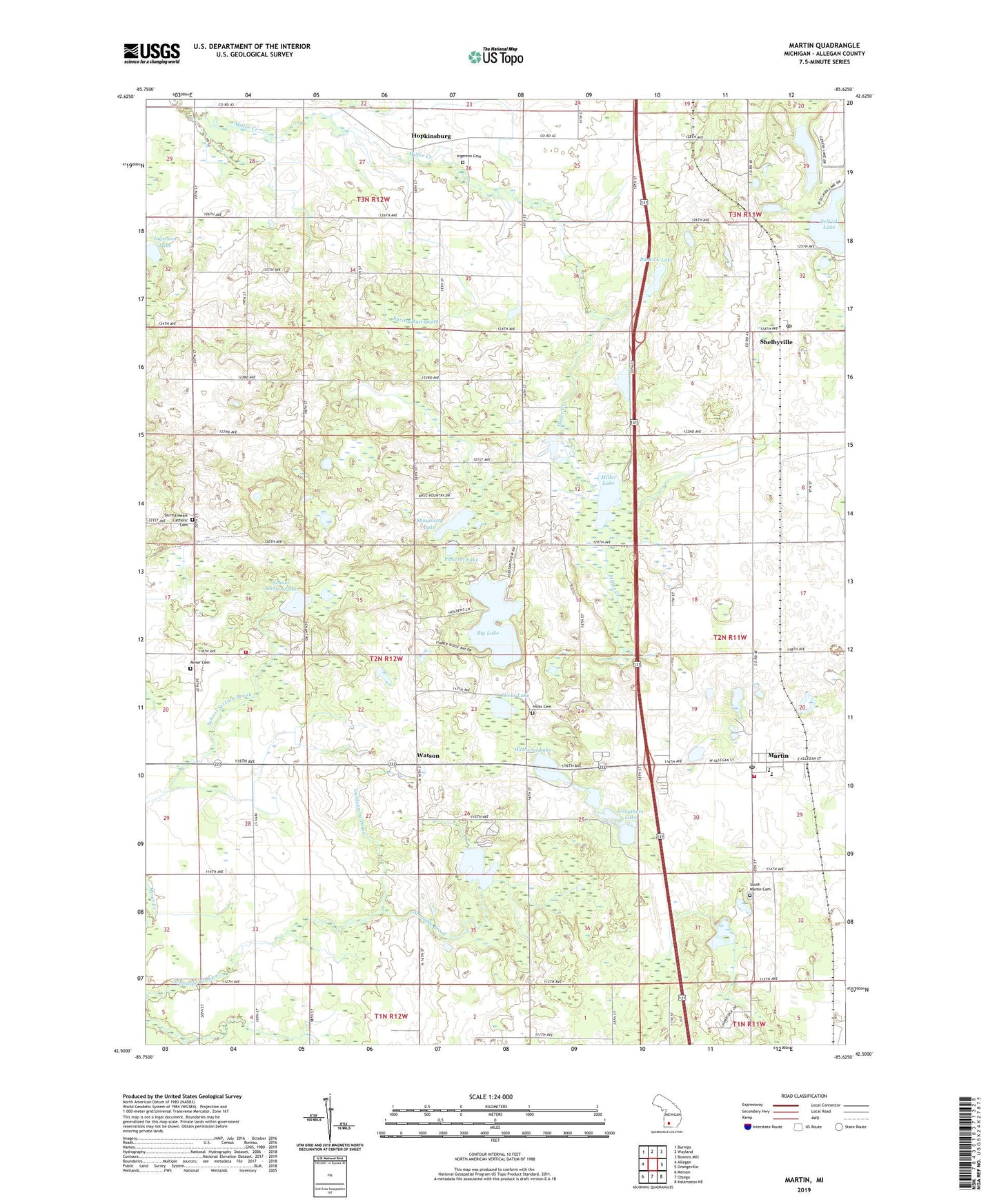
2023 topographic map quadrangle Martin in the state of Michigan. Scale: 1:24000. Based on the newly updated USGS 7.5' US Topo map series, this map is in the following counties: Allegan. The map contains contour data, water features, and other items you are used to seeing on USGS maps, but also has updated roads and other features. This is the next generation of topographic maps. Printed on high-quality waterproof paper with UV fade-resistant inks.
Quads adjacent to this one:
West: Allegan
Northwest: Burnips
North: Wayland
Northeast: Bowens Mill
East: Orangeville
Southeast: Kalamazoo NE
South: Otsego
Southwest: Merson
This map covers the same area as the classic USGS quad with code o42085e6.
Contains the following named places: Big Lake, Buskirk Lake, Butternut Creek, Caruthers Lake, Fisk Station, Geneva Lake, Goldspring Drain, Hicks Cemetery, Hicks Lake, Hidden Ridge RV Resort, Hidden Valley Golf Course, Hopkins Fire Department Station 2, Hopkinsburg, Hughes School, Ingerson Cemetery, Ingerson Lake, Little Gem Mobile Home Court, Martin, Martin Fire Department, Martin High School, Martin Post Office, Martin Reformed Church, Martin Station, Martin Township Library, Martin United Methodist Church, Martin US 131 Raceway, Miller Lake, Miller Lake Campground, Miner Cemetery, Monteith Post Office, Monteith Station, Osborn School, Pickerel Lake, River of Life Church, Sacred Heart Catholic Cemetery, Sacred Heart Church, Schnable Lake, School Section Lake, Selkirk Lake, Shagnasty Lake, Shelbyville, Shelbyville Station, Shelbyville United Methodist Church, South Martin Cemetery, Spring Run Drain, Township of Watson, Village of Martin, Watson, Watson Bible Church, Watson Post Office, Wayland Area Ambulance Service, Wetheral Lake, ZIP Code: 49070