MyTopo
Millgrove Michigan US Topo Map
Couldn't load pickup availability
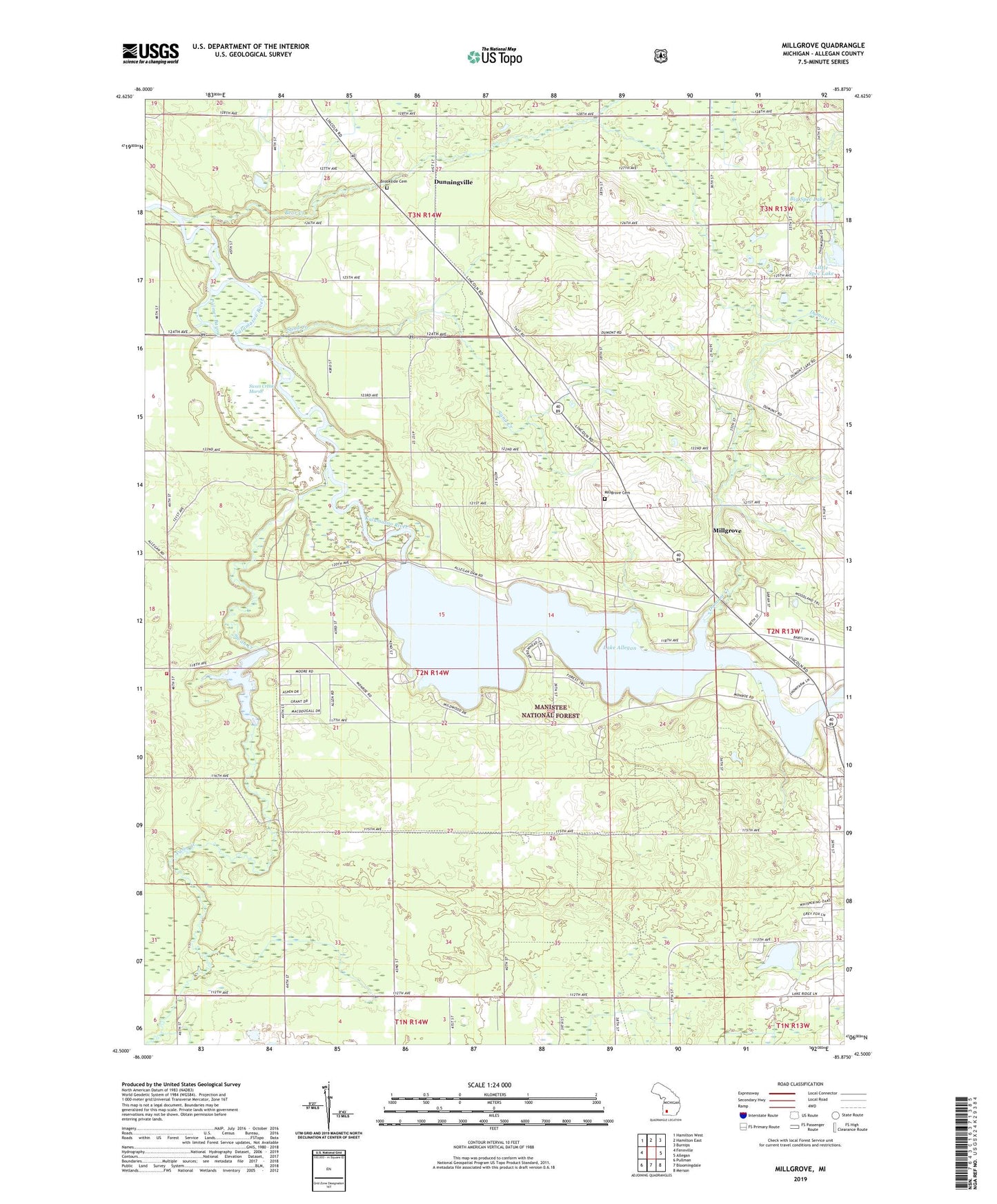
2023 topographic map quadrangle Millgrove in the state of Michigan. Scale: 1:24000. Based on the newly updated USGS 7.5' US Topo map series, this map is in the following counties: Allegan. The map contains contour data, water features, and other items you are used to seeing on USGS maps, but also has updated roads and other features. This is the next generation of topographic maps. Printed on high-quality waterproof paper with UV fade-resistant inks.
Quads adjacent to this one:
West: Fennville
Northwest: Hamilton West
North: Hamilton East
Northeast: Burnips
East: Allegan
Southeast: Merson
South: Bloomingdale
Southwest: Pullman
This map covers the same area as the classic USGS quad with code o42085e8.
Contains the following named places: Allegan Cross Country Ski Area, Allegan State Forest, American Indian Gospel Church, Babylon School, Bear Creek, Big Spec Lake, Brookside Cemetery, Christ Community Church, Church of God, Diamond Chapel, Diamond School, Dumont Creek, Dunningville, Dunningville Post Office, Dunningville Reformed Church, Dunningville Station, Emmaus Road Bible Church, Hillcrest School, Homecrest Villa Mobile Home Park, Kingdom Hall of Jehovah's Witnesses, Lake Allegan, Little Spec Lake, Littlejohn Lake, Littlejohn Lake County Park, Michigan Department of Natural Resources Allegan Field Office, Millgrove, Millgrove Cemetery, Millgrove Church, Millgrove Post Office, Millgrove Station, Moore School, New Hope Baptist Church of Allegan, Palmer Bayou, Pine Point Campground, Plainview Lookout Tower, River Church, Sand Creek, Spec Lake Chapel, Spec Lake School, Swan Creek, Swan Creek Campground, Swan Creek Marsh, Swan Creek Pond, Township of Valley