MyTopo
Burnt Island Michigan US Topo Map
Couldn't load pickup availability
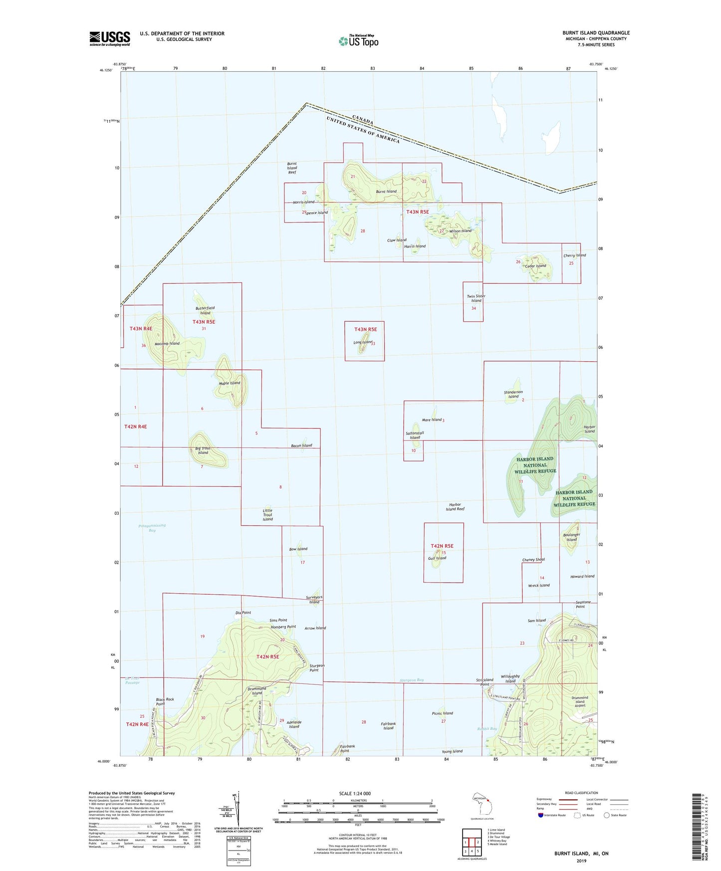
2019 topographic map quadrangle Burnt Island in the state of Michigan. Scale: 1:24000. Based on the newly updated USGS 7.5' US Topo map series, this map is in the following counties: Chippewa. The map contains contour data, water features, and other items you are used to seeing on USGS maps, but also has updated roads and other features. This is the next generation of topographic maps. Printed on high-quality waterproof paper with UV fade-resistant inks.
Quads adjacent to this one:
West: Lime Island
East: Drummond
Southeast: Meade Island
South: Whitney Bay
Southwest: De Tour Village
Contains the following named places: Adelaide Island, Arrow Island, Bacon Island, Big Trout Island, Black Rock Point, Boulanger Island, Bow Island, Burnt Island, Burnt Island Reef, Butterfield Island, Cedar Island, Cheney Shoal, Cherry Island, Claw Island, Dix Point, Fairbank Island, Gull Island, Harbor Island, Harbor Island National Wildlife Refuge, Harbor Island Reef, Harris Island, Homberg Point, Howard Island, Little Trout Island, Long Island, Macomb Island, Maple Island, Mare Island, Nate's Marina, Norris Island, Picnic Island, Potagannissing Bay, Rabbit Bay, Saltonstall Island, Sam Island, Seastone Point, Sims Point, Spence Island, Standerson Island, Strickland Point, Stringham Lake, Sturgeon Bay, Sturgeon Point, Surveyors Island, Twin Sister Island, Willoughby Island, Wilson Island, Wreck Island, Young Island