MyTopo
Lime Island Michigan US Topo Map
Couldn't load pickup availability
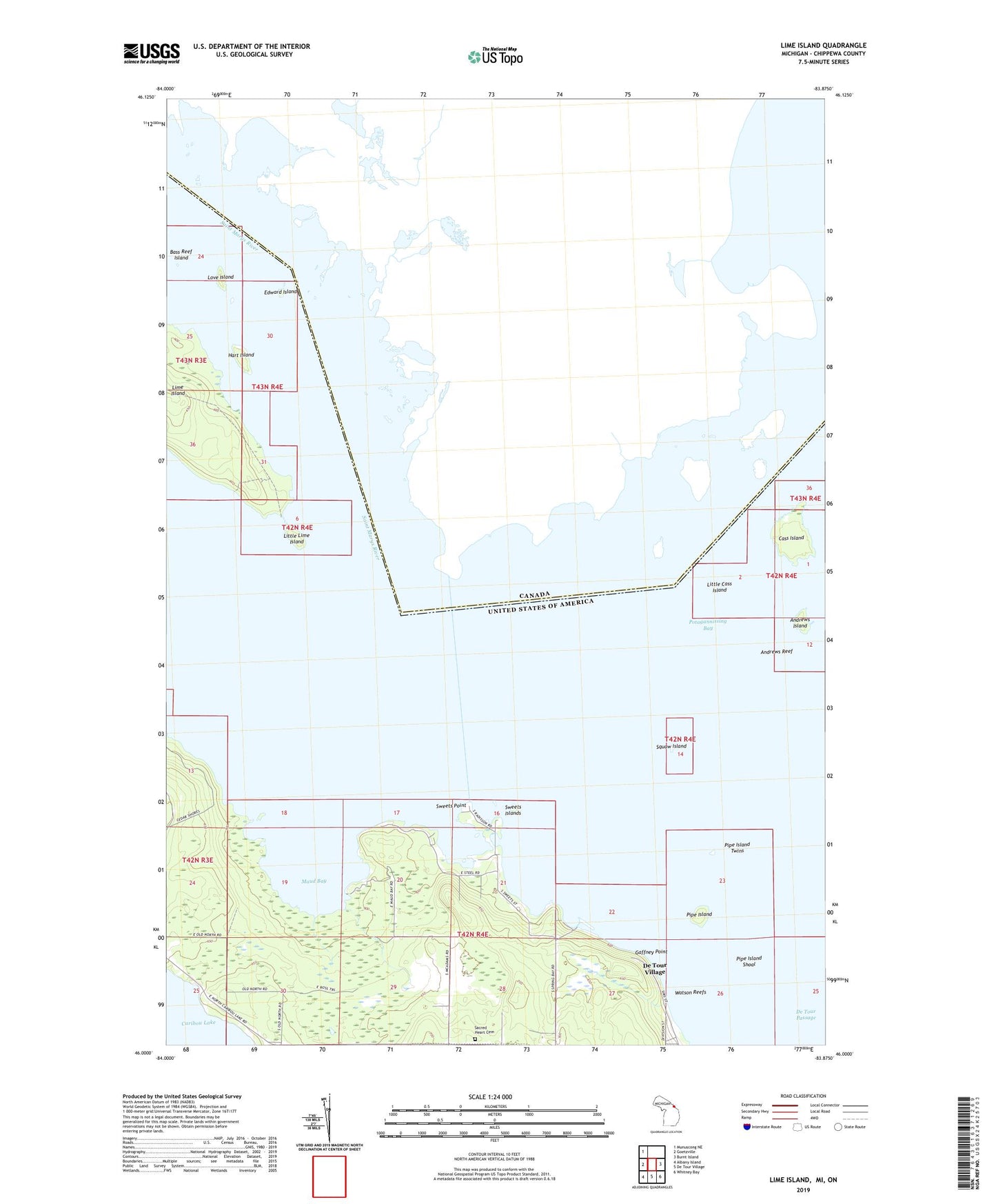
2023 topographic map quadrangle Lime Island in the state of Michigan. Scale: 1:24000. Based on the newly updated USGS 7.5' US Topo map series, this map is in the following counties: Chippewa. The map contains contour data, water features, and other items you are used to seeing on USGS maps, but also has updated roads and other features. This is the next generation of topographic maps. Printed on high-quality waterproof paper with UV fade-resistant inks.
Quads adjacent to this one:
West: Goetzville
Northwest: Munuscong NE
East: Burnt Island
Southeast: Whitney Bay
South: De Tour Village
Southwest: Albany Island
This map covers the same area as the classic USGS quad with code o46083a8.
Contains the following named places: Andrews Island, Andrews Reef, Bass Reef Island, Cass Island, De Tour Dock Company, Edward Island, Gaffney Point, Hart Island, Lime Island, Little Cass Island, Little Lime Island, Love Island, Maud Bay, Pipe Island, Pipe Island Shoal, Pipe Island Twins, Sacred Heart Cemetery, Squaw Island, Sweets Islands, Sweets Point, Watson Reefs, Watson Reefs Light