MyTopo
Meade Island Michigan US Topo Map
Couldn't load pickup availability
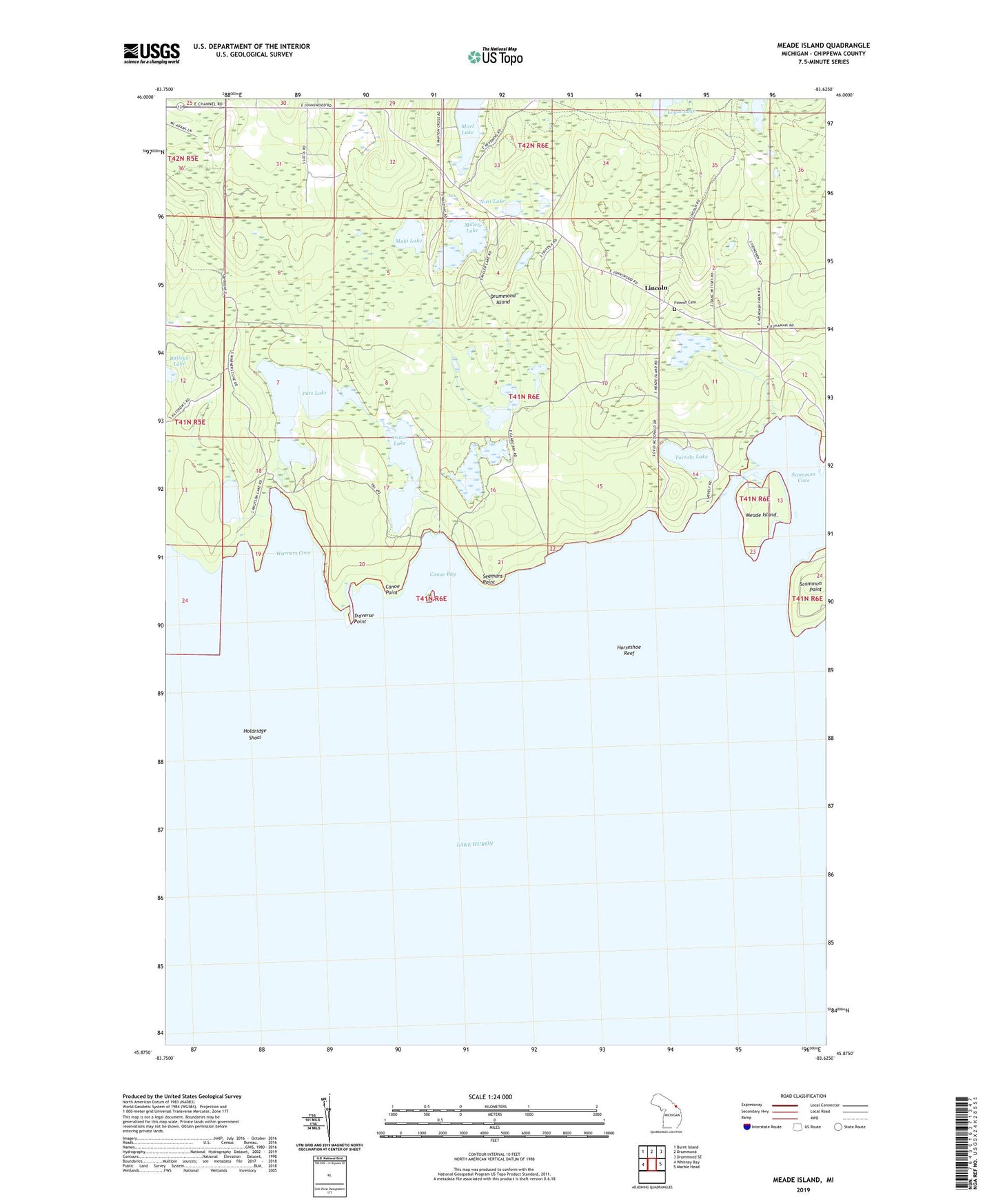
2023 topographic map quadrangle Meade Island in the state of Michigan. Scale: 1:24000. Based on the newly updated USGS 7.5' US Topo map series, this map is in the following counties: Chippewa. The map contains contour data, water features, and other items you are used to seeing on USGS maps, but also has updated roads and other features. This is the next generation of topographic maps. Printed on high-quality waterproof paper with UV fade-resistant inks.
Quads adjacent to this one:
West: Whitney Bay
Northwest: Burnt Island
North: Drummond
Northeast: Drummond SE
East: Marble Head
This map covers the same area as the classic USGS quad with code o45083h6.
Contains the following named places: Beaver Dam Pond, Canoe Bay, Canoe Lake, Canoe Point, Drummond Island Lutheran Church, Drummond Lookout Tower, Finnish Cemetery, Holdridge Shoal, Horseshoe Reef, Knutsen Lake, Lincoln, Maki Lake, Marl Lake, Meade Island, Miller Lake, Nasi Lake, Pats Lake, Scammon Cove, Scammon Point, Seamans Point, Toivola Lake, Traverse Point, Vanio Lake, Warners Cove