MyTopo
Coopersville Michigan US Topo Map
Couldn't load pickup availability
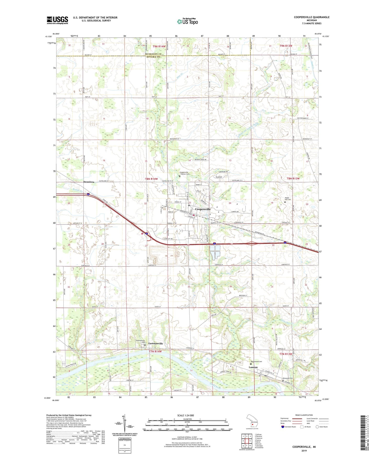
2019 topographic map quadrangle Coopersville in the state of Michigan. Scale: 1:24000. Based on the newly updated USGS 7.5' US Topo map series, this map is in the following counties: Ottawa, Muskegon. The map contains contour data, water features, and other items you are used to seeing on USGS maps, but also has updated roads and other features. This is the next generation of topographic maps. Printed on high-quality waterproof paper with UV fade-resistant inks.
Quads adjacent to this one:
West: Nunica
Northwest: Sullivan
North: Ravenna
Northeast: Casnovia
East: Marne
Southeast: Grandville
South: Allendale
Southwest: Borculo
Contains the following named places: Beaver Creek, Boody School, Centennial School, Central Family Worship Center, Charter Township of Polkton, Church of the Savior, City of Coopersville, Coopersville, Coopersville - Polkton Cemetery, Coopersville - Polkton Fire Station, Coopersville Airport, Coopersville Bible Church, Coopersville Christian Church, Coopersville Church of Christ, Coopersville East Elementary School, Coopersville Farm Museum, Coopersville Fire Station, Coopersville High School, Coopersville Junior High School, Coopersville Police Department, Coopersville Post Office, Coopersville Reformed Church, Coopersville Sheriff's Office, Coopersville Station, Coopersville United Methodist Church, Coopersville West Elementary School, County Line Church, Deer Creek, Deer Creek County Park, Dennison, Dennison Post Office, Dennison Station, Eastmanville, Eastmanville Cemetery, Eastmanville Post Office, Eastmanville United Reformed Church, Elmwood Cemetery, Grace Lutheran Church, Grand Country Mobile Home Village, Grove Street Park, Interurban Depot Historical Marker, Jackson School, Lamont, Lamont Census Designated Place, Lamont Christian Reformed Church, Lamont Christian School, Lamont Post Office, Lillie School, Little Deer Creek, Main Street Park, Maple Hill Cemetery, Maplewood Cemetery, Marshall School, McDearmon School, N Evergreen School, Northeast Ottawa District Library, Randall Street Medical Clinic, Rankins School, Red School, Timberline Estates Mobile Home Park, Toothacre School, Veterans Park, WGVU-FM (Allendale), Wright Church, ZIP Code: 49404