MyTopo
Crystal Michigan US Topo Map
Couldn't load pickup availability
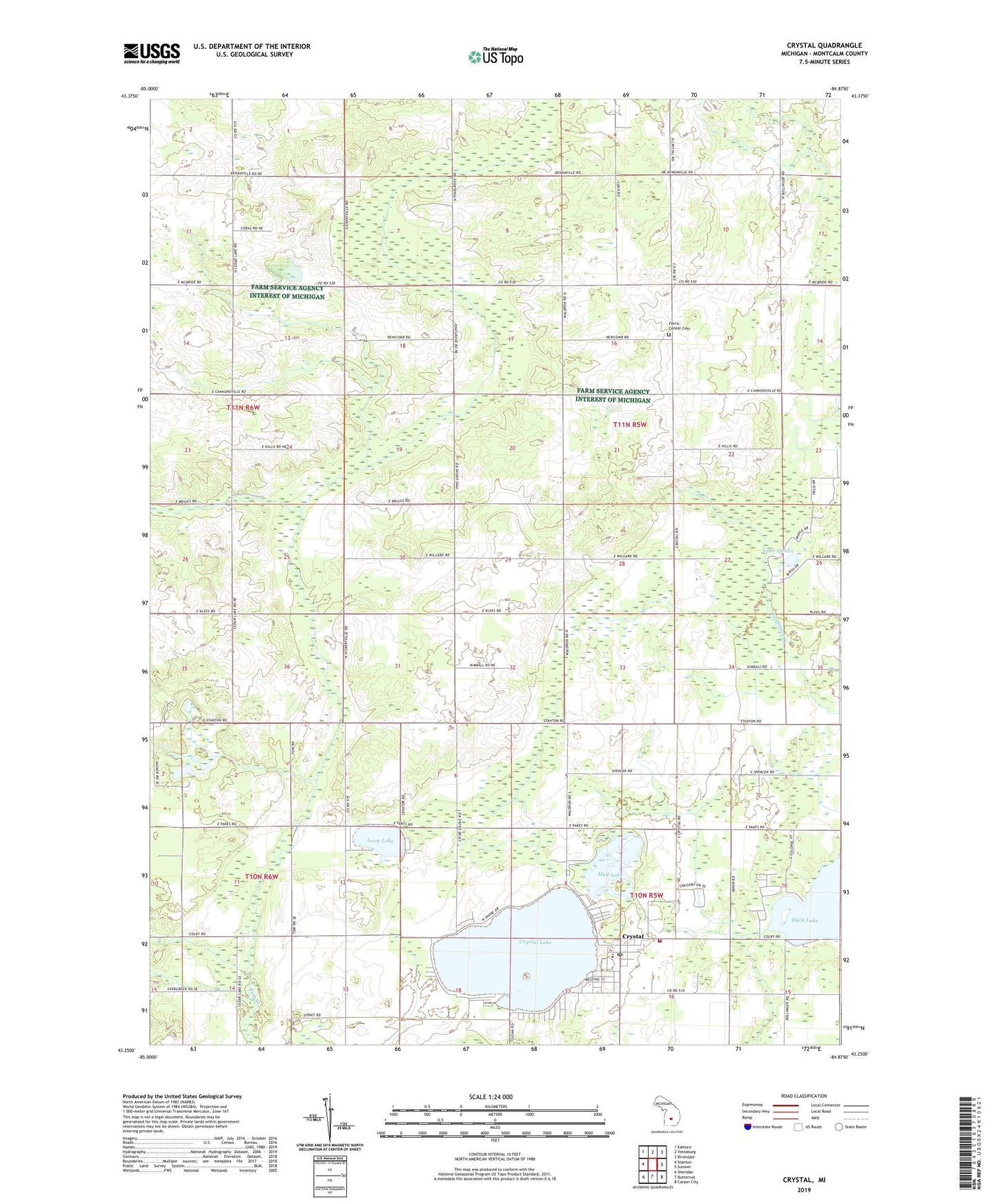
2019 topographic map quadrangle Crystal in the state of Michigan. Scale: 1:24000. Based on the newly updated USGS 7.5' US Topo map series, this map is in the following counties: Montcalm. The map contains contour data, water features, and other items you are used to seeing on USGS maps, but also has updated roads and other features. This is the next generation of topographic maps. Printed on high-quality waterproof paper with UV fade-resistant inks.
Quads adjacent to this one:
West: Stanton
Northwest: Edmore
North: Vestaburg
Northeast: Riverdale
East: Sumner
Southeast: Carson City
South: Butternut
Southwest: Sheridan
Contains the following named places: Community Assembly of God Church, Crystal, Crystal Brethren Church, Crystal Census Designated Place, Crystal Community Library, Crystal Congregational Church, Crystal Elementary School, Crystal Golf Course, Crystal Lake, Crystal Lake Community Church, Crystal Motor Speedway, Crystal Post Office, Crystal Township Fire Department, Duck Lake, Ferris Center Cemetery, Ferris Church, First Church of God, Fishville Post Office, Freedom Way Church of God, Krum Park, Lake Steven, Loon Lake, Mud Lake, Pine Grove Church, Pine Grove School, South Shore Campground, Township of Ferris, Vestaburg School, Victory Lane Sport Park, West End School, Zion Church, ZIP Code: 48818