MyTopo
Sheridan Michigan US Topo Map
Couldn't load pickup availability
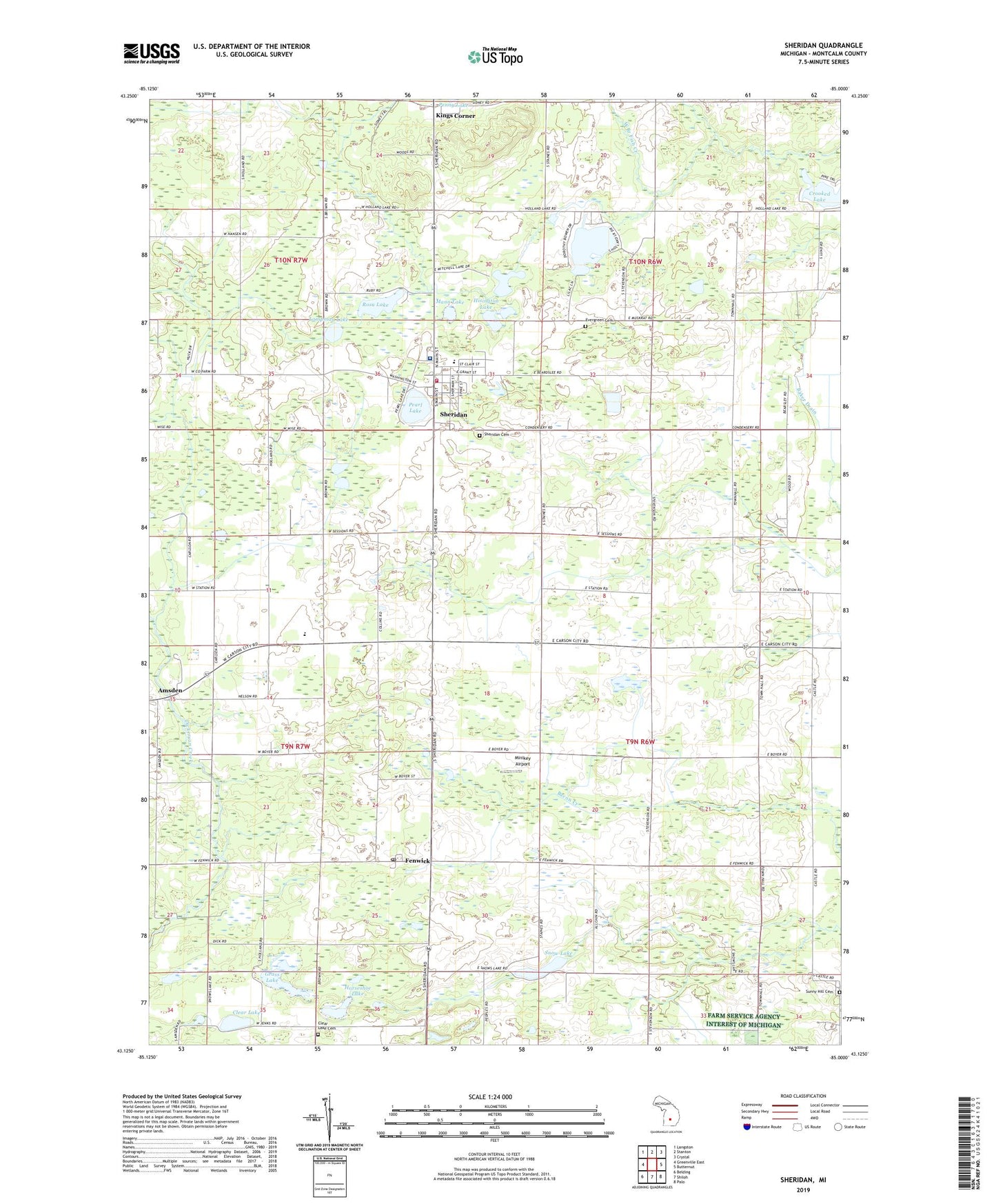
2023 topographic map quadrangle Sheridan in the state of Michigan. Scale: 1:24000. Based on the newly updated USGS 7.5' US Topo map series, this map is in the following counties: Montcalm. The map contains contour data, water features, and other items you are used to seeing on USGS maps, but also has updated roads and other features. This is the next generation of topographic maps. Printed on high-quality waterproof paper with UV fade-resistant inks.
Quads adjacent to this one:
West: Greenville East
Northwest: Langston
North: Stanton
Northeast: Crystal
East: Butternut
Southeast: Palo
South: Shiloh
Southwest: Belding
This map covers the same area as the classic USGS quad with code o43085b1.
Contains the following named places: Amsden, Amsden Post Office, Baker Drain, Baker Lake, Beth Haven Baptist Academy, Beth Haven Baptist Church, Bible Wesleyan Church, Bushnell Centre Post Office, Bushnell Post Office, Church of Christ, Clear Lake, Clear Lake Cemetery, Crooked Lake, Dean's Mills Post Office, Evergreen Church, Evergreen Township Cemetery, Fenwick, Fenwick Post Office, Fenwick Station, First Congregational Church, Grass Lake, Hisington Lake, Holland Lake, Holland Lake Golf Course, Horseshoe Lake, Kings Corner, Lampman Lake, Mann Lake, Minikey Airport, Mitchell Lake, Pearl Lake, Rosa Lake, Sheridan, Sheridan Assembly of God Church, Sheridan Care Clinic, Sheridan Cemetery, Sheridan Church of God, Sheridan Community Fire Department, Sheridan Community Hospital, Sheridan Elementary School, Sheridan Post Office, Sheridan Station, Snow Lake, Snow Lake Kampground, Sunny Hill Cemetery, Township of Bushnell, Township of Evergreen, United Brethren Church, United Methodist Church, Village of Sheridan, ZIP Codes: 48834, 48884